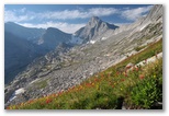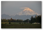
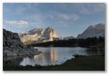
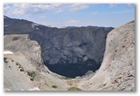
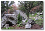
Mt Rainier
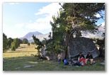
Campmeeting
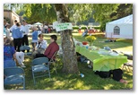
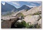
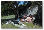
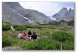
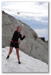
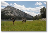
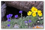
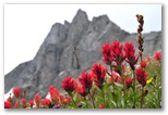
Sabbath picnic
We made it to campmeeting on both Sabbaths, more for lunch than for the meeting. The first Sabbath
we shared a potluck lunch with Jim and Deloris and a couple other families. During the week I sat
in on several sessions of the God and Geology class, a discussion of some of the current ideas in
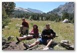
Creationist thought. On the second Sabbath Susan organized a lunch with the Fresks and the Gentslers.
David and Caleb enjoyed comparing their cameras and taking pictures together. Gary and I did a little
of the same. Lunch was delicious and we all hung around for several hours visiting. Very pleasant.
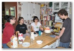
David's birthday
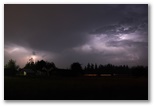
Lightning storm
We celebrated David's birthday with an overnight party. Friends arrived yesterday morning. Susan
took them to see the Impressionist exhibit at the Seattle Art Museum then to lunch at Cafe Flora.
They watched movies in the evening then the guests slept in the den. In the morning we ate birthday
cake for breakfast before the last of the guests left. That evening a series of unusually strong
thunderstorms blew through. We followed the last two with our cameras and took a few pictures from
the Eckblad's road as the storms receded off to the north. After some experimentation I settled on
an exposure of 30 seconds at f5.6 with ISO set to 320. I set the camera on a fencepost and used the
self timer but didn't turn on the long-exposure noise reduction - don't know if that would have
improved the results any. The photos actually came out pretty well although we missed the best of
the lightning.
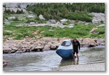
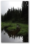
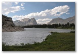
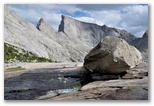
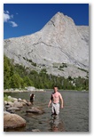
Rattlesnake Lake lunch
Rattlesnake Lake runners
Again this year Susan fixed chili and Greek salad and Monte prepared Philippino food but this year
we served 50 runners instead of 20. Preparing for the race required more work than last year. Due
to the larger number of runners I needed to obtain permits from three different government agencies,
each of which required liability insurance, the best source for which turned out to be USA Track and
Field, so the Rattlesnake Lake marathon was sanctioned by USATF this year. Costs totalled about $10
per runner not including lunch so I had runners bring an entry fee on the morning of the race and
everyone did so. I think we had about 10 no-shows
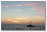
7/09/2008 Salmon Fishing Sunny, low 60's
Larry, Randy and I went salmon fishing out of Westport two days after the Rattlesnake Lake marathon.
Slack tide would be at 5AM, 6AM and 7AM on Tuesday through Thursday, enabling us to make it out
across the bar in the morning, fish most of the day and return back to port on the incoming tide
before the gas pier closed at 5PM. Unfortunately the sea and swell forecast wasn't so favorable -
5' swell and 3' seas on Tuesday increasing to 6' and 3' on Wednesday and Thursday, about at the
limit of what Larry's boat can handle. The fish report wasn't too encouraging either. A few weeks
ago the charter boats were limiting on King salmon but over the previous few days it didn't sound
like anyone had caught anything.

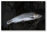
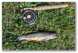
Fish On!
Randy's King salmon
We put the boat in the water on Monday afternoon, downed our Dramamine and retired to Randy's condo
for the night. Tuesday morning we were on our way out across the bar under a pale blue sky streaked
with orange jet trails. We motored northwest for an hour or so then let the north wind push us south
while we trolled for fish. Randy did well, catching two 10-15lb Kings. Larry and I each got a single
Silver. The swells were about a little bigger than forecast but the seas were lower, so the combined
effect was rough but not too bad.
We were able to sleep in an extra hour on Wednesday. Beautiful sunny day but breezy - Larry and Randy
agreed it was the roughest day they'd ever experienced out on Larry's boat. We fished a similar
route to Tuesday but stayed out longer after deciding not to go out the next day. The forecast was
for similar conditions on Thursday and none of us were up for another day that rough. But the fishing
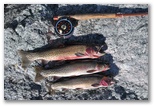
was good - we all reached our limit of two fish each. I caught my first King, about 12 pounds, and
a Silver that weighed about 8 pounds. We cleaned, filetted and vacuum-packed our salmon on the dock
shortly after we landed, then spend another night at Randy's condo rather than try to get the boat
all cleaned up that evening.
It was a good fishing trip, except that when we got back to Larry's I couldn't find my camera. It
took two months more to find it, and the long-lost photos of our fishing trip.
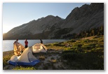
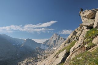
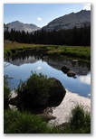
Wind Rivers Backpacking Trip 8/1-7/2008
8/01/2008 Auburn to Big Sandy CG: 1050 miles Sunny, 65-85
Photo gallery of Wind Rivers backpacking trip
We left Auburn at 7PM yesterday and arrived at the Big Sandy Trailhead SE of Pinedale WY at 8PM
this evening, 1055 miles total including a detour of about 50 miles up to Sun Valley to pick up
Silas and Kirsten. David drove to Yakima, Daniel to the Blue Mountains and I drove to Cat Creek
summit east of Mountain Home, 1AM-7AM with an hour nap in a big parking lot just west of Boise.
Daniel drove into Sun Valley and out past Hailey, then Kirsten and Silas drove us to Pinedale.
I stayed awake by listening to
The Golden Compass on my Ipod.
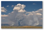
We passed a big fire in the foothills of the Wind River range about 20 miles north of Pinedale,
around the New Fork Lakes, I think. We could just barely pick out flames at the base of a huge
column of smoke; it looked like the flames were extending well above the tops of the trees. The
smoke was blowing off to the southeast; wouldn't take much of a shift in wind direction to bring
it over this way.
In Pinedale I bought a fishing license and rented bear canisters from the USFS office. I bought some
fishing gear from Great Outdoors; they were very helpful, recommending flies and places to fish
and advising on how bad the mosquitos might be. Before leaving town we ate supper at Los Cabos,
decent Mexican food. We were too late to hike in at but we were able to find a spot here in the
crowded campground. The mosquitos were fairly thick at dusk but not very aggressive. Although
cooler here, it was hot in Pinedale, 85 at 4:40PM, and even hotter in Idaho Falls. FFR, the
drive from Pinedale to the trailhead is 60 miles and took us 1 1/2 hours. Nice close up view of
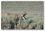
a pronghorn buck on the way in.
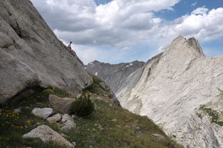
Hiking past Big Sandy Lake
Sunny, 55-70
I intended to fish early but it took me an hour to tie a tippet to my tapered leader. Both the
leader and my tippet material have deteriorated from age so the leader kept breaking when I used a
double surgeon knot. I had considered buying a tapered leader in Pinedale but was too cheap. I
finally got a 1 1/2 surgeon knot to hold. After all that, I found no fish in Big Sandy Creek near
the campgound. Perhaps I should have driven back down the road a couple of miles to one of the
ponds that was just hopping with trout when we drove in yesterday evening.

Cooling off
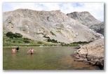
Packing up took two hours; we started up the trail at 10:00 and stopped for lunch midway along Big
Sandy Lake about three hours later. We all swam briefly in the lake then sat in the sun and wind to
dry off. For lunch we ate sandwiches of goat cheese, pesto, fresh lettuce and tomatoes, and
sardines, with fresh cherries for desert. We set out for Temple Lakes around 2PM but when I spotted
trout in a shallow pool in the second meadow stream we crossed, I stopped for a photo while the others
hiked on. Since the trout weren't too spooked I decided to try to catch one with my hands. I lay down
in the grass and reached under the overhanging bank and sure enough, felt a small trout. I gently
wrapped one hand around his head and the other around his tail and scooped him out on to the grass.
Too small to keep so I put him back. Feeling under the bank again I flushed a larger trout, smooth
and muscular. She swam out into the open water in front of me so I slowly slid my hands out around
her, one in front and the other in back and closed them on her head and tail and tossed her up into
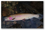
the grass. Nice 11" cutthroat, pale olive green with hint of rainbow coloration on her flanks and
lots of dark spots on the rear half of her body, and a few on the front half. I snapped her head
back to kill her then fished around some more. I caught and kept two more in short order before the
rest, including a nice-sized brookie, wised up. Then I got out my rod and caught several more brook
trout including one keeper in pools closer to the lake before sneaking back to the original pool
where on my first cast, I hooked and landed the 9" brook trout.
Rapid Lk, camp in trees center-right
With 5 nice trout for supper I set out to find the others, worrying some as I hiked up and began to
realize how big the valleys above Big Sandy Lake actually are. They don't look so big on the map.
After about a mile I found the others waiting for me on the grassy bank of Rapid Lake, the first of
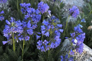
the Temple lakes. That was a relief. Beautiful meadows with deep blue lupine and old windswept
pines just above the lakeshore enticed us to set up camp there under the pines rather than hike the
additional mile to Temple Lake. After setting up tents we split up for a couple of hours. Silas
read
Jonathan Livingston Seagull in Italian on a rocky point over the lake. I fished the
stream above the lake and kept 4 more brook trout. Kirsten and Daniel hiked up the trail to the
outlet of the next lake for some bouldering while David took a nap.
Kirsten, Daniel and Silas working on supper
We regrouped around 6:00 for supper. About 200 yards up along the lake from camp we found a big
boulder, maybe 6' tall and 15' long, with a windswept whitebark pine standing guard over it. In the shelter of
that boulder (we came to call it our breakfast boulder) Daniel fixed pasta with pesto sauce enhanced with sauteed garlic and pine nuts. I
fried up three trout then poached the rest when I discovered how long it took to fry them. Very
tasty. Silas and Kirsten loved the trout. We finished cleaning up around dusk, stashed our bear
canisters in a patch of pines about 50 yards towards the lake from our dinner spot, and went to bed.
8/03/2008 Wind Rivers - Rapid Lake: 9 mi, 3700'
I didn't sleep very well last night; my legs felt worn out and twitchy and my nose was stuffed up,
especially for the first few hours. I also had to get up three times to urinate, a consequence of
drinking the cooking water from the pasta and trout. Flavored with pesto, it was delicious. Towards
morning my nose cleared up, leading me to wonder if the congestion might be due to dehydration. I
could test that theory by drinking more during the afternoon.
David and I were the first ones up, around 6:30 soon after the sun rose on the peaks. We went off
in different directions to poop - a bigger operation when backpacking than at home: find a suitable
spot, dig a hole, deposit, carefully burn the tp without setting the forest on fire, cover it all up
and reclaim the site. Regrouping I proposed that we hike up the ledgy knoll east of camp. I'd been
thinking about hiking up there ever since
last
year's trip in the Wind Rivers. It didn't disappoint us - delightful ledge hiking with lots of
flowers. Back at camp Daniel fixed oatmeal with dried fruit for breakfast. Afterwards we basked in
the sun for several hours, sheltered by our breakfast boulder from the cool northwesterly
breeze.
Around midday we set out on a hike up East Temple peak, the prominent leftward-leaning crag at the
head of the valley. David was feeling tired so he decided to stay around camp. We followed a trail
up the valley almost to the head of Temple Lake then decided to scramble up the ledgy ridge to our
left rather than tackle East Temple. Flowers were abundant on the grassy shelves and ramps between
the ledges. Once on top we decided to see if we could descend the other side of our ridge down to
the lake which drains into Deep Lake. By following the grassy ramps I found a fairly easy route
down. Daniel chose a more difficult route farther north on the same face, the crux of which was
downclimbing a 5.5 pitch. Silas and Kirsten managed to find an intermediate route.
I watched the three of them work out their routes down while I started up the side of Haystack,
scouting out a route to Black Joe Lake via the saddle above Deep Lake. I found a way up via a gully
just south of the high point in the saddle then scrambled north along the ridge to the 11672' high
point. It would be possible to continue down off that point along the ridge then descend ledges and
talus to the east and walk north down the valley to Black Joe Lake, but it would be a strenuous trip
with a backpack. From our camp it would be much easier to cross the low ridge to Clear Lake and
continue around the north end of the Haystack to get to Black Joe Lake. From the head of Deep Lake
the high route would probably be quicker.
The wind was blowing about 40mph up on the high point. Hiding behind a rock shelf I tried calling
Susan. My phone showed two bars but as soon as I placed the call the bars would vanish and I
couldn't connect. Some 1200' below me on a big flat ledge at the head of Deep Lake, Kirsten and
Daniel were hanging out waiting for me, so I descended with careful haste and found them waiting not
for me but for Silas, who'd gone to take a poop and hadn't returned. We waited another ten minutes
then reasoned that he probably had not realized that Daniel and Kirsten were out on the ledge but
instead had assumed that they had started back to camp. If that were the case, then he would have
followed the fisherman's trail out along the east side of Deep Lake, and would have passed by the
two fishermen we could see on the far side of the lake. When we reached them they confirmed that a
guy in blue shorts had passed by a half hour earlier. They were catching a few 10-12" brook trout.
Daniel had managed to catch an 8" trout himself, with his hands, in the inlet stream. I saw a nice
trout in a small pool in the ledgy outlet stream but didn't want to wash off my freshly-applied bug
dope, so left it alone.
Back at camp Daniel started cooking tofu curry and wanted me to provide trout for myself, Kirsten
and Silas since he didn't have much tofu. Having seen lots of trout in the shallow outlet stream
from Miller Lake I figured that would be no problem but when I hiked up there, most of the trout I
caught were too small. I fished up to the outlet of the lake and spotted a decent sized trout in
the lake. Casting after it, I started catching quite a few 7-9" trout. That's barely big enough;
under about 7", there's not enough meat to justify killing and cleaning them. When I had enough for
supper I cleaned them and buried the guts in a damp meadow. My experience has been that if they're
left out, whether on land or in the water, nothing eats them, so it's best to bury them.
The sun was setting behind Scheistler peak by the time I started down to camp. I figured supper
would be all done but Silas and Kirsten were still waiting for trout to add to their curry. Daniel
had mistakenly added nutmeg instead of garam marsala to the tofu curry so he and David hadn't eaten
it all. Having eaten only three bars since breakfast, I found the tofu curry pretty palatable. The
trout curry was even better though since Daniel did the spices right in that one, though the flavor
of the trout was completely masked by the curry. I cleaned the pots and we packed stuff back into
the bare kegs. Barely enough light left in the sky to tie up and hang the stuff sacks containing
the pots and dishes.
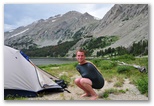
8/04/2008 Wind Rivers - Rapid Lake to Black Joe Lake: 5 mi, 2100'
Another beautiful day, sunny with a cool breeze to keep the bugs at bay. I slept better; my nose
wasn't plugged up and my legs felt better too, oddly enough considering all the hiking yesterday.
No heel soreness either, unlike yesterday when the back of my left heel was pretty tender. I think
my socks were too thick on the hike in.
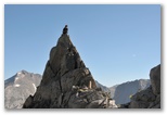
David's pinnacle
David and I were up again at 6:30. He was heading over to the other side of the lake inlet to
photograph a big boulder so I joined him. The boulder was indeed big, maybe 15' high and 30' long.
We took our pictures, and lots more besides - more boulders, flowers, frosted leaves in low spots,
reflections in the lake. Little by little we worked our way up the ridge SE of the lake inlet.
Above a small lake at 11000' we scrambled up a narrow exposed ridge, made my knees tremble. David
stayed on the ridge; from safer ground I photographed him on a spectacular spire.
Above that the way became easier, a gully, then talus stabilized by flowers, a last bit of
scrambling then suddenly broad meadows stretched out before us, short crunchy grass already tinged
with golden orange. The contrast was striking between the sheer 500-1000' cliffs on one side of the
ridge, gently sloping meadows on the other. We assumed we were the first ones there until we
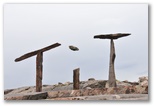
spotted a low stone wall winding along the rim of the ridge for about 50'. Built maybe 10 years
ago, judging by the few clumps of grass growing in the holes from which the stones had been removed.
We couldn't discern a functional purpose for the wall; perhaps it was intended as art.
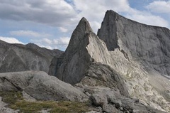
Sky Pilot
We scrambled up to the nearest point on the ridge and I pushed a 500lb boulder off the cliff. The
whole slab it was sitting on moved a little, enough to scare me into hugging the summit with my arms
while I pushed on the rock with my legs. The boulder bounced once on the cliff and a second time on
a steep snowfield before clattering down another couple hundred feet of talus. The great crash and
spray of snow were thrilling. David took a few photos but they didn't quite convey the drama.
After that I called Susan to let her know how we were doing, having not talked with her for a couple
of days. She misses us and hurt her ankle again chasing the deer out of the garden. David called
Anna, who couldn't understand why we would want to roll a big rock off the cliff. "Must be a guy
thing", David told her.
Descent was straightforward, bypassing the knife-edged ridge we'd
ascended. All the way down we could see the others sitting in the sun in the lee of the breakfast
boulder and wondered if they'd noticed our rockfall. They had and said it was pretty cool even from
a mile away.
We lingered even longer than yesterday, all the way from breakfast to lunch. We lay in the sun,
compared tans, read or wrote or talked. Around mid-afternoon a string of cumulus clouds drifting
over from the direction of Scheistler Peak blocked our sun and stirred us to pack up camp. I was
still thinking we might make it over the high ridge beyond Black Joe Lake to the Popo Agie
(pronounced "Popozha" w/ accent on the second syllable) River valley, hiking out over Jackass
Pass.
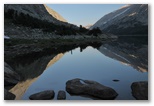
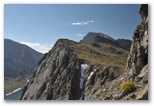
Clear Lake
We set out around 4:30 and headed over the ledgy knoll and down to the outlet of Clear Lake,
stopping on the far side of the lake for a swim in the sunshine. Cooled off, we hiked up over the
ridge and caught the trail to Black Joe Lake. Silas, in the lead, took a slightly different route
and didn't show up at the outlet of Black Joe Lake where we expected to find him. Turns out he
stopped to poop and got behind us. We set out along the southwest shore of the lake but after 15
minutes with no sign of Silas behind us Daniel and I decided to send Kirsten and David on ahead
while we went back to look for him. A fisherman along the shore hadn't seen a backpacker in blue
shorts but had caught a 14" cutthroat earlier. We'd been hearing rumors of 14-17" cutthroat in
Black Joe Lake so his report was encouraging, even though he hadn't caught anything in the past
couple of hours. Just before we reached the outlet we found Silas hiking towards us. He'd been
waiting at the outlet since shortly after we'd left it.
Daniel and I had left our packs in an area of big boulders about a quarter mile south along the
shore from the outlet. When we reached them again I saw a fish rise not far off shore. I swapped
hiking poles for fly rod and cast out using the little brown-hackled red and white dry fly I'd been
fishing with at Miller Lake. On just my second cast a big cutthroat rose up out of the depths and
grabbed it. Nice size, mabye 13", and colorful - silvery brown with dark spots more numerous
towards the tail, wash of rose on the gill covers and side and bright red slash along the side of
the throat. He ran a few times and thrashed a lot as I worked him to a gap in the boulders where I
could get down to the water. Beautiful fish, though a little skinny. I kept him. Two casts later
I hooked another, a little longer and quite a bit fatter though not as colorful. Within a few more
casts I caught a third nice-sized cutthroat. What a thrill to see those big trout rise out of the
green-brown depths to take the fly, and to feel the solid resistance when I set the hook. After a
few photographs I took the fish up on the talus slope, cleaned them and buried the heads and guts
under a rock.
It was getting late so we hustled along the rocky shore, not an easy hike. At one point we climbed
up several hundred feet to bypass steep ledges and a ridge of trees above them, then again to avoid
a jumble of huge angular boulders. Finally reaching the head of the lake, we found David and
Kirsten waiting for us on a gravel beach by the inlet stream. Turns out we had all of the tents so
they couldn't do much to set up camp.
We set up right there on the gravel beach. Stunning scenery - ledges, cliffs, crags, green meadows,
the long blue lake reflecting the setting sun. Daniel fixed Tasty Bites Indian food and rice for us
and I poached the trout. Both were delicious. After the sun set the whole lake was dotted with
rising trout, some right in by shore. Before bed we got out flashlights and discovered trout
cruising the shallows within an arm's length of shore but they were a little too wary to catch by
hand.
8/05/2008 Wind Rivers - Black Joe Lake: 7 mi, 3000'
David and I woke up early again, a few minutes before sun began to illuminate East Temple peak at
the head of the valley. Daniel and Silas had slept out and they were still asleep on the gravel,
their bags wet with dew. My flip-flops were frosted but the grass was dry. As on the previous
couple of mornings, the air was a bit hazy with smoke from the big fire we'd seen north of Pinedale
on the way in.
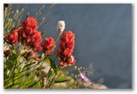
After taking a few pictures of sunlit peaks reflected in the still dark waters of Black Joe Lake,
David and I decided to hike up to meet the sunshine on the ledges above camp. Dramatic scenery -
long slabs of pale gray granite interspersed with ribbons of green meadow, the bright colors of
scarlet paintbrush, lavender aster, yellow cinquefoil and white bistort contrasting with the smoky
blue shadows of the valley below. We wandered up and across the sloping ledges stopping frequently
to marvel at the flowers and the views, to watch the hummingbirds defending their territories, to
compose photos, catch our breath, soak up the warmth of the morning sunlight. After a while we
worked our way down to a bench of meadows and ledges a few hundred feet above the valley floor. We
got separated searching for a way off the bench. I found a route just up-valley from where a small
stream cascades over the cliff. I assumed David was ahead of me but once I was down in the valley I
looked back up and spotted him up above the cliff band, still looking for a way down. With lots of
arm waving and futile shouting, I was able to direct him to the route I took, which looks like it
may have been the only route off the bench other than the way we scrambled up, down by the head of
the lake. Daniel was up and poking around the shores of the little lake above Black Joe as we
returned to camp.
Daniel fixed oatmeal again for breakfast. With two more mornings to go we're out of granola and
oatmeal but we do have lots of granola bars, so we'll be ok. We also decided this morning to stay
at Black Joe Lake another night rather than follow my original plan of hiking over to the Popo Agie
river valley then coming out via Cirque of the Towers. That would have required quite a bit more
hiking with packs and pretty much eliminated any further day hiking. I had really hoped to get over
to the Popo Agie and catch and photograph a golden trout, but that will have to wait until next trip.
During breakfast I went fishing along the beach north of camp. Trout were still rising there even
though the water is quite shallow. Within only a few minutes I had four trout 12-15" long.

Summit of Big Sandy Mountain
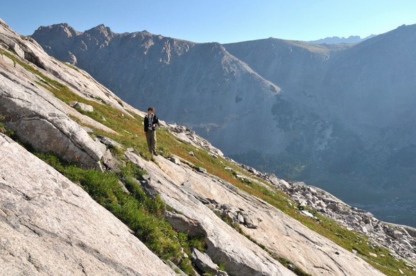
I've been wanting to get to the top of Big Sandy Mountain ever since I first saw it a year ago. As
mountains go it's not particularly impressive, just a high point (about 12,360') on the ridge between
the Big Sandy and the Popo Agie drainages, which also happens to be the continental divide. The west
and south faces of Big Sandy Mountain are moderate slopes of talus and ledges. The summit area is a
fragment of the high grassy/stony plateau widespread in the Wind River range. The sheer headwalls and
glacier-polished slopes of the valleys carved out of this high plateau make up much of the spectacular
scenery in the Wind Rivers. To see the meadows of the plateau while the flowers were still blooming
was one of the reasons I chose to come here in early August, and also one of the reasons I wanted to
hike up Big Sandy.

The flowers were indeed blooming but the broad meadows of the high plateau were no longer green;
perhaps they never get really green. The dried stalks and foliage of last year's growth paint the
meadows in hues of fall - straw, ochre, beige and brown, not unlike the color of the weathered
granite gravel which makes up the thin soil of the plateau. It could be that the snow melts off the
plateau earlier than it does in the valleys so the grass up there greens up earlier and dies off
earlier. More likely though, is that the short stiff blades and stalks of the high plateau plants
U-shaped valley E of Big Sandy Mt
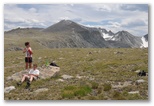
High plateau SE of Big Sandy Mt
don't get beaten down over the winter the way the taller foliage of the valley meadows does so the
dry brown vegetation continues to color the upland meadows all summer long. So what then would be
the explanation for the vivid green meadows on top of cliff-walled ridges which I saw from the plane
the one time I flew over the Wind River range? I don't know, but it was that glimpse of the
mountains below me which inspired me to come hiking here in the first place, and I have no regrets
about that.
Big Sandy proved to be an interesting hike, and not just to see the high meadows again. The kids
enjoyed snowball fights over the patches of snow we passed on the way, and scrambling on rock
pinnacles in the last saddle before the summit. The altitude slowed us down some but even David
didn't seem to have much problem with it. I took lots of flower pictures, setting the picture
control to vivid to compensate for the increasingly dull light as clouds moved in overhead. From
the summit we could see rain showers off to the west and south but they never reached us. We could
also see below us all the places we've hiked since we've been here. We admired the view, ate a bar
or two, called home and lay around in the lee of the rocks hoping for sun, but none was forthcoming.
On the way down we played around in the pinnacles some more, threw flat slabs of rocks like frisbees
off a (small, nobody below) cliff, took more flower photos and found an alternate route down. Our
descent route was about a half mile northwest of the north-trending gully we'd ascended from the
head of the lake, and was both steeper and greener, fairly easy going down grassy slopes and a
brushy dry streambed instead of the barren talus we'd climbed on the way up. We came out on the
north shore of the lake about a third of the way down towards the outlet.
Back at camp Daniel fixed mashed potatoes and veggies and I fixed the trout. Silas and Kirsten
haven't tired of trout yet, nor have I, but with four good-sized cutthroat we had all we wanted.
8/06/2008 Wind Rivers - Black Joe Lake to Big Sandy River: 7 mi, 2100'
We had a few sprinkles overnight and in the morning the air was clearer than it has been the last
several days though we didn't get much sun until midday. David and I hung around the lake this
morning while I fished and took photos of fish. They're all cutthroat, with dark spots more dense
towards the tail and a red slash on either side of the throat but otherwise they vary quite a bit.
Some are all silver like salmon; others are golden brown above with bright rose gill covers and a
rose wash on the flanks and sides of the belly, and some are intermediate in coloration. I kept
fishing while Daniel heated up some water for hot drinks and the kids sat around our kitchen area
talking.
Anticipating a long and warm hike out I cleaned the trout I kept and stashed them in the one
remaining snowbank near camp to chill. Packed in our biggest cooking pot with a ziplock bag full
of snow on top of them, they were still plenty cold when I unpacked them for supper.
After breakfast we all hiked up to the ledges above camp where David and I went yesterday morning.
The sky was cloudy so conditions weren't as good for photos. I followed the others across the
sloping ledges up to the small lakes below East Temple peak. Daniel and Kirsten and Silas? took
a side trip up to the saddle above Deep Lake but were back down at the lake by the time I caught
up to them. They were working on spelling TiT with fractured pieces of granite. After they had
the letters formed Silas hid in a big crack in the ledge and tossed a chunk of rock up while
David and I tried to catch it in just the right position. After a while we succeeded.
Seeking photos I took a slightly different route down. Interesting terrain - mostly ledges scraped
clean of talus except for scattered boulders randomly scattered over them. Strips of soil carpeted
with short grass and pine and willow krummholz run down the ledges filling fractures and low places.
The kids found a cliff with boulders conveniently perched on top and had lots of fun rolling the
boulders off the cliff. I found a few photos. The landscape was inspiring but the light wasn't very
good. As we reached the lake the clouds broke up and the sun came out so we all ventured into
the water, wading far out into the shallows at the head of the lake. Silas and Kirsten actually
went swimming but not for long. Back on the beach Daniel entertained us by demonstrating the
remarkable elasticity of his briefs. Then Silas's tent rolled into the lake on a gust of wind after
he and Kirsten had emptied it of all their gear.
Kirsten
Silas
David and I hiked out together somewhat behind the others. Not wanting to tackle the talus fields
again we followed a rudimentary trail along the north shore of the lake instead. That route was
quite a bit easier except for a 200' climb up around a waterfall and cliff near the outlet. A well-
defined trail connects Black Joe and Big Sandy lakes. We stopped at the small stream in the meadow
by Big Sandy lake while the boys tried to catch trout with their hands but the trout weren't
cooperating. We camped down in the woods along the Big Sandy river at the head of a small, shallow
lake about a half mile southwest of the outlet of Big Sandy lake. Somewhat ratty-looking woods,
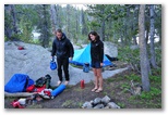
Final camp
Beetle-killed pines
partially burned a few years ago and suffering from insect damage on top of that. Many of the pines
throughout the Big Sandy drainage are dying from beetle infestations. From on top of Big Sandy peak
we could see numerous patches of rust-colored trees marking recent kill areas. It was dusk by the
time we fixed supper, on a ledge about 200' from camp. Daniel cooked up lentils and rice and I
poached trout as usual. Kirsten finally had her fill of trout so Silas and I split the rest of her
share. I only cooked three, keeping one cutthroat out to take home.
8/07/2008 Wind Rivers - Big Sandy River to Big Sandy CG: 5 mi, 200'
A herd of goats foraged through camp around dawn, more interested in browsing lakeside brush than in
chewing on any of our gear. I fished for a little in the shallow waters at the inlet of the lake
before the others got up. The riverbanks were too brushy to do much along the stream. Fish were
rising out in the lake. I kept one nice brook trout about 11" long with a large head but not too
skinny, caught a few other small trout. The slush was almost all melted in my ziploc "ice pack" but
still cold enough to keep the trout chilled out to the car.
We ate bars while we packed up. When we passed the goat packers' camp their entire herd started to
follow us up the hill. Just like our goats, they follow the biggest group, particularly if that
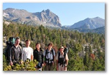
group is headed towards the trailhead. We stopped for our only group photo on a bare knoll looking
back towards Jackass Pass. Good bye, Wind Rivers. On the way back to the trail we didn't quite get
lost but had some difficulty finding a route around a little gorge not apparent on the map. The
last four miles on the trail out to the car passed as quickly as could be hoped. The river is very
pretty where it flows through meadows along the way, clear water gliding over dark boulders and
drifts of warm brown gravel. As we were packing up the car back at the trailhead we talked briefly
to a couple of guys who were heading in. We described our campsite at Rapid Lake and our breakfast
boulder and they not only knew the spot, but told us that was their favorite campsite in the entire
Wind River range.
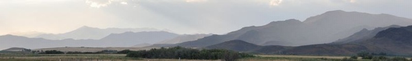
We stopped in Pinedale to drop off our bear cannisters and eat lunch at the Mexican restaurant
again. East of Idaho Falls a brisk westerly breeze was blowing clouds of dust up around Middle and
Twin buttes near Atomic City. We stopped for photos. We passed thunderstorms and a rainbow around
Craters of the Moon National Monument. Late afternoon sunlight and a thin haze of smoke in the air
made for beautiful landscapes in the hills approaching Hailey and Sun Valley. We looked for a place
to eat out in Sun Valley but all the restaurants were packed so we went shopping at the upscale
market in Ketchum and fixed our own supper of spaghetti with pesto back at Kirsten's condo. Writing
this some weeks later I don't recall much of the drive home. I didn't take over driving until dawn,
somewhere around the Tri-cities area. We dodged a big thunderstorm southeast of Yakima, bought some
delicious peaches in Nachez and arrived home about 24 hours after we left the Big Sandy trailhead.
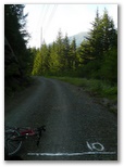
Mile 10
Sunny and hot
Our last day to get ready. Shopping for equipment and food occupied Wednesday and Thursday. That
and fielding late registration requests. I turned off online registration on Monday because we
were already over 130 runners and I expected a few additional mail-in registrations. Anticipating
120 runners, I'd only ordered 130 medals. I counted T-shirt requests and upped the order by 20
shirts but couldn't change the medal order. By Friday morning I'd added another 30 runners who'd
emailed me asking to run the race despite the $50 entry fee and no guarantee of a T-shirt or medal.
Yesterday I marked most of the course,
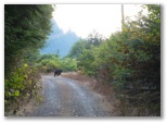
Bear Break
bicycling up from the finish to mile 5 and back again, stopping at each mile
to draw a line and the mile number with unbleached flour on the right side of the trail. It was
hot and I ran out of water around mile 10. Didn't help that I hadn't ridden a bicycle in over a
month either. On the way back down I came around a corner to see a big black bear ambling down
the center of the trail about a hundred yards ahead of me. I waited until it moseyed off into
the bushes, then a couple minutes more, before I rode on by singing the Halleluia chorus. Nothing
else came to mind.
Saturday we almost made it to church. But once again, not quite. Towards sunset I loaded
up the van with 12 blue 5-gallon jugs full of water and 6 blue 7-gallon jugs of Gatorade along
with 5 tables and 5 wastebaskets and drove up to Snoqualmie pass wondering what I'd do if I didn't
have the right combination for the gate locks on the John Wayne Pioneer trail. With 800lbs of fluid
aboard I sloshed into the Hyak parking lot and called Ray, with whom I was planning to leave the
checkin supplies for the morning. He showed up in the motor home a few minutes later while I was
looking for the turnaround point. Found it, fortunately, and marked it with flour, then stashed
the checkin supplies in the back of Ray and Jane's motorhome before heading into the tunnel around
10:30PM. I had the right combination. (sigh of relief).
Driving the tunnel was more eerie than running it. Taller and narrower than I
expected, it featured dark gray walls with ghostly white scars and scrapes, dripping water and
fairly thick fog through the middle. Driving through seemed to take a long time. So did setting
up the aid stations. It was 12:30AM when I reached Cedar Falls in the now empty van to discover
that, as I'd suspected, I would have to drive back up to Twin Falls in order to get off the trail.
Susan was still up but only moving at half speed when I got home at 1:30AM. Fortunately she had
most of the food and serving gear packed up. I assembled my running stuff and got to bed around 2.
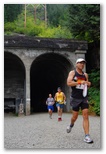
Tunnel Marathon (by David)
Mostly cloudy but very warm and humid
The big day - the
2008 Light at the End of the Tunnel Marathon. I was up at 4:15 but didn't finish packing the
car until 5:45, so Susan and I left 45 minutes late to our rendezvous' at the start and the finish
respectively. Fortunately Leslie was there to meet the runners and the buses and put the two
together. I'd forgotten to tell her where the runners should park but a quick phone call
straightened that out before too many showed up. Rich was at the finish so we unloaded everything
since he'd be there to watch it until Susan arrived. Setting up the Rattlesnake aid station and
dropping gu at the Garcia station took a half hour longer than I expected but I was able to call up
to the start and listen in over the phone so I could start the timing clock on time. Fortunately
Terry had taken the race timer up to the start for Tony to use. No photos though; Ian's mom called
at 5:00AM to report that Ian was too sick to come. Only Susan was around when I arrived at the
start. Tony had gone through the tunnel to help David bring the flashlight drop bags back.
They were just returning when I set out at 1:00:00 on the race clock. Temperature was already close
to 70 in the sunshine, damp but not very cold in the tunnel. As I left I handed my light to Susan,
not wanting to carry it for 26 miles, so I ran the Tunnel without it. As long as I kept looking at
the pinpoint of light in the darkness, I was OK. The roadbed is somewhat concave so I could usually
feel if I was veering off to one side or another. The vague hint of an echo from the walls on
either side helped too. When I guessed I might be around mile two I tried to spot the mile marking
in the faint glimmer of light from the distant opening but as soon as I looked down and to the side,
I found myself swerving towards the wall and onto the warning carpet. At the first aid station I
found both the Gatorade and water jugs almost full and only a couple of cups in the wastebasket. I
stopped about a minute and a half, ate a gu and filled my bottles with Gatorade. At three miles I
was 25:33 so I ran about 8:00/mile through the tunnel. That's about what I'd guessed back there in
the dark.
I held about the same pace for the next three miles then picked it up to about 7:50/mile until the
half, keeping cool by stopping every few miles to splash cold water over my head and back. That
felt good - not just the cold water but also to be running 7:35 and 7:40 miles with no more effort
than I would have needed to run 8's on a flat course. Despite the heat there were lots of little
streams and waterfalls are still running along the trail because it hasn't been that long since the
end of the snowmelt. The cold water really helped me in the first half. I couldn't hold the same
pace in the second half though, and especially in the last six when I slowed to almost 8:30/mile. I
wasn't particularly sore; I just couldn't go any faster, despite consuming a gu and Gatorade or
water at every aid station. Could have been dehydration, or maybe lack of sleep, or maybe just
being out of shape, having not run a marathon since the middle of July. The important thing as far
as I was concerned is that I was able to hang on to sub 3:35 and run a Boston qualifier and prove
that the my course is fast. I ran hard and prayed for strength, and in the end I had the strength I
needed and was grateful to the point of tears as I crossed my finish line in 3:34:24, my slowest and
one of my most meaningful, BQ runs.
Although it was great to run the race, it meant I almost completely missed the running of the race.
I missed the start and most of the activity at the finish, but on the other hand I did get a pretty
good sense of the runner's experience out on the course. The self-serve aid stations worked great,
surprisingly efficient, and the mile markers and directional markings on the course were very clear.
Salima and Caroline at Garcia and Bill and his protege at Rattlesnake contributed a friendly and
welcoming feeling to the course. Many runners did have a hard time with the heat though. Ice water
and Susan's grape juice were very popular at the finish, along with the watermelon. Not so much for
my chips and salsa and the pb&j sandwiches. Tony and Jess did a great job with the timing despite
some ambiguity about a few of the early starters. T-shirts proved to be a tough job, one that Teri,
aided by a friend of Shawn Gay's, handled with grace and good humor. In order to determine which of
the late registrants could receive shirts we had to take repeated inventories of who had already
finished and how many of each size of shirt we had left, even as both counts were continually
changing. In the end nearly everyone got a T-shirt in their size, or close to it. We did run out
of medals but all the regular registrants who wanted a medal received one, I think. Need to order
extra of both next year even if we have to charge a little more to cover the expense. Several people
commented to Susan how much they liked the design, which made her happy.
Thanks perhaps to the two Expresso Love gu's I swallowed at miles 6 and 16, I kept going for the rest
of the afternoon, visiting runners, helping with the T-shirt distribution, packing up, taking down the
Rattlesnake Lake aid station, driving home. Too tired to clean the course in the evening so I'll have
to do that tomorrow morning; hope the bears don't get into the aid stations overnight.
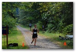
Diana Robinson finishing (by David)
early AM sun then overcast, showers late
Legs pretty sore today. I spent much of the day on the computer creating tables, procedures and an
asp page to store and display the
Light at the End of the Tunnel Marathon 2008 results. I based the layout on the
Tacoma City marathon results page,
appropriately I think since RD Tony Phillippi has been my mentor and key assistant for the Tunnel
marathon. The results indicate a pretty competitive field - 22% qualified for Boston. I came in 28
out of 138 overall and 6 out of 20 in my age group (20th and 30th percentile respectively). I think
times would have been faster had it not been for the heat and humidity; Washington runners just
aren't used to those conditions. Even so, at least 3 people set PR's.
David took Anna out on their last date of the summer so that she could break up with him. They'd
discussed it in advance; although breaking up was her idea, it wasn't a surprise to him. She's
off to college back east tomorrow. Last time she broke up with him David continued to ask her
out on dates, apparently ignoring the fact that they'd broken up. She kept accepting his invitations
and after a month or so they merged back together again. Not sure what will happen this time around
since they won't see each other for four months. As Susan's mother told her when she returned from
camp to find her boyfriend going out with another girl, "Absence makes the heart grow fonder... for
someone else!"
When David is out and Susan and I are alone here, I find myself thinking - this is how it's going
to be the rest of our lives, just the two of us, the boys off living their own lives while we're
home alone. If I want to play tennis there'll be no one to play with, no one to fix salsa and vegetables
for at lunch time, no one to compare photographs with, no more "Art of" library books lying around.
Always just the two of us for supper, if we fix supper at all. And we only have him for a few more
days; I mourn a little the passing of each remaining day. Not that there aren't consolations, Maui
for instance. And they'll be back for vacations (especially if we pay their way), maybe summers for
awhile, and we'll still be able to worry about them, worry tinged with regrets now that they're
gone and we can't repair our parental errors. But Susan and I love each other and enjoy one another's
company, so maybe it won't be so bad.
8/20/2008 Showers and rain
With teeth all smooth and clean I drove over to North Bend to clean up the parking area, my labor in
lieu of rent. Two piles of polyethylene tarps and about a ton of 1-2' long chunks of 4x6's and
6x8's, mostly pressure-treated. I tried to come up with a use for them but couldn't so took two
loads to the dump. After the second load I was ready to go home and return tomorrow but all the
routes home were blocked by accidents so I figured I might as well stay and finish the job. I
spread out each plastic sheet in order to fold it into a 3'x4' square which I could fit in the back
of the van. While I worked the gray sky collapsed into rain around me. Then a west wind picked up
and within minutes drove the rain and mist back into the mountains, but I was already drenched.
With a vanload of soggy blocks and dripping tarps topped with trash I finally drove home around
7:30PM.
8/21/2008 Showers, occ sun, cool. 1.2" of rain over the last couple of days
Set up Daniel's printer and tried the Costco paper out - it works - then spent a couple hours
answering marathon-related email and fixing the results again. After lunch I took the third load of
wood blocks and plastic sheets from the Tunnel Marathon parking area to the transfer station.
Brandon and Ryan Gratias arrived with a load of construction debris while I was finishing up.
They're thinking of climbing Rainier this Friday night and Saturday - tempting but I think I'm
occupied taking David over to UPS. Would be tough to run Watershed Preserve marathon the next day
anyhow.
Later I washed up the rest of the bowls and plates from the marathon and put a few things away.
Not too much left to do - post-mortem with Susan and write-up of aid and food used and ideas for
next year, finish validating and correcting the results, get remaining flashlights and drop bags
back to their owners, finish drying and putting away tubs, tables and water jugs. I want to make
a few changes to the website too - use frames so the heading stays put while the content scrolls,
create a registration form which incorporates a waiver so we don't need to get waivers signed at
check-in (Yakima marathon is a good example of that), write up job descriptions for all volunteer
roles, put up directions to aid stations and spectator sites and update the
photo album of the course.
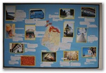
Daniel's board
Susan and David spent the day over at UPS helping Daniel get his bulletin board up. David took
photos of the Tacoma locations Daniel wanted to feature on his board then printed them out.
Daniel wrote up a brief blurb on each one and pinpointed its location with a flag on a Tacoma city
map, then Susan helped in paste it all up. Very professional result and the envy of his fellow RA's.
8/29/2008 Lake Lillian hike Mostly cloudy, 70's
There having fallen a fair amount of rain in the last week or two I thought I'd better get up and
see if the
Boletus edulis were up yet along the trail to Lake Lillian. They weren't, despite a lot
more moisture in the soil than we found during
last fall's
hike. I saw very few mushrooms of any kind but the flowers were still putting on a fine display,
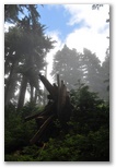
their colors bright despite the gray day. One hiker heading back from Lake Lillian complained that
they'd enjoyed only one sunbreak all day long, and it lasted only one minute. I didn't do much better
on the sunbreaks but on the other hand the fog along the ridge made the tree trunks look pretty cool,
and the rain held off until my last 20 minutes hiking down through the new second growth to the car.
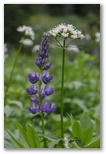
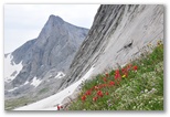
Lupine and Valerian
I brought my fly rod in case I felt like fishing at Lake Lillian but I didn't use it. The
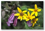
Penstemon and Arnica?
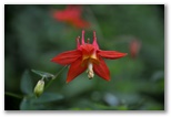
Red Columbine
hike in took 3 1/2 hours including quite a few photo stops and I didn't leave the car until 12:30. I
lingered at the lake for about a half hour, talked to Susan on the phone, watched for fish rising. I
did see several rises and someone had left the offal from a trout perhaps as large as 10" in the water
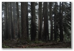
Hemlock and Pacific Silver Fir
where the trail first reaches the shore but I was cold and the clouds were closing in so I decided not
to try my luck. Maybe next time. I also saw trout, a school of perhaps 10 fish up to 8" long, in a
shallow pool downstream from Twin Lakes, just before the stream drops off a cliff. I wouldn't have
thought they could survive in such shallow water; maybe they migrate back up to Twin Lakes for the
winter, but even there I wouldn't think they'd have much headroom. Too skittish to cast to.
The hike back from the lake took 2 hours, and unlike
last
time, it was still daylight when I reached the car.