01/01/2010 Showers w/ occ brief sunbreaks, high 40's
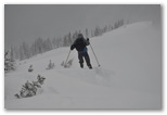
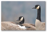
Started the year and the decade off right with a long run with a bunch of Marathon Maniacs at Adrian Call's First Call Marathon, a double out-and-back on the paved Sammammish River trail. I'd intended to run only the marathon distancebut overnight someone stole the cones Adrian had placed on the trail at the marathon turnaround point so we all ran another 1 1/2 miles to the 50K turnaround. I could have cut the second leg short but having already run half a 50K on the first leg I went ahead and did the full distance, my first 50K since Gray Rock back in July 2008. Heading out on the second leg I started getting a little stiff and sore so I took off my shoes at the turnaround and ran most of the way back barefoot. At 50F on the wet pavement and grass my feet weren't quite warm enough for comfort but with wind pants on they didn't quite go numb either.
I developed some stiffness in my lower left shin tendon during the race and it was a bit tender and swollen afterwards. Apparently that problem isn't yet resolved.
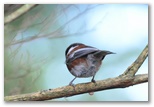
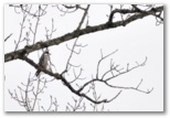
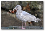
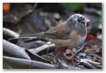
Though my time wasn't spectacular - I averaged 11:00/mile - the birding was pretty good. I counted 34 species which is respectable for a winter race.
Started the year and the decade off right with a long run with a bunch of Marathon Maniacs at Adrian Call's First Call Marathon, a double out-and-back on the paved Sammammish River trail. I'd intended to run only the marathon distancebut overnight someone stole the cones Adrian had placed on the trail at the marathon turnaround point so we all ran another 1 1/2 miles to the 50K turnaround. I could have cut the second leg short but having already run half a 50K on the first leg I went ahead and did the full distance, my first 50K since Gray Rock back in July 2008. Heading out on the second leg I started getting a little stiff and sore so I took off my shoes at the turnaround and ran most of the way back barefoot. At 50F on the wet pavement and grass my feet weren't quite warm enough for comfort but with wind pants on they didn't quite go numb either.
I developed some stiffness in my lower left shin tendon during the race and it was a bit tender and swollen afterwards. Apparently that problem isn't yet resolved.
Though my time wasn't spectacular - I averaged 11:00/mile - the birding was pretty good. I counted 34 species which is respectable for a winter race.
01/04/2010 Rain (2.1" year to date), high 40's
We sent Daniel off to Spain for the second semester of his Junior year this morning at 7AM. Getting out of the house was a little hectic, as usual. Although he laid everything out on the living room floor yesterday, he didn't actually pack his backpack until this morning. He'd assumed that it would qualify as carry-on luggage but once he had everything packed, we discovered that it was too large and would have to be checked so he had to unpack again and we had to search for a smaller pack in which he could carry his camera, computer and papers. Mission accomplished at the cost of a 10 minute delay in our departure. Fortunately the airport wasn't crowded and he had no difficulty making his plane.
After that it was a slow day because none of us had much sleep last night.
01/05/2010 More rain, mid 40's
A good day to curl up in front of the computer, so I did.
A good day to curl up in front of the computer, so I did.
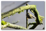
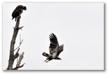
One of the pleasures of a new year is starting a new annual yard bird list. I went out birding on the second and managed to find 26 species including 3 raptors - a sharpie, kestrel and redtail - and 6 sparrows, including one of the white-throated sparrows. Since then we've picked up another 7 species of which the highlight was a merlin flyover this morning. Both merlin and kestrel are tough to get here in the yard so we're off to a good start.
The weather was dry for a change, giving David and me an opportunity to get outside with our cameras. I've been itching to photograph some birds but on rainy days this time of year there just isn't enough light, or at least so I've been thinking.
01/07/2010 Increasing clouds, rain late, 50
 Spectacular sunrise this morning, one of the few mornings recently that I've been up in time to see
the sun rise though even this morning I was a little late for the best color.
Spectacular sunrise this morning, one of the few mornings recently that I've been up in time to see
the sun rise though even this morning I was a little late for the best color.
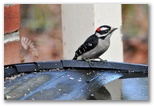
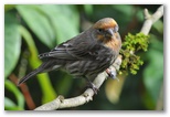
In the past I've been reluctant to push the ISO above 500 but I'm finding that if I can get close to a bird, I can up the ISO to 1250 and even 1600 without much loss of quality as long as the images are sharp. That allows me to use sufficiently high shutter speeds to get away with hand- holding the 300 f4 even on dark days. In darker conditions I can drop the shutter speed as low as 1/60 and still get a few good shots by bracing the camera. Though the D300 produces quite a bit of noise at 1250 and above NeatImg cleans it up pretty well. The images at the top of this page were all shot at ISO 1250. The Towhee and Song Sparrow above under 1/5/2010 were shot at ISO 1250 as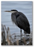 well. For the Downy Woodpecker I used 1/250 at f6.3, ISO 800, but I would have been much better off
using ISO 1250 and opening the aperature up to f5 in order to use 1/500, since that shot (and the
other half dozen I took of the same subject) all suffered from some degree of motion blur.
well. For the Downy Woodpecker I used 1/250 at f6.3, ISO 800, but I would have been much better off
using ISO 1250 and opening the aperature up to f5 in order to use 1/500, since that shot (and the
other half dozen I took of the same subject) all suffered from some degree of motion blur.
This afternoon Susan, David and I drove into Bellevue for lunch at a new (to us) Indian restaurant and a visit to the company store then Susan dropped us off at the Union Bay Natural Area while she returned some items at University Village. I'd hoped to find some birds to photograph but under a heavy overcast it was already beginning to get dark by the time we got out there. Then walking along the trail by the lake I spotted a rather tame heron and I got a shot to make the outing worthwhile. Susan liked this image, taken handheld at 1/400 f4.0, ISO 1600 with the 300 f4 lens. I accidentally had the exposure compensation set at -1.0 which increased the noise somewhat but no doubt increased my yield of usable images. This one is sharpened with noise reduction in NeatImg.
In the past I've been reluctant to push the ISO above 500 but I'm finding that if I can get close to a bird, I can up the ISO to 1250 and even 1600 without much loss of quality as long as the images are sharp. That allows me to use sufficiently high shutter speeds to get away with hand- holding the 300 f4 even on dark days. In darker conditions I can drop the shutter speed as low as 1/60 and still get a few good shots by bracing the camera. Though the D300 produces quite a bit of noise at 1250 and above NeatImg cleans it up pretty well. The images at the top of this page were all shot at ISO 1250. The Towhee and Song Sparrow above under 1/5/2010 were shot at ISO 1250 as
Great Blue Heron
This afternoon Susan, David and I drove into Bellevue for lunch at a new (to us) Indian restaurant and a visit to the company store then Susan dropped us off at the Union Bay Natural Area while she returned some items at University Village. I'd hoped to find some birds to photograph but under a heavy overcast it was already beginning to get dark by the time we got out there. Then walking along the trail by the lake I spotted a rather tame heron and I got a shot to make the outing worthwhile. Susan liked this image, taken handheld at 1/400 f4.0, ISO 1600 with the 300 f4 lens. I accidentally had the exposure compensation set at -1.0 which increased the noise somewhat but no doubt increased my yield of usable images. This one is sharpened with noise reduction in NeatImg.
01/08/2010 Showers, mid 40's
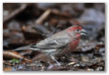
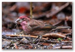 Another gray day. Sometime around mid-morning Susan asked for help identifying some red birds at
the feeder, so I went downstairs to check them out. I expected House Finches since we have a small
flock around the house but to my surprise there were two Purple Finches under the feeder. Usually
they're not around this time of year though I heard one overhead a few days ago and thought I saw
a female at the feeder. At first I thought they might be Cassin's finches but I checked with Sibley
and confirmed the id. I tried for photos but of course they flew off and didn't return until after
I came back inside. Later though, I tried again and this time got a few shots from my blanket-blind.
Very dark there behind the house, so both the House Finch and Purple Finch were shot at ISO 1600,
f4.0 using my 300mm f4 lens at 1/200 and 1/80 respectively, so there's a bit of motion blur. On both
I cleaned up some of the noise and did some sharpening with NeatImg. Viewing the photos, I finally
realized that I can tell these two apart fairly easily by the reddish wash on the wings. The Purple
Finch has it; the House Finch does not. In side by side photos the differences are readily apparent
but when you see just one by itself outdoors it's not always as easy to tell them apart.
Another gray day. Sometime around mid-morning Susan asked for help identifying some red birds at
the feeder, so I went downstairs to check them out. I expected House Finches since we have a small
flock around the house but to my surprise there were two Purple Finches under the feeder. Usually
they're not around this time of year though I heard one overhead a few days ago and thought I saw
a female at the feeder. At first I thought they might be Cassin's finches but I checked with Sibley
and confirmed the id. I tried for photos but of course they flew off and didn't return until after
I came back inside. Later though, I tried again and this time got a few shots from my blanket-blind.
Very dark there behind the house, so both the House Finch and Purple Finch were shot at ISO 1600,
f4.0 using my 300mm f4 lens at 1/200 and 1/80 respectively, so there's a bit of motion blur. On both
I cleaned up some of the noise and did some sharpening with NeatImg. Viewing the photos, I finally
realized that I can tell these two apart fairly easily by the reddish wash on the wings. The Purple
Finch has it; the House Finch does not. In side by side photos the differences are readily apparent
but when you see just one by itself outdoors it's not always as easy to tell them apart.
House Finch
Purple Finch
01/09/2010 Sabbath PC-high clouds, around 50. (1.9" rain in the guage)
Due to rain yesterday and last night the bottom of the driveway is flooded but by mid-morning the sun came out and the rest of the day was very nice, quiet and warm with quite a bit of sunshine. David and Nick went biking down in O'Grady in the afternoon and I got out for a late afternoon run, 6 miles of which I did 5 barefoot leaving the bottoms of my feet a little tender. My L AT tendon does not seem to be recovering well from the 50K; it was already a little tight within the first mile but didn't get any worse. Running barefoot doesn't seem to bother it much.
As we were getting ready to get ready to go to church, David succeeded in setting up a Skype connection with Daniel so we spent the next hour talking with him. He's settled in with his host family, a single mother and her daughter, and is loving Granada. He talked at length about the social life there. Apparently the Spanish spend alot of time out socializing with each other, often in tapas (sounded like "topless") bars where you order a beer and it comes with such a large quantity of appetizers (the tapas) that nobody gets drunk because they get too full first. He and his roommate Peter have been spending quite a bit of time just walking around the city, where they're able to pass as locals by speaking quietly in Spanish. Tourists, particularly the Americans, can be recognized because they speak with loud voices in languages other than Spanish.
Daniel himself has been speaking mostly in Spanish and is getting to the point where he doesn't need to mentally translate everything from English. He even found it somewhat difficult at first to speak English with us, and asked that we not talk together too frequently because it interrupts his immersion in Spanish. It was great to be able to see him as well as hear him. He looked pretty tired but that may have been due partly to the low-resolution connection.
David began building his new computer after lunch then finished it up in the evening after Cody, who just finished building his own system, came over to help him figure out where to plug in all the cables. His components (ASUS P7P55D-e Pro, i5-750, 2x2Gb GSkill Eco DDR3 1333, Sapphire Vapor-x 5770, Samsung Spinpoint F3 500Gb, Lian-li Lancool PC-K7) arrived yesterday and all worked the first time, or at least once David and Cody figured out how to plug them in.
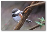
Tail-less Northern Shrike
Golden-crowned Sparrow
Later in the afternoon David and I rode bikes over to 212th near 400th where a few days earlier I'd noticed that someone had printed "Zombie" on the blue flood escape route sign above where it says "Evacuation Route". David wanted to photograph the sign and I was hoping we might come across a hawk sitting on the telephone wires somewhere. No hawks but on our way home on 180th we flushed a tail-less Northern Shrike. Although I saw one back in December by 212th and 180th, browner than today's bird I think, and in posession of a full tail, they aren't common around here; if I've seen any others in the past few years I didn't record the sighting. The photo was taken with my D300 at ISO 1250 using a 300 f4 lens with 1.4x teleconverter, 1/640 at f5.6. I subsequently cropped it to 40% of original dimensions, reduced noise w/ Neatimg, increased contrast in Picasa and sharpened just the bird w/ Elements. The Golden-crowned Sparrow photo on the right was taken this morning in our back yard, 1/125 f4 with the 300f4 lens w/o teleconverter, ISO 1250 with noise reduction in Neatimg and a little sharpening of the bird's face in Elements.
01/11/2010 Wet, 0.7" rain in the guage
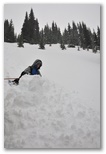
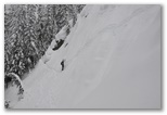
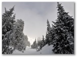
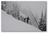
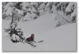
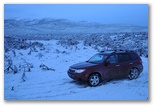
01/14/2010 Snowshoeing Wet, mild
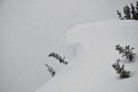 A brief break in the weather was forecast for today but it arrived 8 hours early so by the time we
set out for Crystal to go snowshoeing, light rain had already begun again. It's been consistently
warm and wet recently and the usually snow-packed Crystal Mountain parking lot had just a half
inch of new wet snow on top of bare gravel. We started up on snowpack consisting of a foot or
two of granular snow saturated with water right down to the ground. The snow half way up to the
ridge, though twice as deep and capped with a couple inches of sticky powder, was the same
consistency. About that point the wind picked up and it began to snow so we tucked in under a
dense fir tree and sat on bare ground to eat our lunch before continuing up the open slope. The
wind was gusting to maybe 30mph sweeping clouds of mixed powder and granular snow into our
faces as we labored up the hill. On all the hillsides around us the firs were still snow-covered;
only on the slope we were climbing were the trees were bare and dark, their snow having been
scoured off by the wind. Towards the crest of the ridge the powder was quite a bit deeper and the
wind gusts more insistent so we worked our way into partial tree cover for some shelter. Attaining
the ridge we were repeatedly enveloped in blowing snow but we lingered to knock off a few cornices
and even managed to set off a couple small avalanches on the lee side. It would have been fun
telemarking over there had I brought skis. We started down with less than a half hour to go until
sunset, picking a route through the trees to avoid the wind. As we dropped into the valley just
downwind of the big open slope we met three skiers. Like wild animals they emerged silently
from a gray grove of snowy firs, looked us over briefly then fled down the slope, their turns far
more graceful than our buttsliding descent. We regained the trail on the bend of the slope below the
corniced ridge and followed it back to the parking lot at dusk.
A brief break in the weather was forecast for today but it arrived 8 hours early so by the time we
set out for Crystal to go snowshoeing, light rain had already begun again. It's been consistently
warm and wet recently and the usually snow-packed Crystal Mountain parking lot had just a half
inch of new wet snow on top of bare gravel. We started up on snowpack consisting of a foot or
two of granular snow saturated with water right down to the ground. The snow half way up to the
ridge, though twice as deep and capped with a couple inches of sticky powder, was the same
consistency. About that point the wind picked up and it began to snow so we tucked in under a
dense fir tree and sat on bare ground to eat our lunch before continuing up the open slope. The
wind was gusting to maybe 30mph sweeping clouds of mixed powder and granular snow into our
faces as we labored up the hill. On all the hillsides around us the firs were still snow-covered;
only on the slope we were climbing were the trees were bare and dark, their snow having been
scoured off by the wind. Towards the crest of the ridge the powder was quite a bit deeper and the
wind gusts more insistent so we worked our way into partial tree cover for some shelter. Attaining
the ridge we were repeatedly enveloped in blowing snow but we lingered to knock off a few cornices
and even managed to set off a couple small avalanches on the lee side. It would have been fun
telemarking over there had I brought skis. We started down with less than a half hour to go until
sunset, picking a route through the trees to avoid the wind. As we dropped into the valley just
downwind of the big open slope we met three skiers. Like wild animals they emerged silently
from a gray grove of snowy firs, looked us over briefly then fled down the slope, their turns far
more graceful than our buttsliding descent. We regained the trail on the bend of the slope below the
corniced ridge and followed it back to the parking lot at dusk.
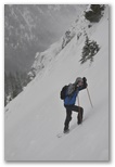
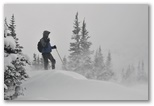
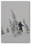
Ascending after lunch
Near the ridge
On the ridge
Kicking cornices
The end of a slide
01/15/2010 Guacamole Wet and windy, 50F,
When we were at University Village last week I bought a molocajete at William's and Sonoma. A few years ago I picked one up at a Mexican store in Federal Way as a Chrismas present for Susan but it was apparently made of cement and we never used it. This one is the real article, a heavy bowl on three short legs, squat and rotund like a Pre-columbian figurine, ground out of somewhat porous gray volcanic stone dotted with small white feldspar crystals and accompanied by a stout fist-sized pestle enlarged at both ends like a basalt dumbell.
When we got home I prepped the molocajete according to Diane Kennedy's instructions in her book From My Mexican Kitchen, by grinding a handful of rice to powder, washing out the bowl and repeating until the rice no longer turned gray from basalt dust. After about three iterations both pestle and bowl were noticeably smoother.
Since then I've prepared two batches of guacamole in it. Using the molocajete lends a stone-age feel to an otherwise somewhat tedious food-prep task. As Diane Kennedy promised, grinding the ingredients in a molocajete gives the guacamole a superior flavor, and I have yet to encounter any sand in it. Nick joined us for a late lunch of chips, refried beans (with cumin and a touch of cinnamon added) and the guacamole. He pronounced it delicious and he's from San Antonio, so may be somewhat of an authority. On the other hand, he's David's age and is always hungry so would probably like guacamole however I prepared it.
01/18/2010 David back to school Sun w/ some high clouds, mid-50's; 1.1" rain in the guage
For the past week or so the weather pattern seems to have been gray rainy days with clearing at night, frustrating my plans to get out and photograph yardbirds. Last night was typical - overcast all day with rain in the afternoon, then after dark the clouds breaking up to reveal a deep black sky with bright stars - another beautiful sunny night. Today however broke the pattern and we had sunshine with mild temperatures most of the day.
I thought I might run in the morning before we took David back to school so I fixed breakfast, granola and soymilk with a pear, as soon as I got up then since the sky was bright, I grabbed the camera and headed out to enjoy breakfast in the blind by the bird feeder in hopes that the White-throated Sparrow would show up again. It didn't but I spent much of the morning in the blind anyhow and got a few decent photos, close up but nothing special. After awhile I got tired of the blind and just stood out by the feeder with the camera on a sandbag on top of the tripod. The juncos and purple finches were OK with that arrangement and soon flocked back to the ground under the feeder less than 6' from me. The white-flecked junco showed up too, the first time I've seen it in over a month.
Since I never made it out for a run I took my gym bag and hit the college track while David and Susan went out to lunch. I had a good workout, ran four 880's at 3:33-3:19 w/ 1 easy lap in between, then took off my shoes and ran two more fast ones with a slow lap in between. I ran the second barefoot 880 in 3:08, one of my fastest ever. Two years ago I ran a 3:07, and two years before that, a 6:18 mile which probably included a sub-3:08 half. I'm thinking that with some training I might even be able to break 3 minutes barefoot, and possibly even approach a 6 minute mile.
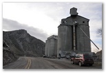
Speaking of fast, we saw a Peregrine Falcon stoop on a pigeon along the Tacoma waterfront between the grain elevators and Old Town as we were driving David back to school. It dove down behind an overpass where the pigeons were flying about but missed its target and sliced back up into the sunshine, its pale gray back and contrasting black and white head and face leaving no doubt about the id.
For the past week or so the weather pattern seems to have been gray rainy days with clearing at night, frustrating my plans to get out and photograph yardbirds. Last night was typical - overcast all day with rain in the afternoon, then after dark the clouds breaking up to reveal a deep black sky with bright stars - another beautiful sunny night. Today however broke the pattern and we had sunshine with mild temperatures most of the day.
I thought I might run in the morning before we took David back to school so I fixed breakfast, granola and soymilk with a pear, as soon as I got up then since the sky was bright, I grabbed the camera and headed out to enjoy breakfast in the blind by the bird feeder in hopes that the White-throated Sparrow would show up again. It didn't but I spent much of the morning in the blind anyhow and got a few decent photos, close up but nothing special. After awhile I got tired of the blind and just stood out by the feeder with the camera on a sandbag on top of the tripod. The juncos and purple finches were OK with that arrangement and soon flocked back to the ground under the feeder less than 6' from me. The white-flecked junco showed up too, the first time I've seen it in over a month.
Since I never made it out for a run I took my gym bag and hit the college track while David and Susan went out to lunch. I had a good workout, ran four 880's at 3:33-3:19 w/ 1 easy lap in between, then took off my shoes and ran two more fast ones with a slow lap in between. I ran the second barefoot 880 in 3:08, one of my fastest ever. Two years ago I ran a 3:07, and two years before that, a 6:18 mile which probably included a sub-3:08 half. I'm thinking that with some training I might even be able to break 3 minutes barefoot, and possibly even approach a 6 minute mile.
Speaking of fast, we saw a Peregrine Falcon stoop on a pigeon along the Tacoma waterfront between the grain elevators and Old Town as we were driving David back to school. It dove down behind an overpass where the pigeons were flying about but missed its target and sliced back up into the sunshine, its pale gray back and contrasting black and white head and face leaving no doubt about the id.
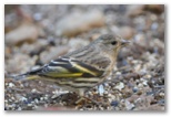
Pine Siskin under the feeder
After taking a few bird photos in the morning I drove over to Landsberg to remeasure the course for the Cedar River Yours Truly 50K this coming Sunday. I've cycled it and measured it using gmap-pedometer but I wanted to double-check it with my GPS. Both the revised gmap-pedometer measurement and the GPS placed the turnaround 50 yards or more beyond my former turnaround. Because in the past a few people thought the course was long I decided not to extend it and used the old turnaround again.
Lots of birds along Lake Wilderness, not very many along the Cedar River. Here's my bird list.
01/22/2010 Sun w/ some high clouds, mid-50's
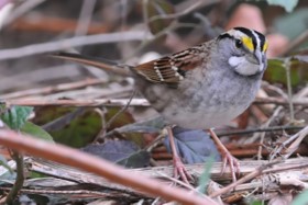
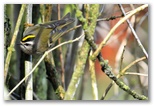
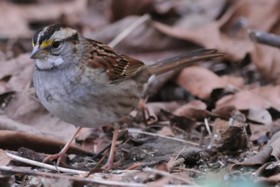 I finally succeeded in getting photos of both of the White-throated Sparrows today. Although I've
seen one or the other from time to time, they're a little more secretive than the juncos and
Golden-crowns so I haven't been able to get decent photos. I also haven't seen them together so
haven't been sure that both were still around. Studying the photos it's not hard to tell them
apart. The one on the left is the adult, with black crown stripes, bright white eyestripe with a
fat yellow patch in front of and over the eye and clear gray breast. The first-winter bird on the
I finally succeeded in getting photos of both of the White-throated Sparrows today. Although I've
seen one or the other from time to time, they're a little more secretive than the juncos and
Golden-crowns so I haven't been able to get decent photos. I also haven't seen them together so
haven't been sure that both were still around. Studying the photos it's not hard to tell them
apart. The one on the left is the adult, with black crown stripes, bright white eyestripe with a
fat yellow patch in front of and over the eye and clear gray breast. The first-winter bird on the
 right has brown mixed with black in the crown stripes, a dull white eyestripe with a narrow yellow
wedge in front of the eye and more mottled gray on the breast with an indistinct central spot.
right has brown mixed with black in the crown stripes, a dull white eyestripe with a narrow yellow
wedge in front of the eye and more mottled gray on the breast with an indistinct central spot.
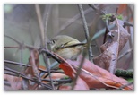
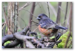
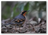
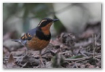
While I waiting in the feeder blind to get a good view of the White-throated Sparrow, a bright male Varied Thrush, the only one around this winter, came by. He is quite wary so I was fortunate to get a few shots without spooking him. He approached the feeder a couple more times while I was still in the blind but I wasn't able to get any more photos.
Adult White-throated Sparrow
Juvenile White-throated Sparrow
Varied Thrush
While I waiting in the feeder blind to get a good view of the White-throated Sparrow, a bright male Varied Thrush, the only one around this winter, came by. He is quite wary so I was fortunate to get a few shots without spooking him. He approached the feeder a couple more times while I was still in the blind but I wasn't able to get any more photos.
01/23/2010 Ovc, occ rain, mid 40's
I ran 50K today at Pigtail's Lake Youngs race. Lots of Maniac friends there, including Leslie whom I haven't seen in a while. We ran the last 20 miles together and I got caught up on how she's doing. She's excited about her work in a medical research lab and happy with her running.
Were it not for some stiffness and tenderness in my shin towards the end I'd have been able to run another hour or so. It was cold though; my gloves quickly became wet through so my hands were chilled for most of the race. Holding them in front of Van's propane heater during aid station stops really helped. I probably would have been more comfortable had I kept my rain pants on but having once taken them off, I didn't want to put them back on again.
Betsy and Marie finishing
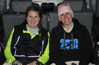
Marie and Betsy warming up in the Element
Ovc, increasing rain, low 40's
I really enjoyed putting on the race today even though I didn't run. I didn't really start preparing yesterday afternoon until after sunset, mostly because I fell asleep for a couple hours after getting home from Pigtails' race. Getting everything ready and packing up the car took about 4 hours with the help of my packing list from last year. Were it not for making the chili, I could even have been in bed by 10PM. Susan and I worked together on the chili and finished it around midnight.
The race was to begin at 8AM and I was on time for a change. Except for a few early starters I sent everyone off at a few minutes after 8 under a thin overcast with hints of blue sky showing through. Then I packed up again and drove to the trail junction to mark it with flour and set up two 5-gallon jugs on a folding aluminum table for the aid station. Did the same at the turnaround except used a milk crate instead of the table, and left a package of Reese's mini peanut butter hearts that one of the runners had brought. They were a big hit so I'll have to do that again next time.
By late morning when the last few runners came in from the first lap the overcast had thickened considerably and soon after the last runner left, light rain began to fall. Pamela Wuest, who stopped at 25K and stayed around for some chili, helped me set up the canopy. I enjoyed her company but she began to get too cold and had to leave. Figuring I'd have an hour or so to myself I gave Dave Nichol a call but soon afterwards the first 50K runners began to show up and from then on I was busy serving chili and hot chocolate and visiting with the finishers. I appreciated the company, especially considering how cold and wet most of the runners were when they came in. Matt Hagen stayed the longest since he was waiting for Betsy to finish. Both of them ran 50K yesterday too.
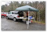
Matt holding down the fort
01/30/2010 Ovc, occ light rain, high 40's
I was anxious and restless last night and didn't sleep well. Those are conditions condusive to remembering dreams and I did remember an interesting one.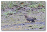 fairly challenging SQL developer position he has open. It would be 6-12 months of full-time work -
a big change from the past 6 months. The prospect of the interviews is intimidating but the
position sounded like a good fit so I'm going for it.
fairly challenging SQL developer position he has open. It would be 6-12 months of full-time work -
a big change from the past 6 months. The prospect of the interviews is intimidating but the
position sounded like a good fit so I'm going for it.
A Mourning Dove that Susan spotted in the driveway late this afternoon was yardbird 42 for 2010, roughly half of the total number of species I'll see here by the end of the year. Its left wing was drooping and it had a streak of missing feathers across its shoulder, both possibly the result of a gunshot wound. I misjudged how tame it was and ended up flushing it while trying for photographs. It flew, apparently without any difficulty, across the street to the far edge of the neighbor's field.
I was anxious and restless last night and didn't sleep well. Those are conditions condusive to remembering dreams and I did remember an interesting one.
I was driving along a freeway late in the afternoon and spotted an older green VW bug, not unlike
the one I used to have during and after college, pulled over on the right shoulder so I pulled up
behind it, as did another driver. Not expecting to be long I left the car running and the doors
open while I walked up to the VW to investigate. Inside were two young men. One was somewhat
threatening, possibly dangerous; the other seemed more neutral or at least less volatile. They
wanted us to get into the VW with them but they weren't clear why. I thought maybe they meant to
kidnap us but the other man, who'd stopped with me, had already climbed into the back seat of the VW
and thought I should go along with them. He was friendly and seemed reasonable so I did as he suggested
though I still thought it likely that the two men in the VW intended to harm us. They drove us a
ways, maybe 10 miles, and we pulled up at a ramshackle old house surrounded by tall grass on a
hilltop. It was getting dark but still light enough to see the green of the grass. I was still
concerned about the intentions of the men in the VW but it turned out they were going to just leave
us at the house. Concerned about our cars left back along the freeway, still running, I urged them
to at least give us a ride back but they drove off and left us there. I considered running back to
my car but it wasn't really feasible. I don't recall what happened after that.
I suspect the dream has something to do with a couple of interviews Jeff set up for me regarding a
2010 Yardbird #42 - Mourning Dove
A Mourning Dove that Susan spotted in the driveway late this afternoon was yardbird 42 for 2010, roughly half of the total number of species I'll see here by the end of the year. Its left wing was drooping and it had a streak of missing feathers across its shoulder, both possibly the result of a gunshot wound. I misjudged how tame it was and ended up flushing it while trying for photographs. It flew, apparently without any difficulty, across the street to the far edge of the neighbor's field.
01/31/2010 Snowshoeing at Crystal again Light rain early then partial clearing, around 50
 Not much snow up at Crystal, perhaps even less than two weeks ago. On the drive up to the ski area
the snow doesn't even begin until close to 4000' - no problem to park in the little pullout at the
Norse Peak trailhead, though we continued on up to Lot C at the foot of the old ski slope. Monica
came too, her first time on snowshoes and she did very well, following David and me up some steep
terrain and sliding down an equally intimidating slope without hesitation. We followed Silver Creek
(I think) up from the top of the Gold Hills chair, climbed up a very steep little gorge to attain a
hanging valley then turned left up an indistinct but more or less open gully towards the ridge which
runs S from Bullion Basin. We ran out of time after lunch so didn't quite reach the ridge and
sunshine, traversing left instead and descending another gully which opened up into a narrow
avalanched bowl which in turn dropped us back down to Silver Creek below the gorge. Based on the
data from my HR monitor my total exertion for the four hour hike was comparable to running 18 miles.
Not much snow up at Crystal, perhaps even less than two weeks ago. On the drive up to the ski area
the snow doesn't even begin until close to 4000' - no problem to park in the little pullout at the
Norse Peak trailhead, though we continued on up to Lot C at the foot of the old ski slope. Monica
came too, her first time on snowshoes and she did very well, following David and me up some steep
terrain and sliding down an equally intimidating slope without hesitation. We followed Silver Creek
(I think) up from the top of the Gold Hills chair, climbed up a very steep little gorge to attain a
hanging valley then turned left up an indistinct but more or less open gully towards the ridge which
runs S from Bullion Basin. We ran out of time after lunch so didn't quite reach the ridge and
sunshine, traversing left instead and descending another gully which opened up into a narrow
avalanched bowl which in turn dropped us back down to Silver Creek below the gorge. Based on the
data from my HR monitor my total exertion for the four hour hike was comparable to running 18 miles.
02/02/2010
I'm back at work at Microsoft this week. Though I'm not wild about the commute it's nice to feel productive again. Nick has accumulated a list of a half dozen enhancements to the application. We walked through them yesterday and they look pretty straightforward, probably about three weeks of work including testing and documentation. The application is working well for them as designed so they don't need major changes at this point.
I left early today to do the interviews that Jeff set up. The first interview, with a SQL developer named Neil, put me at ease and got me warmed up for the second interview with Tony. Neil and I chatted awhile then he asked me to diagram the model for the project I'm currently working on. We discussed some of the modeling issues I encountered on that relatively simple project and spent some time on the supertype/subtype modeling question. Overall we spent the bulk of the interview discussing data modeling. I think Neil probably should have asked me at least one tough SQL query question as well as some more specific questions about T-SQL coding; I recall conducting interviews like that in the past, and the difficulty of writing up feedback with insufficient information. The interview with Tony was almost all data modeling. He asked some very good questions well designed to evaluate the depth of my data modeling experience and level of familiarity with both physical and logical models. We also spent quite a bit of time on the variations of the supertype/subtype theme. Towards the end he seemed to relax and we discussed our general data modeling peeves and preferences. I was only expecting two interviews but Tony asked if I would meet briefly with Karl after we were done. I took that as a good sign. The interview with Karl was brief and to the point; he mostly asked whether I had experience with specific aspects of high-volume OLTP database design, programming and optimization and I mostly told him that I did not, but could learn. Although I think I'm probably in the running I expect they'll see candidates with deeper SQL development experience in the areas they're looking for. I drove home feeling satisfied that I did respectably well, whether or not I get chosen.
02/05/2010 Partly cloudy, brief shower, 37-54
Did a 28 mile bike ride this afternoon and a 16 mile run (5 barefoot) yesterday morning. I feel like I'm ready for another marathon but I'm only running a half this Sunday. The next marathon is on President's Day, a week from Monday after a half marathon next Saturday. I'd rather run than go to church but am keeping at least half my Saturdays open for church, even though we often don't make it.
This evening I attended the Friend's of St Thomas discussion group for the first time in several months. Interesting dynamic with mildly skeptical old men on one side of the room and on the other side, an young man, perhaps not yet 20, full of zeal for the truth and a care-worn woman with a warm faith in Jesus. The Pastor did a good job of moderating the discussion, drawing out our points of view while keeping the conversation both somewhat practical and more or less on our topic, whatever that was. Though I enjoyed the conversation, afterwards on the drive home I became discouraged again. Maybe it would be best to drop church entirely for a few years; after a break perhaps I could take up Adventism again with a fresh start.
02/07/2010 Geoduck Gallop, Nisqually Overcast, mid-40's
 I ran the Geoduck Gallop Half Marathon in Olympia today, then on the way home we stopped at
Nisqually NWR to try for some bird photos. David and his friend Val came along too. While I ran
they ate breakfast at Sage's then found some ducks, including a beautiful male Wood Duck (is there
any other kind of male Wood Duck?) at a lake near the Capitol. David borrowed my 300mm with the 1.4
converter and couldn't quite fit all of the Wood Duck in the frame. Though I didn't intend to, I
ran the race fairly hard, 8:00/mile overall, despite not having brought any gels with me. I slowed
down a bit for a few miles in the middle and ran with a woman named Elizabeth who's doing Boston for
the first time this coming April, then rejuvenated, ran the next few at about 7:40 before having to
slow down a bit for the last couple miles. My right arch has been a bit sore the last few days so I
thought I might have trouble with it but everything felt fine during the race.
I ran the Geoduck Gallop Half Marathon in Olympia today, then on the way home we stopped at
Nisqually NWR to try for some bird photos. David and his friend Val came along too. While I ran
they ate breakfast at Sage's then found some ducks, including a beautiful male Wood Duck (is there
any other kind of male Wood Duck?) at a lake near the Capitol. David borrowed my 300mm with the 1.4
converter and couldn't quite fit all of the Wood Duck in the frame. Though I didn't intend to, I
ran the race fairly hard, 8:00/mile overall, despite not having brought any gels with me. I slowed
down a bit for a few miles in the middle and ran with a woman named Elizabeth who's doing Boston for
the first time this coming April, then rejuvenated, ran the next few at about 7:40 before having to
slow down a bit for the last couple miles. My right arch has been a bit sore the last few days so I
thought I might have trouble with it but everything felt fine during the race.
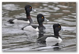
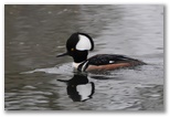
At Nisqually not much was happening in the woods but things picked up once we got out on the dike near the old barn. Several photographers with huge lenses on tripods were watching the action as Bald Eagles harassed each other out on the flats. The first guy we came up to pointed out a peregrine sitting high up in a cottonwood. He had an old Nikon 600mm f4 which he said wasn't very sharp, not as good as the 500 f4 in his opinion. He was waiting for a Kestrel which had been perched on top of the nearest snag to return to its perch. After chatting with him for a while I stopped to visit with another photographer, this one with the 500 f4 on a tripod. He was using it
to photograph distant eagles on perches, and also carrying a D700 with the 300 f4 and 1.4 TC for
birds in flight. His tripod was a Gitzo Series 3 w/ Wimberly 2 head. Nice to see this stuff in
action. We both took photos of the same eagle because I wanted to compare my D300 with his D700 -
his shots were considerably sharper; I'm not sure why. On the way back we got some good close-up
views of a pair of Hooded Mergansers and several male Ring-necked Ducks. Turns out the latter
actually have a brown ring around their neck; I've never been close enough to notice it before. The
duck photos made the day for me.
stopped to visit with another photographer, this one with the 500 f4 on a tripod. He was using it
to photograph distant eagles on perches, and also carrying a D700 with the 300 f4 and 1.4 TC for
birds in flight. His tripod was a Gitzo Series 3 w/ Wimberly 2 head. Nice to see this stuff in
action. We both took photos of the same eagle because I wanted to compare my D300 with his D700 -
his shots were considerably sharper; I'm not sure why. On the way back we got some good close-up
views of a pair of Hooded Mergansers and several male Ring-necked Ducks. Turns out the latter
actually have a brown ring around their neck; I've never been close enough to notice it before. The
duck photos made the day for me.
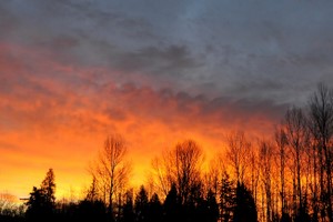
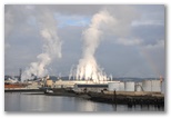 As I was driving along the Tacoma waterfront after dropping David and Val off, the sun finally
burned through the overcast and lit up the paper mill across the bay. It was a striking scene -
white columns of steam rising into the steel gray sky with a bright rainbow arching over it all. I
As I was driving along the Tacoma waterfront after dropping David and Val off, the sun finally
burned through the overcast and lit up the paper mill across the bay. It was a striking scene -
white columns of steam rising into the steel gray sky with a bright rainbow arching over it all. I
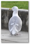 turned off down to the waterfront, parked the car, switched lenses and ran back up the bridge but
unfortunately the rainbow had nearly faded away, and I overexposed the shots anyhow. But some gulls
turned off down to the waterfront, parked the car, switched lenses and ran back up the bridge but
unfortunately the rainbow had nearly faded away, and I overexposed the shots anyhow. But some gulls
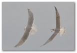 were eating starfish on the rocks below a little park down there, so I switched lenses again and
photographed the gulls. That was fun, especially when a couple showed up with bread for the birds.
In a few minutes I had all the gulls I could wish for, flying, perching, squabbling. It was fun.
were eating starfish on the rocks below a little park down there, so I switched lenses again and
photographed the gulls. That was fun, especially when a couple showed up with bread for the birds.
In a few minutes I had all the gulls I could wish for, flying, perching, squabbling. It was fun.
Peregrine high in cottonwood
Young Bald Eagles
Ring-necked Ducks
Male Hooded Merganser
Canada Geese
At Nisqually not much was happening in the woods but things picked up once we got out on the dike near the old barn. Several photographers with huge lenses on tripods were watching the action as Bald Eagles harassed each other out on the flats. The first guy we came up to pointed out a peregrine sitting high up in a cottonwood. He had an old Nikon 600mm f4 which he said wasn't very sharp, not as good as the 500 f4 in his opinion. He was waiting for a Kestrel which had been perched on top of the nearest snag to return to its perch. After chatting with him for a while I
Common Goldeneye, Tacoma waterfront
02/08/2010 Sunny, near 50
Jeff called to tell me I didn't get the job; they found someone with more specific ERP and CRM experience. I wasn't particularly disappointed; though I would like another month or two of work, ten to twelve months might be too much of a good thing. Meanwhile I had a productive day at Microsoft - designed the tables for the binary-source mapping and wrote several procedures for listing excluded files by name or subdirectory. Writing good code is very satisfying.
Jeff called to tell me I didn't get the job; they found someone with more specific ERP and CRM experience. I wasn't particularly disappointed; though I would like another month or two of work, ten to twelve months might be too much of a good thing. Meanwhile I had a productive day at Microsoft - designed the tables for the binary-source mapping and wrote several procedures for listing excluded files by name or subdirectory. Writing good code is very satisfying.
02/11/2010 Ovc w/ rain later, 57-47
It's been a bit of an emotional rollercoaster the past couple of days with the job offer. Jeff called yesterday afternoon to tell me that their first candidate had fallen through and I was effectively second in line. I'd been comfortable with not getting the job in the first place but it was gratifying to hear that I was chosen for the position after all and I began to get excited about the prospect of digging into a challenging assignment. And nervous about it again too. The job would mean missing out on the Southwest w/ David during spring break and Europe with the family this summer; though Susan would still go with David she was particularly disappointed about not returning together on the QM2. On the other hand, the income would enable us to get started on the major remodel Susan has been thinking about for some time in addition to paying for some toys for me.
So today I went in to meet with the data modeler with whom I'd be working closely for the next several months and to have lunch w/ Jeff to discuss details of time off and such. The meeting with Lisa went reasonably well; she explained portions of the conceptual model and we discussed some of the issues she's still researching; though alot was new to me it didn't seem like anything I couldn't get a handle on. As it turned out though, she was looking for someone who could bring the perspective of having done something similar for another organization, which I can't provide. Jeff called this afternoon to tell me that they've decided to look for someone else. Though I did expect to get the job I'm not too surprised; that was the same concern they had before and nothing has changed. Jeff was pretty apologetic for how the whole thing had gone, and I'd probably feel the same way in his position but I tried to reassure him that I was neither surprised nor particularly disappointed, given the sacrifices I'd have to make to take the position. On the way home I actually felt strangely energized by this whole situation, inspired to take advantage of the unexpected gift of the year I might have spent working for Jeff to do some things I've been just getting started on - painting, fixing up the house, learning .NET, getting deeper into SQL Server. Now too I can move ahead with the Maniacs work, a couple of months of redevelopment of the website which perhaps I'll tackle in .NET the way I should have when I first did it a couple of years ago.
03/09/2010
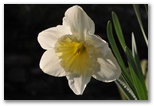
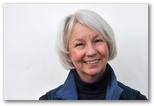 Took another passport picture of Susan this afternoon. This wasn't the one we ended up using (her eyes
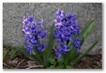
aren't horizontal) but I thought it was a nice photo of her nonetheless. The daffodils and hyacinths
are blooming already along the front walk, relatively early I think.
Took another passport picture of Susan this afternoon. This wasn't the one we ended up using (her eyes
aren't horizontal) but I thought it was a nice photo of her nonetheless. The daffodils and hyacinths
are blooming already along the front walk, relatively early I think.
 It looks as though David and I really are going to go on our trip to Arizona for his spring break.
I've reserved a spot for us to tour Lehman Cave in Great Basin National Park on Sunday morning, to
dayhike Coyote Buttes South on Monday and to backpack into Pariah Canyon on Tuesday. I've spent hours
developing multiple itineraries for the trip which vary according to if/when we are able to obtain a
permit for Coyote Buttes North via the morning lottery at the Pariah Ranger Station. I'd like to do
Coyote Buttes North, lower Antelope Canyon, Water Holes Canyon and the overnight backpack in Pariah
Canyon and Buckskin Gulch, all between Tuesday morning and Friday noon when we have to head home in
time to get to the CWA auction on Saturday evening. The trick will be getting the CBN permit, and if
we don't get it on Monday morning, arranging to be at the BLM ranger station at 8:30AM on subsequent
mornings to try again.
It looks as though David and I really are going to go on our trip to Arizona for his spring break.
I've reserved a spot for us to tour Lehman Cave in Great Basin National Park on Sunday morning, to
dayhike Coyote Buttes South on Monday and to backpack into Pariah Canyon on Tuesday. I've spent hours
developing multiple itineraries for the trip which vary according to if/when we are able to obtain a
permit for Coyote Buttes North via the morning lottery at the Pariah Ranger Station. I'd like to do
Coyote Buttes North, lower Antelope Canyon, Water Holes Canyon and the overnight backpack in Pariah
Canyon and Buckskin Gulch, all between Tuesday morning and Friday noon when we have to head home in
time to get to the CWA auction on Saturday evening. The trick will be getting the CBN permit, and if
we don't get it on Monday morning, arranging to be at the BLM ranger station at 8:30AM on subsequent
mornings to try again.
 The photo gear I ordered for the trip has all arrived as well. I took it out for a spin in the back
yard today. The tripod with the ballhead really makes a difference with the 300 f4; even at a 500th
of a second the shots from the tripod are detectably sharper than resting the camera/lens on a
sandbag as I was doing before. I'm using the Kirk bracket on the lens and the L-bracket for the
camera. They snap instantly in and out of the ballhead; I'm very glad now that I paid the extra $20
for the quick release version. The ballhead not only holds the camera steady but also seems to
dampen vibration from the shutter release. My only concern is that the tripod-ballhead combination
is a bit large to fit in my pack and seems a little heavy to carry around all day, but I won't know
for sure until I spend a day in the field with it, perhaps in Buckskin Gulch. Regarding the bird
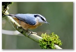
photos, I sharpened all but the house finch in Elements to compensate for the blurring caused by
shrinking the originals. Might have overdone it a bit behind the Nuthatch's eye. The junco is the
second leukistic one we've had around the feeder this winter. The house finch, a young male from
last summer, has a bad left eye and a few feathers stuck in his left foot, perhaps from scratching
the eye.
The photo gear I ordered for the trip has all arrived as well. I took it out for a spin in the back
yard today. The tripod with the ballhead really makes a difference with the 300 f4; even at a 500th
of a second the shots from the tripod are detectably sharper than resting the camera/lens on a
sandbag as I was doing before. I'm using the Kirk bracket on the lens and the L-bracket for the
camera. They snap instantly in and out of the ballhead; I'm very glad now that I paid the extra $20
for the quick release version. The ballhead not only holds the camera steady but also seems to
dampen vibration from the shutter release. My only concern is that the tripod-ballhead combination
is a bit large to fit in my pack and seems a little heavy to carry around all day, but I won't know
for sure until I spend a day in the field with it, perhaps in Buckskin Gulch. Regarding the bird
photos, I sharpened all but the house finch in Elements to compensate for the blurring caused by
shrinking the originals. Might have overdone it a bit behind the Nuthatch's eye. The junco is the
second leukistic one we've had around the feeder this winter. The house finch, a young male from
last summer, has a bad left eye and a few feathers stuck in his left foot, perhaps from scratching
the eye.
Susan
Red-breasted Nuthatch
Chestnut-backed Chickadee
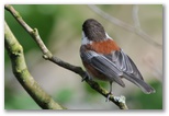
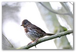
Fox Sparrow
Piebald Junco
Young House Finch
03/12/2010
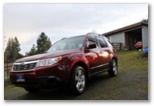 Waxed the Subaru today in preparation for our trip. The New Subaru that is. Three days ago I took
the old one into the shop because it's been running a little warm, and found out that it has a
leaking head gasket. No telling how many miles before it blows out completely, but it will take 3-5
days in the shop to get it fixed, and we didn't have 3-5 days before we were to leave on our trip.
Susan has been urging me to buy a new car this spring while prices are relatively low, and so we can
hand the old one down to the boys to use at school. I was figuring on running the old one for
another year but rather than cancel our trip, we bought a new car. We did consider taking the van
but I didn't want to risk Susan getting stranded in the Subaru, and we'll probably need all-wheel
drive to get to at least one of the trailheads on our trip. Matt's Honda Element impressed me at
the YT50K back in January so we went that evening and tried out an Element. Not a bad car - I liked
that the cargo area was big enough for me to sleep in, and it does have AWD. The finish seemed a
little spare, and I wanted to at least take a look at the current model Forester and maybe the CRV
or RAV4 as well. The next afternoon I test drove a 2010 Forester. It's a little bigger than mine
and lo and behold, I would be able to sleep in it with the back seats down. I liked the ground
clearance too, an inch more than either my old Forester or the Element. Mileage comparable to the
Element, better than my old Forester or the Toyota SUV's, and price alot lower than the hybrid
Highlander that we looked at a couple months ago. So Wednesday evening Susan and I set out to buy a
Subaru. I looked at prices on the Internet and followed up with two dealers, Mike Scarff Subaru in
Auburn and Bruce Titus Tacoma Subaru, who both had the model and color I wanted. Both were offering
the same price too, just over 24K. We had already pulled into the parking lot at the Auburn
dealership when I called Titus to let them know we had decided on Auburn. Over the phone the Titus
salesman took another $300 off the price so we turned around and drove to Tacoma instead. I tried
paying with a credit card but neither dealer would do that but they settled for a post-dated check
and we drove home (via a celebratory dinner at Stanley and Seaforts) with a new red Subaru. An
unwaxed Subaru as it turned out, so I did that myself today for considerably less than $300.
Waxed the Subaru today in preparation for our trip. The New Subaru that is. Three days ago I took
the old one into the shop because it's been running a little warm, and found out that it has a
leaking head gasket. No telling how many miles before it blows out completely, but it will take 3-5
days in the shop to get it fixed, and we didn't have 3-5 days before we were to leave on our trip.
Susan has been urging me to buy a new car this spring while prices are relatively low, and so we can
hand the old one down to the boys to use at school. I was figuring on running the old one for
another year but rather than cancel our trip, we bought a new car. We did consider taking the van
but I didn't want to risk Susan getting stranded in the Subaru, and we'll probably need all-wheel
drive to get to at least one of the trailheads on our trip. Matt's Honda Element impressed me at
the YT50K back in January so we went that evening and tried out an Element. Not a bad car - I liked
that the cargo area was big enough for me to sleep in, and it does have AWD. The finish seemed a
little spare, and I wanted to at least take a look at the current model Forester and maybe the CRV
or RAV4 as well. The next afternoon I test drove a 2010 Forester. It's a little bigger than mine
and lo and behold, I would be able to sleep in it with the back seats down. I liked the ground
clearance too, an inch more than either my old Forester or the Element. Mileage comparable to the
Element, better than my old Forester or the Toyota SUV's, and price alot lower than the hybrid
Highlander that we looked at a couple months ago. So Wednesday evening Susan and I set out to buy a
Subaru. I looked at prices on the Internet and followed up with two dealers, Mike Scarff Subaru in
Auburn and Bruce Titus Tacoma Subaru, who both had the model and color I wanted. Both were offering
the same price too, just over 24K. We had already pulled into the parking lot at the Auburn
dealership when I called Titus to let them know we had decided on Auburn. Over the phone the Titus
salesman took another $300 off the price so we turned around and drove to Tacoma instead. I tried
paying with a credit card but neither dealer would do that but they settled for a post-dated check
and we drove home (via a celebratory dinner at Stanley and Seaforts) with a new red Subaru. An
unwaxed Subaru as it turned out, so I did that myself today for considerably less than $300.
Waxed and ready to go
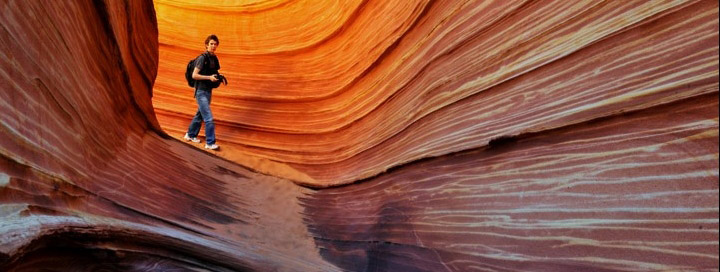
David in the Wave, Coyote Buttes North management area, southern Utah
03/13/2010 Saturday Auburn, WA to Ely, NV
We left Auburn last night around 7PM. I'd intended to pick David up at school and leave directly from there but figured we could make up a little of the time we lost by taking I-90, I-82 and I-84, then heading south from Twin Falls to Ely rather than my original plan to go through Portland, Bend, Burns Winnemucca, Carlin and Eureka mostly on secondary roads. I drove to Yakima, David to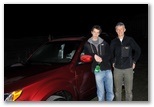
 Pendleton while I slept, then he slept while I drove over the Blue Mountains in a snowstorm. The
car handled very well in the snow, as expected. Listening to The Known World, an audiobook I
picked up at the library, I was able to drive as far as Baker City. Around 2AM I found the Oregon
Trail agate site, along the dirt road which branches right off the gravel road which leaves OR Hwy
86 across from the OT interpretive center, but an inch of new snow obscured the agates when I went
looking for a few minutes at dawn. I slept in the back of the car, David in the passenger seat. It
was a little cramped but not too uncomfortable.
Pendleton while I slept, then he slept while I drove over the Blue Mountains in a snowstorm. The
car handled very well in the snow, as expected. Listening to The Known World, an audiobook I
picked up at the library, I was able to drive as far as Baker City. Around 2AM I found the Oregon
Trail agate site, along the dirt road which branches right off the gravel road which leaves OR Hwy
86 across from the OT interpretive center, but an inch of new snow obscured the agates when I went
looking for a few minutes at dawn. I slept in the back of the car, David in the passenger seat. It
was a little cramped but not too uncomfortable.
 We stopped at Lime to look for the crystal site I read about some years ago but couldn't find
anything but limestone. The cement plant is closed and is deteriorating quite photogenically. I
took a few pictures; David wanted to but couldn't rouse himself from sleep. A stiff westerly breeze
was blowing so I couldn't stay out long. After Boise the wind turned fierce, scouring the landscape
for tumbleweeds and sending them stampeding across fields, vaulting fences and bounding through
freeway traffic. Some were barely larger than squirrels, others the size and color of bears, all racing before
the wind or gathering in restless piles in gullies and hollows. At Mountain Home we turned south
off the freeway to check out the big sand dune at Bruneau Dunes State Park. Dropping through the
rim rock on our descent to the Snake River we ran into a big drift of tumbleweeds stretching nearly
across the road and deep enough to bury a pickup truck.
We stopped at Lime to look for the crystal site I read about some years ago but couldn't find
anything but limestone. The cement plant is closed and is deteriorating quite photogenically. I
took a few pictures; David wanted to but couldn't rouse himself from sleep. A stiff westerly breeze
was blowing so I couldn't stay out long. After Boise the wind turned fierce, scouring the landscape
for tumbleweeds and sending them stampeding across fields, vaulting fences and bounding through
freeway traffic. Some were barely larger than squirrels, others the size and color of bears, all racing before
the wind or gathering in restless piles in gullies and hollows. At Mountain Home we turned south
off the freeway to check out the big sand dune at Bruneau Dunes State Park. Dropping through the
rim rock on our descent to the Snake River we ran into a big drift of tumbleweeds stretching nearly
across the road and deep enough to bury a pickup truck.
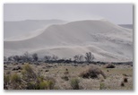
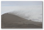
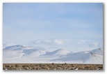
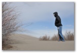 I was pleasantly surprised to find that Bruneau Dunes is a natural area where ORV's are prohibited.
The wind was raking sand off the top of the dunes in a gritty brown curtain, very impressive and
certain death to exposed cameras. We took a few furtive photos and hiked to the crest of the big
one where wind-blown sand blasted our pants cuffs. I didn't take time to identify the windswept
ducks on the lake but did notice a Northern Harrier working the brushy drainage west of the dune.
It's a place I'd like to visit again in more favorable conditions, particularly during spring
migration.
I was pleasantly surprised to find that Bruneau Dunes is a natural area where ORV's are prohibited.
The wind was raking sand off the top of the dunes in a gritty brown curtain, very impressive and
certain death to exposed cameras. We took a few furtive photos and hiked to the crest of the big
one where wind-blown sand blasted our pants cuffs. I didn't take time to identify the windswept
ducks on the lake but did notice a Northern Harrier working the brushy drainage west of the dune.
It's a place I'd like to visit again in more favorable conditions, particularly during spring
migration.
 On our way east to Twin Falls we reached Susan on the phone. I described the wind, the big dune, the dusty yellow clouds and the herds of tumbleweed
and she enjoyed picturing the scene. Heading south on US 93 into Nevada we found ourselves pursuing
a snowstorm which like a mirage kept fading away ahead of us leaving bright snowy hills under a
windy blue sky with cold sunlight streaming in from the west. We eventually caught up to a little
snow around dusk just north of Ely but the main event had passed through earlier in the day leaving
several inches in town with drifts up to a foot deep around the parking lot of the Rustic Inn, a
humble but comfortable (poor but honest...) little place I found in the yellow pages. The
proprietor recommended La Fiesta for Mexican food so we went there and spent $25 on too much dinner
after checking in to our $50 motel.
On our way east to Twin Falls we reached Susan on the phone. I described the wind, the big dune, the dusty yellow clouds and the herds of tumbleweed
and she enjoyed picturing the scene. Heading south on US 93 into Nevada we found ourselves pursuing
a snowstorm which like a mirage kept fading away ahead of us leaving bright snowy hills under a
windy blue sky with cold sunlight streaming in from the west. We eventually caught up to a little
snow around dusk just north of Ely but the main event had passed through earlier in the day leaving
several inches in town with drifts up to a foot deep around the parking lot of the Rustic Inn, a
humble but comfortable (poor but honest...) little place I found in the yellow pages. The
proprietor recommended La Fiesta for Mexican food so we went there and spent $25 on too much dinner
after checking in to our $50 motel.
We left Auburn last night around 7PM. I'd intended to pick David up at school and leave directly from there but figured we could make up a little of the time we lost by taking I-90, I-82 and I-84, then heading south from Twin Falls to Ely rather than my original plan to go through Portland, Bend, Burns Winnemucca, Carlin and Eureka mostly on secondary roads. I drove to Yakima, David to
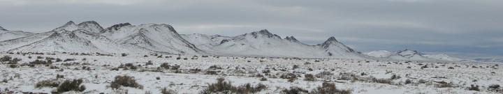
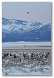
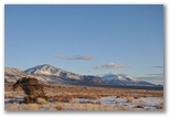
At the Lehman Cave Visitor's Center the ranger was just putting up the flag when we arrived. I was not inclined to believe him at first when he told me they were on Pacific Time and we were an hour early for our cave tour, but that did explain why the clock at the motel in Ely had been an hour slow. We used our extra hour to eat a leisurely breakfast in the sunshine in front of the visitor's center where the snowbanks were just receding from the front lawn and the only clouds in the deep blue sky were hovering over snowy mountains on the horizon 100 miles to the east.
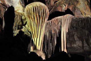
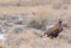
Dark phase Ferruginous Hawk
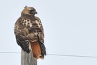
Red-tailed Hawk
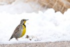
Western Meadowlark
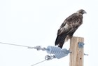
Golden Eagle
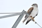
Light phase Ferruginous Hawk
South of Panguitch we finally began to leave the storm behind us but the snowpack continued to increase until we reached the pass north of the turnoff to Zion, 3-4 feet up there and crusty snowfields lingering on shady slopes all the way down to where we stopped for the night, about 7 miles north of Kanab. There we found the ORV track off the east end of the old road and followed it about a third of a mile in before the sand became too soft. We found a campsite there and though it was nearly 6PM, set off to the north across bright orange sand dunes stabilized with juniper, rabbitbrush, oaks and scattered Ponderosa pines. Our objective was Peekaboo canyon, aka Red canyon, a small but colorful slot which runs east-west along the north edge of the dunes. When we hadn't reached the wash in 45 minutes I realized we wouldn't make it so we turned back, reaching the car right at sunset. The evening was cold and breezy so we ate supper in the car, more of the delicious lasagna Susan had sent with us. Thanks to her provisioning and a couple of meals out, we never did have to fire up the stove the whole trip. That was a big help, giving us that much more time to spend out hiking around taking pictures.
Frosty morning with dawn around 6:45 Mountain Daylight Time. We packed up quickly and drove to the Pariah ranger station where we ate breakfast while waiting for the doors to open. About 10 groups were applying for Coyote Buttes North permits; we were assigned number six. At 9:05AM a volunteer ranger spun the wire cage and the first ball she pulled out was #6, so once again, we were in. I thanked Jesus because I'd been talking with him during the night about how I'd been mistaken about the timezone, even though I'd been convinced that I was right, and how I might also be mistaken in my conviction that I'm not saved. Evidently I'm not always correct in my beliefs, and Jesus might be able to do something with that.
The 18.5 mile drive from hwy 89 to the Paw Hole trailhead for Coyote Buttes South was tough. The first 10 miles to the Arizona state line (2 miles past the Wire Pass trailhead) were deeply rutted and often rocky, though fortunately the dirt was hard-packed and only slippery in a few places. The last 2 1/2 miles of soft orange sand after the turn-off to Paw Hole would probably would have been impassable for us were it not firmed up by underlying moisture from winter snow, patches of which still lingered on shady corners.
Paw Hole teepees
Orange hollow
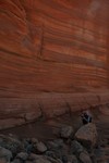
Shaded wall
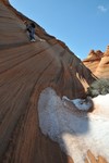
Tough descent
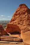
Lunch cave
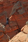
Lichen wall
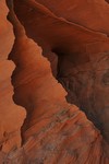
Fins
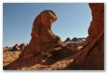
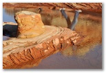
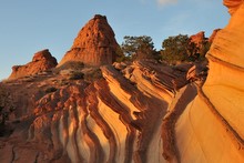
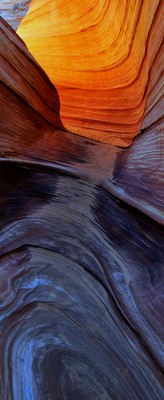
We drove out from Paw Hole at dusk intending to camp at Stateline but we failed to notice the turnoff in the dark so ended up spending the night in the parking lot at Wire Pass. On the way I forgot to stop at a snowbank to replenish the cooler so we unpacked all our food and chilled it overnight in the frost on top of the car. Coyotes serenaded us sometime during the night and at 5:30AM a big pickup roaring by on the road woke us up. By the time the first cars pulled into the
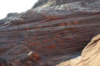
Above the two red teepees that the BLM directions reference as landmarks on the way to the Wave, there's a cove enclosed on three sides by weird and wonderful sandstone textures. Daniel and I came across it two years ago on our way back to the car so I took David up there this morning on the way in. It was not far out of our way and well worth the visit.
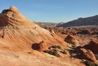
David on teepee north of the Wave
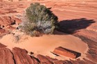
Shrub in ledgy wash below the Wave
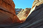
Entrance to the Wave
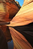
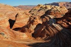
View north over the Wave
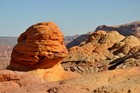
Muffins above the Wave
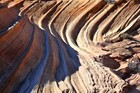
Striated sandstone above the Wave
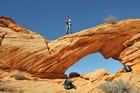
Arch on the rim above the Wave
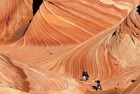
Photographers in the Wave
After poking around a bit above the Wave (though we missed the Second Wave a hundred meters or so west of the main event), we scrambled up the slope southwest of the wave and crossed above the crack to the arch, where we ate lunch and spied on the hikers taking photos and eating their lunches in the Wave. After lunch we explored
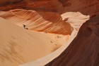
David in sand dune bowl
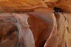
The hard way into the bowl
Instead we hiked generally south to the head of a big canyon that opens out to the northeast. We considered hiking down it and out towards some red teepees off in the distance but the head of the canyon was a little too steep to descend so we continued south up onto an plateau of irregular white
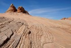
Top Rock teepees
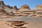
Iron pellet flat
Dinosaur tracks
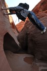
Crossing quicksand
Agate arrowhead
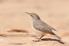
Rock Wren
Not much wildlife today either - a black bovine along the trail on the way in, several Side-blotched Lizards, Ravens, the Golden Eagle, the possible Peregrine, several Rock Wrens, a pair of Titmice in a bush above the crack (and slightly too furtive for photos) and a flock of Pinon Jays somewhere out there.
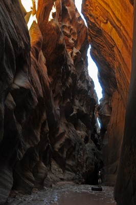
David in Buckskin Gulch (standing on truck tire)
On the way out from Wire Pass, about two miles from hwy 89, we turned right on a side road and found a flat spot to camp about a quarter mile up. Overnight we hung David's pack and clothing on bushes around camp hoping the odor imparted to them yesterday by his poop in a bag would dissipate. He had to go while we were in the Wave and there was no place for it, so we used a couple of ziplock bags in which we'd been carrying our lunch. Later, up on top, I found a somewhat weathered purple fleece pullover and we wrapped the bags in that, but to David's dismay the odor still managed to permeate his pack. This morning his clothes were OK but the pack wasn't quite. We stopped at the BLM ranger station to deposit the bag and I draped the poopy purple pullover on a log in the sun all day while we hiked Buckskin Gulch. It was fine, though still a little sandy, when we returned to the car at dusk.
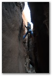
Long Canyon slot
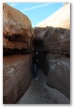
Long Canyon slot
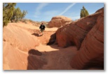
David running down the wash
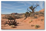
Juniper snags
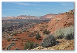
View from the rim
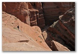
David descending the Middle Route
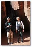
Ready for canyon hiking
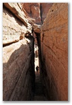
The easy way down
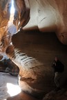
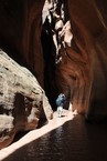
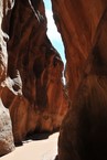
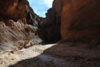
Absorbed in exploring the canyon we forgot about lunch, then when we finally noticed that we were hungry we couldn't find a sunny spot
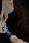
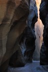
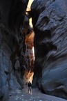
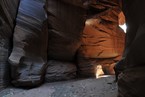
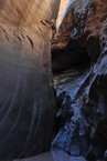
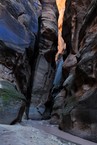
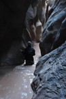
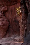
Last sun in the canyon
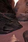
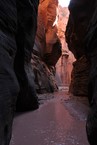
03/18/2010 Thursday Page, AZ
For today, our last full day before we had to head home, we had three locations left that I wanted to visit - Lower Antelope Canyon, Upper Antelope Canyon, and Water Holes canyon. We decided to see if we could get a permit for Water Holes first, then check out Lower Antelope and maybe Upper Antelope, then try Water Holes if we had time. We drove out to LeChee pronounced "hle-chi'ee" according to the Navajo woman at the LeChee senior center) but the Navajo parks office in the white trailer behind the pink stucco building was closed. The woman at the senior center gave us a couple of phone numbers to try but no-one answered, so we drove back to Lower Antelope Canyon.
For today, our last full day before we had to head home, we had three locations left that I wanted to visit - Lower Antelope Canyon, Upper Antelope Canyon, and Water Holes canyon. We decided to see if we could get a permit for Water Holes first, then check out Lower Antelope and maybe Upper Antelope, then try Water Holes if we had time. We drove out to LeChee pronounced "hle-chi'ee" according to the Navajo woman at the LeChee senior center) but the Navajo parks office in the white trailer behind the pink stucco building was closed. The woman at the senior center gave us a couple of phone numbers to try but no-one answered, so we drove back to Lower Antelope Canyon.
Lower Antelope Canyon Photo Gallery
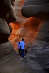
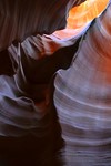
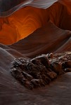
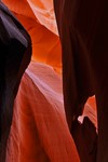
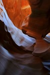
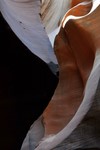
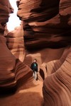 Lower and Upper Antelope Canyons are both commercial sites on the Navajo Reservation just east of
Page along Hwy 98. From "downtown" Page take Lake Powell Blvd around to Coppermine Road then turn
left on hwy 98 at the bottom of the hill. Or drive a mile or two south of Page on hwy 89 and turn
left onto 98. Shortly after crossing the bridge over Antelope Wash and before the power
plant turn right into the parking area for Upper Antelope or left, and left again, for the parking
area for Lower Antelope. Both canyons are accessible only via guided tours which cost $25 per
person (plus a $6/person hiking permit fee) and start at the respective parking areas. Upper
Antelope requires a jeep ride up the wash so the tours are somewhat more structured, though once
in the canyon it is not difficult to "lose" your tour group. For Lower Antelope you
just walk in from the parking lot. Because I was carrying a tripod, David and I received a
"photographer's permit" for Lower Antelope which enabled us to stay in the canyon for up to 4
hours. We used 3 of them.
Lower and Upper Antelope Canyons are both commercial sites on the Navajo Reservation just east of
Page along Hwy 98. From "downtown" Page take Lake Powell Blvd around to Coppermine Road then turn
left on hwy 98 at the bottom of the hill. Or drive a mile or two south of Page on hwy 89 and turn
left onto 98. Shortly after crossing the bridge over Antelope Wash and before the power
plant turn right into the parking area for Upper Antelope or left, and left again, for the parking
area for Lower Antelope. Both canyons are accessible only via guided tours which cost $25 per
person (plus a $6/person hiking permit fee) and start at the respective parking areas. Upper
Antelope requires a jeep ride up the wash so the tours are somewhat more structured, though once
in the canyon it is not difficult to "lose" your tour group. For Lower Antelope you
just walk in from the parking lot. Because I was carrying a tripod, David and I received a
"photographer's permit" for Lower Antelope which enabled us to stay in the canyon for up to 4
hours. We used 3 of them.
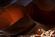 Lower Antelope isn't much of a hike. We paid our $62 and received our photographer tags, then
followed our guide, a young Navajo man of indeterminate age down into the wash, across a ledge
with a dinosaur track in it, then into a sinuous crack about a foot wide in a flat sandstone
ledge at the apparent end of the wash. We lost the rest of our group, a family with a couple of
young kids, as soon as we stopped for photos. We came across our guide again an hour or two later and
talked with him a bit. Giving tours in Antelope Canyon is a sideline; his main job is welding
pipes for the renovation of the middle generator at the powerplant, which explained why no smoke
Lower Antelope isn't much of a hike. We paid our $62 and received our photographer tags, then
followed our guide, a young Navajo man of indeterminate age down into the wash, across a ledge
with a dinosaur track in it, then into a sinuous crack about a foot wide in a flat sandstone
ledge at the apparent end of the wash. We lost the rest of our group, a family with a couple of
young kids, as soon as we stopped for photos. We came across our guide again an hour or two later and
talked with him a bit. Giving tours in Antelope Canyon is a sideline; his main job is welding
pipes for the renovation of the middle generator at the powerplant, which explained why no smoke
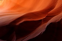 was coming out of middle stack this morning. He told us he'd worked all night and had welded 120
pipes, and in fact had been working for almost 36 hours straight, two 12-hour shifts of his own
plus another 12-hour shift in between when he'd filled in for a friend. He explained that by the
time the renovation is complete in a couple of years he hoped to have made enough money to retire.
That surprised us because we'd guessed his age at about 25. We wondered what he would do after he
retired but didn't ask. He was heading home to go to bed until his next shift began this evening.
We tipped him $10 towards his retirement, having asked another guide if tips were appropriate.
was coming out of middle stack this morning. He told us he'd worked all night and had welded 120
pipes, and in fact had been working for almost 36 hours straight, two 12-hour shifts of his own
plus another 12-hour shift in between when he'd filled in for a friend. He explained that by the
time the renovation is complete in a couple of years he hoped to have made enough money to retire.
That surprised us because we'd guessed his age at about 25. We wondered what he would do after he
retired but didn't ask. He was heading home to go to bed until his next shift began this evening.
We tipped him $10 towards his retirement, having asked another guide if tips were appropriate.
The photography was trickier than I remembered. On our previous visit I'd been using a Panasonic point-and-shoot without doing anything special with the settings. While the colors in my photos from that trip were stunning, I'd been a little frustrated with high noise levels and the inability to control depth of field.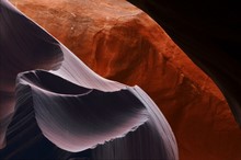 One of the big factors in my decision to buy a DSLR was my plan to return to Lower Antelope Canyon
with equipment to match the subject but once in the canyon again, I had trouble getting the settings
right on the more complicated equipment. White balance was particularly challenging - "Auto"
assumed that the shaded orange walls were neutral gray, leaving orange only in places with strong
reflected color. "Sunlight" on the other hand put everything in shades of reddish-brown, accurate
One of the big factors in my decision to buy a DSLR was my plan to return to Lower Antelope Canyon
with equipment to match the subject but once in the canyon again, I had trouble getting the settings
right on the more complicated equipment. White balance was particularly challenging - "Auto"
assumed that the shaded orange walls were neutral gray, leaving orange only in places with strong
reflected color. "Sunlight" on the other hand put everything in shades of reddish-brown, accurate
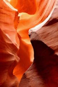 but not nearly as beautiful as the rainbow of hues ranging from purple to yellow in the photos from
the point-and-shoot. After a while I found another photographer to compare settings with; he was
using a D3 I think, and his photos had a beautiful range of deep reds and yellows which I couldn't
seem to capture regardless of which WB setting I used. In the end I settled for switching between
"Sunlight" and "Auto" with a smattering of more exotic settings thrown in for variety. The
photographer I compared notes with was also using long exposures, achieved by stopping the lens way
down and using a very low ISO, so towards the end I tried that approach with unfortunate results.
It turns out that the 18-105 DX lens has problems with flare at high f-stops. When I shot at f18
and above with a strong highlight in or near the frame, the images were ruined by small pale circles
which increased in frequency and decreased in size as the f-stop increased. A shot which would have
no discernible flare at f11 or f13 would be littered with pale spots at f22. Unfortunately I didn't
figure out the cause of the spots until later, and as a result ruined probably a third of my photos,
particularly in the upper canyon where I used high f-stops almost exclusively. And using long
exposures didn't even seem to make much difference with color saturation either, though I need to
experiment a little more with that. The tripod and ballhead, on the other hand, were again
terrific. I could achieve any angle I wanted quickly and easily. The ballhead held the camera
perfectly stable and the quick-release meant that I could pack up and move, or re-orient the camera
from horizontal to vertical, in a flash.
but not nearly as beautiful as the rainbow of hues ranging from purple to yellow in the photos from
the point-and-shoot. After a while I found another photographer to compare settings with; he was
using a D3 I think, and his photos had a beautiful range of deep reds and yellows which I couldn't
seem to capture regardless of which WB setting I used. In the end I settled for switching between
"Sunlight" and "Auto" with a smattering of more exotic settings thrown in for variety. The
photographer I compared notes with was also using long exposures, achieved by stopping the lens way
down and using a very low ISO, so towards the end I tried that approach with unfortunate results.
It turns out that the 18-105 DX lens has problems with flare at high f-stops. When I shot at f18
and above with a strong highlight in or near the frame, the images were ruined by small pale circles
which increased in frequency and decreased in size as the f-stop increased. A shot which would have
no discernible flare at f11 or f13 would be littered with pale spots at f22. Unfortunately I didn't
figure out the cause of the spots until later, and as a result ruined probably a third of my photos,
particularly in the upper canyon where I used high f-stops almost exclusively. And using long
exposures didn't even seem to make much difference with color saturation either, though I need to
experiment a little more with that. The tripod and ballhead, on the other hand, were again
terrific. I could achieve any angle I wanted quickly and easily. The ballhead held the camera
perfectly stable and the quick-release meant that I could pack up and move, or re-orient the camera
from horizontal to vertical, in a flash.
Having found my photos from last time somewhat cluttered, I looked for simpler compositions this time. Inspecting them on the camera viewfinder I was somewhat disappointed but once I got them onto the computer, I was much happier with the results.
The photography was trickier than I remembered. On our previous visit I'd been using a Panasonic point-and-shoot without doing anything special with the settings. While the colors in my photos from that trip were stunning, I'd been a little frustrated with high noise levels and the inability to control depth of field.
Having found my photos from last time somewhat cluttered, I looked for simpler compositions this time. Inspecting them on the camera viewfinder I was somewhat disappointed but once I got them onto the computer, I was much happier with the results.
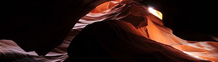
In a state of aesthetic fatigue after three hours in Lower Antelope Canyon, we drove across the street and signed up for a tour of Upper Antelope Canyon. With two couples from Texas and a young man from Norway we piled into the canopied bed of something like a pickup truck and rode up the wash with our tour guide from Antelope Canyon Navajo Tours. I recalled his name as Mike but the card he gave me says Dalvin Etsitty 928-698-3384.
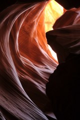
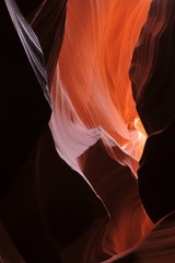
The canyon itself is more open and spacious inside and much darker than Lower Antelope. Fluted walls of dark reddish sandstone rise directly from a flat sandy floor then close in overhead allowing, during midday from spring to fall, a few beams of sunlight to reach down inside.
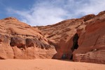
Upper Antelope entrance
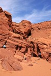
Upper end of the canyon
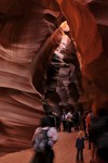
Inside Upper Antelope
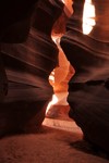
The entrance from inside
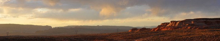
When I told our guide about our desire to hike Water Holes canyon and our lack of a permit he told us "Just go hike up it and if you see a ranger, pay him the permit fee." That sounded good to us so we drove down there, following 89 west past Page to 98, then south a few miles to park on the left side just north of the bridge. The parking area was fenced and gated with a big weathered sign which stated "Entry without permission is a violation of tribal and federal law" or some such thing. Moreover the gate was padlocked, but the lock was open and several cars were already parked inside, so we opened the gate and pulled in too. I checked the windshields of the other cars, at least one of which was from out of state, and saw no permits so I figured we wouldn't attract any attention. Not until we were hiking back down the canyon around sunset did it occur to me that we would be the last ones out, and we might find the gate locked with our car inside, or worse, with our car towed away. I prayed about that but didn't share my worry with David. He'd find out soon enough.
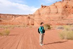
In the wash
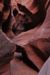
Sinuous section
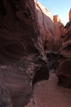
Near the entrance
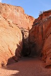
Lower entrance to slot
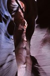
Deeper section
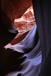
Subdued colors
The first slot opened up into a wash again but after about a quarter mile we came to a dry pothole falls about 10 feet high. David managed to scramble around above it but I didn't quite dare follow him. By hiking up around to the left there was a place to drop into the canyon above the falls but it too was steeper than I wanted to tackle late in the day. David scrambled out that way after exploring a short ways up one of the branches. The right branch is apparently the one to take; it extends for some distance and is very narrow in places, according to The American Southwest website.
On the way out we hiked along the rim of the upper slot canyon section. That was a little spooky; from above the slot is a black crevasse in the weathered sandstone, narrow enough to jump across in many places though I didn't dare try. Just thinking about still tweaks my innards. David was bold enough to sit on a point of rock over the chasm; the photo doesn't manage to convey how
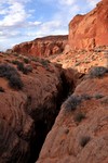
Slot from above
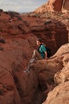
David perched over chasm
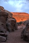
Approaching sunset
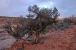
Mountain Mahogany
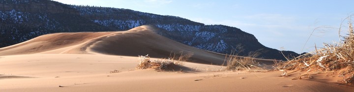
Though I would have liked to stay another night and hike back up Water Holes canyon, that trip really needs a full day and we'd have had to leave by early afternoon, and then drive 24 hours straight to get back in time for the CWA charity auction Saturday evening, so instead we started home. We didn't even stop at a Mexican restaurant in Page for supper. Instead we made camp off the road down to Coral Pink Sand Dunes state park a few miles north of Kanab. Someone has plowed a bunch of roads back into the juniper woods, apparently to cut some junipers, and we found a
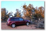
Our last campsite
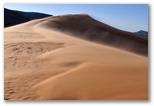
The biggest dune
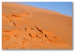
Wind-etched sand
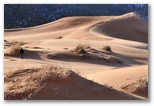
David in dunes
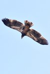
Golden Eagle
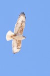
Ferruginous Hawk
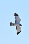
Male Northern Harrier
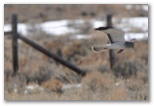
Male Northern Harrier