07/16/2010 Wonderland Trail backpack Photo Gallery
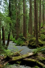
 Paradise to Devil's Dream 6 miles, 2400' (from Longmire)
Rick has been wanting to hike the Wonderland trail for a long time now and was looking for company so I joined him for a four day hike from Paradise to Mowich Lake, in turn for which he helped with timing at our Light at the End of the Tunnel marathon the following weekend. As usual, I was late getting packed up, having just returned from our trip to Montana two days earlier. We left for Mowich around 1PM, dropped my car off at Mowich Lake then drove over to Paradise. Rick had originally considered hiking an additional 10 miles down to Ipsut Creek and the Carbon River road but I talked him out of it, not feeling that ambitious. As it was, the 42 miles and 10,000' to Mowich Lake was enough.
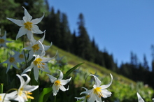
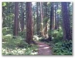
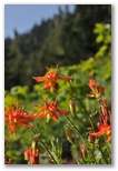
I also skipped the first six miles down from Paradise to Longmire. Rick wanted to do it for the sake of completeness but I wanted to hang out and take a few photos at Paradise, and get in a run, instead. I photographed avalanche lilies and ran 2 miles up and back on the road below Paradise, a beautiful spot for a run. I also drove our packs down to Longmire so Rick could make better time on the descent. We arrived at Longmire just about the same time, spent 45 minutes packing up and left about 6PM. Our original plan was to camp at Pyramid Creek but we missed it and ended up at Devil's Dream instead. That made 12 miles total for Rick so he was pretty wiped out when we finally made camp around dusk. It was a pleasant hike up a gentle gradient through the woods but with about 50 pounds on my back I was happy to see camp too.
Avalanche Lilies near Paradise
Rick has been wanting to hike the Wonderland trail for a long time now and was looking for company so I joined him for a four day hike from Paradise to Mowich Lake, in turn for which he helped with timing at our Light at the End of the Tunnel marathon the following weekend. As usual, I was late getting packed up, having just returned from our trip to Montana two days earlier. We left for Mowich around 1PM, dropped my car off at Mowich Lake then drove over to Paradise. Rick had originally considered hiking an additional 10 miles down to Ipsut Creek and the Carbon River road but I talked him out of it, not feeling that ambitious. As it was, the 42 miles and 10,000' to Mowich Lake was enough.
I also skipped the first six miles down from Paradise to Longmire. Rick wanted to do it for the sake of completeness but I wanted to hang out and take a few photos at Paradise, and get in a run, instead. I photographed avalanche lilies and ran 2 miles up and back on the road below Paradise, a beautiful spot for a run. I also drove our packs down to Longmire so Rick could make better time on the descent. We arrived at Longmire just about the same time, spent 45 minutes packing up and left about 6PM. Our original plan was to camp at Pyramid Creek but we missed it and ended up at Devil's Dream instead. That made 12 miles total for Rick so he was pretty wiped out when we finally made camp around dusk. It was a pleasant hike up a gentle gradient through the woods but with about 50 pounds on my back I was happy to see camp too.
07/17/2010 Wonderland Trail backpack
 Devil's Dream to South Puyallup 7 miles, 2400' (including sidetrip on Emerald Ridge)
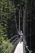
We were scheduled for a challenging hike today, up to Indian Henry's Hunting Ground, down to Tahoma Creek, up over Emerald Ridge, down to South Puyallup, up to Klapatchie Park and down to North Puyallup, 13 miles altogether. Rick was still tired from yesterday so we slept in and decided to go only as far as South Puyallup instead, six miles away. That still left us with the climb over Emerald Ridge which Rick's guidebook reported had a dangerous knife-edge section. Rick was considering a detour down to the West Side road to avoid it but I told him I'd carry his pack across the knife edge if he was uncomfortable with it and he agreed to try it. I was more concerned about the blister he'd developed on the outside of his foot. Though the boots weren't new, he had only used them for one short hike within the past year or so and the insole didn't fit well. It didn't look to me as though he'd be able to complete our hike but he was game to try so I put a special blister patch on it and we set out for Indian Henry's Hunting Ground. The famous flower meadows were mostly still snow-covered so we didn't linger there but hiked on down to the Tahoma Creek. The suspension bridge over the creek is the longest and highest in the park and turned out to be considerably more intimidating than Emerald Ridge. We stopped for lunch at the far end then I hiked back and forth across it again just for fun.
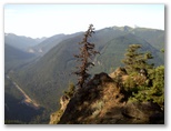
We took a break after the tiring climb up to Emerald Ridge. Rick took a nap while I explored a bit farther up the ridge, along a narrow moraine then up ledges and meadows to a peak of sorts about 400' higher than the trail. A few snow patches and lots of flowers up there. It would have been fun to hike farther up towards the Puyallup glacier but I didn't have time.
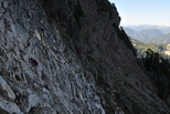
The descent to South Puyallup camp was difficult not due to the famous knife edge, which was way overrated, but rather to lots of loose cobbles the size of golf balls in the trail. The afternoon sun was warm and I was pretty sticky by the time we reached camp so after setting up the tent and pumping water, I found a way down to the river and took a cold bath. Rick fixed supper and we had a leisurely evening in camp. Lots of food, few bugs and not many people either when we arrived, though by dusk all the other tent sites were occupied. Since we were not scheduled to camp there I was worried that one more party would show up needing a place to camp, but none did.
Rick on the Tahoma Creek Bridge
We were scheduled for a challenging hike today, up to Indian Henry's Hunting Ground, down to Tahoma Creek, up over Emerald Ridge, down to South Puyallup, up to Klapatchie Park and down to North Puyallup, 13 miles altogether. Rick was still tired from yesterday so we slept in and decided to go only as far as South Puyallup instead, six miles away. That still left us with the climb over Emerald Ridge which Rick's guidebook reported had a dangerous knife-edge section. Rick was considering a detour down to the West Side road to avoid it but I told him I'd carry his pack across the knife edge if he was uncomfortable with it and he agreed to try it. I was more concerned about the blister he'd developed on the outside of his foot. Though the boots weren't new, he had only used them for one short hike within the past year or so and the insole didn't fit well. It didn't look to me as though he'd be able to complete our hike but he was game to try so I put a special blister patch on it and we set out for Indian Henry's Hunting Ground. The famous flower meadows were mostly still snow-covered so we didn't linger there but hiked on down to the Tahoma Creek. The suspension bridge over the creek is the longest and highest in the park and turned out to be considerably more intimidating than Emerald Ridge. We stopped for lunch at the far end then I hiked back and forth across it again just for fun.
We took a break after the tiring climb up to Emerald Ridge. Rick took a nap while I explored a bit farther up the ridge, along a narrow moraine then up ledges and meadows to a peak of sorts about 400' higher than the trail. A few snow patches and lots of flowers up there. It would have been fun to hike farther up towards the Puyallup glacier but I didn't have time.
The descent to South Puyallup camp was difficult not due to the famous knife edge, which was way overrated, but rather to lots of loose cobbles the size of golf balls in the trail. The afternoon sun was warm and I was pretty sticky by the time we reached camp so after setting up the tent and pumping water, I found a way down to the river and took a cold bath. Rick fixed supper and we had a leisurely evening in camp. Lots of food, few bugs and not many people either when we arrived, though by dusk all the other tent sites were occupied. Since we were not scheduled to camp there I was worried that one more party would show up needing a place to camp, but none did.
07/18/2010 Wonderland Trail backpack
 South Puyallup to Golden Lakes 12 miles, 3600'
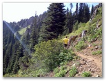
We almost turned back today. Rick wasn't feeling very good in the morning and his blister got worse yesterday. With our trip half over we've only covered less than a third of our distance. We had a tough time doing six miles yesterday and need to make twice that today and tomorrow both. The hike out to Longmire via the West Side road would take all day, and at the end of it we'd still have six miles to go to Longmire, and worst of all, once we got to Longmire, Rick's car might not be there. There was a possibility that Valerie might have retrieved it for us, in which case we'd have to call her or Susan to come get us. Not something we wanted to do, so we set out up the trail, figuring that if the climb up to St Andrews didn't go well we could turn back at that point. As it turned out, we didn't have to because Rick felt better as the day progressed. We encountered snow about at the point where we gained the ridge on the way up to St Andrews Park. Below us the lowlands were covered with clouds but we had clear skies and bright sunshine as we traversed snowfields over to Klapatchie Park. The shallow lake at Klapatchie Park was mostly melted out and reflected the mountain nicely. The initial part of the descent to North Puyallup was even more scenic with foggy sunbeams radiating down from trees at the top of an avalanche chute. We passed several piles of bear poop and an area where a local wind blast had snapped off a dozen big firs and hemlocks. Down at the North Puyallup river crossing we ate lunch on ledges by the river below the foundation of a big road bridge, apparently for the West Side Road, that was never completed. Reminded me of ancient ruins being swalllowed up by the forest.
As we started up towards Golden Lakes we could see perhaps why they didn't extend the West Side Road. The trail traverses a long and steep slope which no doubt would have been very expensive to put a road across. Golden Lakes was buggy and not particularly scenic; I didn't take any photos. The couple at the campsite next to us directed me to some running water because I didn't want to use the lake, then they joined me while I was pumping. When their pump stopped working I offered to loan them ours tomorrow when we'll be done with it. They were grateful because they had another 10 days on the trail.
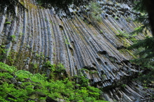
Columnar Basalt below South Puyallup Camp
We almost turned back today. Rick wasn't feeling very good in the morning and his blister got worse yesterday. With our trip half over we've only covered less than a third of our distance. We had a tough time doing six miles yesterday and need to make twice that today and tomorrow both. The hike out to Longmire via the West Side road would take all day, and at the end of it we'd still have six miles to go to Longmire, and worst of all, once we got to Longmire, Rick's car might not be there. There was a possibility that Valerie might have retrieved it for us, in which case we'd have to call her or Susan to come get us. Not something we wanted to do, so we set out up the trail, figuring that if the climb up to St Andrews didn't go well we could turn back at that point. As it turned out, we didn't have to because Rick felt better as the day progressed. We encountered snow about at the point where we gained the ridge on the way up to St Andrews Park. Below us the lowlands were covered with clouds but we had clear skies and bright sunshine as we traversed snowfields over to Klapatchie Park. The shallow lake at Klapatchie Park was mostly melted out and reflected the mountain nicely. The initial part of the descent to North Puyallup was even more scenic with foggy sunbeams radiating down from trees at the top of an avalanche chute. We passed several piles of bear poop and an area where a local wind blast had snapped off a dozen big firs and hemlocks. Down at the North Puyallup river crossing we ate lunch on ledges by the river below the foundation of a big road bridge, apparently for the West Side Road, that was never completed. Reminded me of ancient ruins being swalllowed up by the forest.
As we started up towards Golden Lakes we could see perhaps why they didn't extend the West Side Road. The trail traverses a long and steep slope which no doubt would have been very expensive to put a road across. Golden Lakes was buggy and not particularly scenic; I didn't take any photos. The couple at the campsite next to us directed me to some running water because I didn't want to use the lake, then they joined me while I was pumping. When their pump stopped working I offered to loan them ours tomorrow when we'll be done with it. They were grateful because they had another 10 days on the trail.
07/19/2010 Wonderland Trail backpack
 Golden Lakes to Mowich Lake 11 miles, 2500'
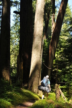
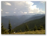
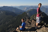
Still a few mosquitos around in the morning as we packed up. We stopped at the ridge where the trail starts down to the Mowich river and hiked out about a half mile to an open peak on the park boundary where we had a 360 degree panoramic view. Perfect day for hiking, sunny cool and clear. The undercast filling the valleys evaporated as we descended so we had sunshine for our lunch on the cobbles of the North Mowich river. The trees along the river were among the largest we'd seen during our three days on the trail. Torsten and Camilla, the couple from Golden Lakes, passed us while we were eating lunch, then we overtook them again on the way up towards Mowich Lake. I gave them our water filter and we swapped addresses and phone numbers. They're planning to get home on the 29'th. Rick and I are tentatively planning on hiking another segment of the Wonderland trail the weekend of the 31'st, so that should work out OK.
The hike up to Mowich Lake was hot so I dunked my head in every stream I passed - kept me quite comfortable. The last mile according to the guidebook proved to be only half that on the ground, for which we were grateful. We emerged from the forest into the parking lot at Mowich Lake around 4PM, early enough to get to Ranchito's for Mexican food before driving back to Longmire for Rick's car.
Rick near Mowich River
Still a few mosquitos around in the morning as we packed up. We stopped at the ridge where the trail starts down to the Mowich river and hiked out about a half mile to an open peak on the park boundary where we had a 360 degree panoramic view. Perfect day for hiking, sunny cool and clear. The undercast filling the valleys evaporated as we descended so we had sunshine for our lunch on the cobbles of the North Mowich river. The trees along the river were among the largest we'd seen during our three days on the trail. Torsten and Camilla, the couple from Golden Lakes, passed us while we were eating lunch, then we overtook them again on the way up towards Mowich Lake. I gave them our water filter and we swapped addresses and phone numbers. They're planning to get home on the 29'th. Rick and I are tentatively planning on hiking another segment of the Wonderland trail the weekend of the 31'st, so that should work out OK.
The hike up to Mowich Lake was hot so I dunked my head in every stream I passed - kept me quite comfortable. The last mile according to the guidebook proved to be only half that on the ground, for which we were grateful. We emerged from the forest into the parking lot at Mowich Lake around 4PM, early enough to get to Ranchito's for Mexican food before driving back to Longmire for Rick's car.
07/25/2010 Light at the End of the Tunnel Marathon
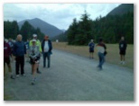
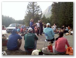
Of all the mornings to sleep through my alarm, this is not the one I would have chosen. I went to bed at 1AM and set two alarms on my watch for shortly after 4, planning to pick up Rick at 4:45 and make it out to North Bend with a half hour to set up before starting to check in runners at 6. Instead, I didn't wake up until ten minutes before six. As soon as I saw light outside the window I knew I was in trouble. I made it out of the house in ten minutes and arrived at the start just five minutes before the early starters were supposed to be leaving. A crowd of about 70 runners was milling around on the entrance road to the park. Matt and Betsy had stepped in to start collecting money and registering runners. They're great that way, always stepping in whenever they see a need. We set up tables and the two of them plus another woman named Rebecca helped me get the runners registered in record time. Betsy took half the alphabet and I took the other, getting each runner's name, collecting the $20 and calling out the bib number, then Matt and Rebecca searched through the stack of bibs and handed the right bib to the runner. Within 15 minutes we had all the early starters checked in; 15 minutes laterI gave the course information spiel and at 7:35 we sent them off up the trail.
In another glitch, Leslie's car wouldn't start so we had no race clock. Rick and I started our watches simultaneously at the early start and exactly an hour later, I took a photo with my camera to create a timestamped jpg by which I could determine runners' times by their finish line photos as a cross check against our clock times. That system worked well. Late in the race Rick accidently stopped his watch but mine kept going. When one of the runners a week later raised a question about his time, I was able to verify from the finish line photos (which I was able to get for all but about 10 of the runners) that our times were accurate from start to finish. Rick didn't end up doing much of the timing. Betsy and Matt stepped in as soon as the first half marathoners (who'd started with the early marathoners) began to arrive. They did most of the timing until they had to leave around before noon, then Shawn McTaggert and a friend, Tony's daughter's boyfriend I think, took over until Tony and his daughter finished around 1PM. It was her first marathon and Tony ran the the whole way with her. He was very much the proud dad at the finish, and she was obviously pleased with her accomplishment. Rick took over from Shawn I think, then Trevor and Jon, whom Susan had recruited at the last minute to be course marshal and help fixing/serving lunch, took over timing for the last few runners when Rick and I left to pick up the aid stations. Cody also helped with lunch, and also ran up the course to deliver my shoes to Howard when his Vibram Fivefingers proved unequal to 26 miles of gravel trail. Howard finished strong in my shoes but ran well under his potential overall due to his tender feet.
Between finish line photos and various other activities I kept continually busy; eating lunch took me several hours. Susan showed up right on time and had lunch all set up and ready by 10:30 or so. I was worried that we wouldn't have enough food. We registered about 120 runners in advance and ended up with 105 on race morning. It looked as though we had only enough food for about 70 but as it turned out, we had plenty of leftovers of everything. I imagine a number of people left before lunch and of those who stayed around, perhaps not everyone ate much. Hard to know exactly how many we fed.
07/31/2010 White River 50 Miler
I've considered running the White River 50 Mile Endurance Run for several summers now but never felt ready for 50 miles; the farthest I've ever run before was 7 1/2 hours and 38 miles. Each time I've run over 7 hours I've begun getting muscle cramps so I figured I just wasn't cut out for really long distances. But White River isn't just a run; it's also a hike with 8,700' elevation gain (and loss) over the 50 miles. Two 4000' climbs account for about 12 miles of the course, so it's really just a long 50K combined with a big hike. That's how I described it to Susan, neglecting to mention the overall distance because she's been opposed to my running a 50 miler. She has a hard enough time seeing me after a marathon, though now that I've done 90-odd of those she's a little more comfortable with it.
Anyhow, last weekend I was talking with Matt Hagen at our Light at the End of the Tunnel marathon and he mentioned that he was doing White River this weekend. Without much consideration I decided to give it a try. Not sure how it would go because while I've been hiking quite a bit recently, I haven't been running much, just a marathon a month with a handful of shorter runs in between. At least my last one, Missoula, was only three weeks ago and I felt fine hiking the next day, so I wouldn't have lost too much distance conditioning and could probably go longer than 26. How much longer, and at what risk of injury - hard to predict.
Susan and I drove up to Crystal the day before for packet pickup, where she discovered I was running a 50 miler. She took it well; I pointed out that my description of the event was not inaccurate, just not quite complete. We didn't really have to go up to Crystal because I could have picked up my shirt at the start on race morning, but having not done the race before, I wanted to get a little more information about where to put drop bags and such. That proved to be a good idea, particularly because I was able to talk with Scott Macoubrey, the race director, for a few minutes about how to run the race. He recommended taking a salt capsule together with a full bottle (20-24 oz) of fluid at each aid station to prevent muscle cramps. The symptoms he described, where the muscle starts fluttering or twitching then seizes up, were exactly what I've experienced. After the Gray Rock 50K, a warm 7 1/2 hour run with lots of elevation gain and loss, half a dozen individual muscles in my legs were doing that all at once. Scott also suggested eating solid food - pb&j sandwiches, bars, potatoes - at the aid stations before the downhill sections, particularly Sun Top, since you could digest them during the aerobically-easy descents. For fluids, he liked carbonated drinks - Coke, 7-up - late in the race for quick energy. I followed his advice during the race, along with a gel every hour in the first half and every 40 minutes or so in the second, and never really got depleted during the entire 12 hour run.
As usual, I didn't get enough sleep the night before the race. Figuring out gear and packing my drop bags took longer than I anticipated. I finally decided to include the extra pair of shoes in the Buck Creek bag at mile 27. I'd start out in Adrenalines and switch to the lighter Racers for the second half, a strategy which worked out well. I put Vaseline, sunburn cream, gels, Gatorade, bars, salt capsules and band aids in each drop bag and needed none of it, except the change of shoes.
In the morning I realized I hadn't planned how I was going to carry adequate fluids. It took me an extra 20 minutes to dig out my old hydration pack and figure which bladder went with it, so I didn't end up checking in until only 5 minutes before the early start at 5:30AM. The 50 or so other early starters left while I was still waiting for a Porta-potty and they were pretty well out of sight by the time I started 5 minutes later. I set out in my Adrenalines, black shorts, white tech T-shirt from the Mid-Mountain Marathon (one of my few other true trail marathons) and lightweight black shell jacket. I figured I'd bring that because of the chance of thunderstorms in the forecast though I only wore it for the first mile or so. I carried my smaller hydration pack with about a quart of water and my fuel belt with phone (in lieu of camera), 8oz bottle, 2 gu's and a small pouch with bandaids, tape, Vaseline, salt capsules, driver's license and car key. In the hydration pack I had 3 more gu's along with more tape and vaseline.
 I'd missed the pre-race instructions regarding how the course was marked but that turned out to be
pretty obvious, streamers of orange plastic tape and white chalk arrows marked every fork in the
trail. Jogging up the air strip I felt clunky and tired, and within the first couple of miles, I
began getting a stinging sensation in the soft area at the top of my left foot. In my experience
that comes and goes, and so it did during the race, acting up somewhere later on as well but
clearing up again too. It took me about a mile to catch up to the first early starters. I passed a
couple of women then met up with Jon Yoon and ran with him to the first aid station in the woods at
Camp Sheppard, mile 3.9. Shortly after that the trail forks and we began the 6
mile climb to Ranger Creek. I didn't take any pictures there but wish I had. The trail climbs up
through a break in the cliffs with tight steep switchbacks, some of them right under the rock face,
culminating in a 20' log ladder. After traversing up through open fir woods the trail suddenly
emerges on the top of the cliff with a spectacular view out over the valley. Next time I'll carry a
camera instead of the cell phone, but I made do with the camera phone. Photo stops probably cost me
10 minutes over the next couple of miles along the rim of the cliff. I was running with Francesca
when the first regular starters passed us. Anton, the ultimate winner, was already a minute or so
in the lead. He was wearing nothing but shorts and shoes.
I'd missed the pre-race instructions regarding how the course was marked but that turned out to be
pretty obvious, streamers of orange plastic tape and white chalk arrows marked every fork in the
trail. Jogging up the air strip I felt clunky and tired, and within the first couple of miles, I
began getting a stinging sensation in the soft area at the top of my left foot. In my experience
that comes and goes, and so it did during the race, acting up somewhere later on as well but
clearing up again too. It took me about a mile to catch up to the first early starters. I passed a
couple of women then met up with Jon Yoon and ran with him to the first aid station in the woods at
Camp Sheppard, mile 3.9. Shortly after that the trail forks and we began the 6
mile climb to Ranger Creek. I didn't take any pictures there but wish I had. The trail climbs up
through a break in the cliffs with tight steep switchbacks, some of them right under the rock face,
culminating in a 20' log ladder. After traversing up through open fir woods the trail suddenly
emerges on the top of the cliff with a spectacular view out over the valley. Next time I'll carry a
camera instead of the cell phone, but I made do with the camera phone. Photo stops probably cost me
10 minutes over the next couple of miles along the rim of the cliff. I was running with Francesca
when the first regular starters passed us. Anton, the ultimate winner, was already a minute or so
in the lead. He was wearing nothing but shorts and shoes.
 I spent several minutes at the Ranger Creek aid station, mile 11.7 and 3:09 into the run/hike. I
downed an S-cap along with 3 refills of my 8oz bottle and ate a gel too, I think. After a couple
miles through mostly old-growth forest above Ranger Creek we reached the top of the ridge and views
opened up across flower meadows with scattered firs. The next several miles up to Corral Pass were
a delight both for the scenery and the easy running, though passing oncoming runners where the
single-track trail traversed steeper slopes was tricky at times. I averaged 14 min/mile and reached
the Corral Pass aid station, mile 16.9, at 4:20. I spent 6 minutes there, eating and drinking.
I spent several minutes at the Ranger Creek aid station, mile 11.7 and 3:09 into the run/hike. I
downed an S-cap along with 3 refills of my 8oz bottle and ate a gel too, I think. After a couple
miles through mostly old-growth forest above Ranger Creek we reached the top of the ridge and views
opened up across flower meadows with scattered firs. The next several miles up to Corral Pass were
a delight both for the scenery and the easy running, though passing oncoming runners where the
single-track trail traversed steeper slopes was tricky at times. I averaged 14 min/mile and reached
the Corral Pass aid station, mile 16.9, at 4:20. I spent 6 minutes there, eating and drinking.
 Altogether I probably spent nearly an hour hanging out at aid stations. Next time I could probably
trim that to 15 minutes by quickly taking the S-cap and water then carrying food back out on the
trail.
Altogether I probably spent nearly an hour hanging out at aid stations. Next time I could probably
trim that to 15 minutes by quickly taking the S-cap and water then carrying food back out on the
trail.
Leaving Corral Pass I was 23 minutes behind the 12-hour pace split of 4:02. On the way back down to Ranger Creek I ran about a mile with Rhonda, who's done 23 100-milers in her life but only one marathon in the past 5 years. She went up several times during the awards ceremony after the race, so she must have picked up the pace after she left me. I stopped part way down the 5 mile, 2500' descent from Ranger Creek to tape a developing hot spot on my left big toe. Though I had to replace the tape at Buck Creek, no blister ever developed. My left outer quad started feeling tight on that descent as well so I stopped and massage it briefly. That may have helped because though I had some tenderness there, the tightness pretty well cleared up. At Buck Creek I changed socks and shoes and hung out eating and drinking for almost 15 minutes. That was where I'd planned on quitting if I had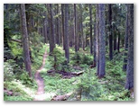 to. I didn't have to, though it was difficult to imagine heading back out on the trail for
essentially another marathon run. I left Buck Creek at 6:46, 28 minutes behind the 12 hour split.
After the Adrenalines the Racers felt tight, particularly on my outer middle toes. Maybe it was a
mistake to switch - I guess the next 23 miles would tell, but I didn't feel like going back to
change.
to. I didn't have to, though it was difficult to imagine heading back out on the trail for
essentially another marathon run. I left Buck Creek at 6:46, 28 minutes behind the 12 hour split.
After the Adrenalines the Racers felt tight, particularly on my outer middle toes. Maybe it was a
mistake to switch - I guess the next 23 miles would tell, but I didn't feel like going back to
change.
The trail is flat along the river and down the far side of the air strip for a mile or more before the big hill climb up to Fawn Ridge and Sun Top. I dunked my head in the White River and was feeling cool, well-fueled and strong as I started up the hill. I passed runners steadily all the way up to the aid station at Fawn Ridge, mile 31.7. Unfortunately I didn't record my split there. I passed a couple of other runners just above the aid station then didn't see anyone for an hour. I'd forgotten the long gentle descent through the woods after the false summit. Were it not for the scattered streamers of orange tape, I'd probably have turned back thinking I was on the wrong trail.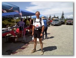
 Finally I came across the Sun Top road and reached the aid station on top after a 5 minute sunny
climb through open woods and huckleberries. I spent 8 minutes there, eating and drinking and
enjoying the sunshine. A big gray thunderhead was spreading high over the Cascade crest from the
east and we could hear faint rumblings of thunder from time to time but it hadn't come much closer
in the half hour since I passed the false summit. Leaving Sun Top, mile 37, at 9:25 I was only 3
minutes behind the 12 hour split though I didn't know it at the time. I'd wanted to be leaving Sun
Top at 9:00 but with 2:35 and a long descent remaining for the final 13 miles, I figured I still had
a chance at breaking 12 hours.
Finally I came across the Sun Top road and reached the aid station on top after a 5 minute sunny
climb through open woods and huckleberries. I spent 8 minutes there, eating and drinking and
enjoying the sunshine. A big gray thunderhead was spreading high over the Cascade crest from the
east and we could hear faint rumblings of thunder from time to time but it hadn't come much closer
in the half hour since I passed the false summit. Leaving Sun Top, mile 37, at 9:25 I was only 3
minutes behind the 12 hour split though I didn't know it at the time. I'd wanted to be leaving Sun
Top at 9:00 but with 2:35 and a long descent remaining for the final 13 miles, I figured I still had
a chance at breaking 12 hours.
The descent on the hard gravel forest road passed fairly quickly. I held back some to avoid trashing my legs, which though not exactly sore were feeling a little stiff. Even so I clocked 8:00/mile by the mile markers for the third mile. I slowed some after that due to pee stops and a longer break to clean pebbles and pine needles out of my shoes and socks. I stopped to pee 3 times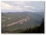 in the hour long descent; clearly I wasn't getting dehydrated. I had anticipated that if I was
going to have trouble with my AT tendon anywhere on the course, it would be during that descent.
One reason I'd switched to the Racers was because the lighter shoes seem to minimize irritation to
the tendon. I could feel something going on in my lower left shin, hard to say just what. It might
just have been the scrape I got around mile 10 backing into a sharp stick while composing a picture.
In any case, it seemed to feel better when I ran on the right side of the road, where the surface
canted to the right. So I did, except when the gravel was softer on the left. I zig-zagged my way
down the hill and reached Skookum Flats at 10:28, just a minute behind the 12 hour split. I left
after the usual refueling, and a couple spongefulls of ice water over ny head, at 10:35, leaving me
13 minutes a mile for the remaining 6 1/2 hours of rolling technical (lots of roots and rocks)
single track up along the White River if I was going to break 12 hours.
in the hour long descent; clearly I wasn't getting dehydrated. I had anticipated that if I was
going to have trouble with my AT tendon anywhere on the course, it would be during that descent.
One reason I'd switched to the Racers was because the lighter shoes seem to minimize irritation to
the tendon. I could feel something going on in my lower left shin, hard to say just what. It might
just have been the scrape I got around mile 10 backing into a sharp stick while composing a picture.
In any case, it seemed to feel better when I ran on the right side of the road, where the surface
canted to the right. So I did, except when the gravel was softer on the left. I zig-zagged my way
down the hill and reached Skookum Flats at 10:28, just a minute behind the 12 hour split. I left
after the usual refueling, and a couple spongefulls of ice water over ny head, at 10:35, leaving me
13 minutes a mile for the remaining 6 1/2 hours of rolling technical (lots of roots and rocks)
single track up along the White River if I was going to break 12 hours.
 I ran it in 11:50/mile, my fastest split (excluding the downhill sections) of the whole race. About
three miles in I began to have trouble concentrating on the trail and began to feel overwhelmed by
all the roots and rocks in my way, a clear sign that it was time for a gel. I really didn't feel
like eating another gel but I downed one anyhow and emptied my 8oz bottle plus a good draught from
I ran it in 11:50/mile, my fastest split (excluding the downhill sections) of the whole race. About
three miles in I began to have trouble concentrating on the trail and began to feel overwhelmed by
all the roots and rocks in my way, a clear sign that it was time for a gel. I really didn't feel
like eating another gel but I downed one anyhow and emptied my 8oz bottle plus a good draught from
 my hydration pack and within a few minutes the trail was manageable again. For the last 20 minutes
or so I pushed my heartrate back up over 150, breathing hard and only walking the roughest sections.
The downhills were becoming a pain in the quads but fortunately the descents were both infrequent
and short. At 11:45 there were a few spectators along the trail, a very welcome sight. A couple
minutes later I broke out on the road with the finish just a quarter mile away, another very welcome
sight. There being no need to sprint, I finished the way I started, trying to run smoothly and
easily, picking up each foot and putting it down again in front of the other one, my stance a little
more upright than usual to assist with recovery in case I tripped. Crossing the finish line I
choked up and couldn't talk for a moment; I haven't been so moved by finishing a race since I first
qualified for Boston.
my hydration pack and within a few minutes the trail was manageable again. For the last 20 minutes
or so I pushed my heartrate back up over 150, breathing hard and only walking the roughest sections.
The downhills were becoming a pain in the quads but fortunately the descents were both infrequent
and short. At 11:45 there were a few spectators along the trail, a very welcome sight. A couple
minutes later I broke out on the road with the finish just a quarter mile away, another very welcome
sight. There being no need to sprint, I finished the way I started, trying to run smoothly and
easily, picking up each foot and putting it down again in front of the other one, my stance a little
more upright than usual to assist with recovery in case I tripped. Crossing the finish line I
choked up and couldn't talk for a moment; I haven't been so moved by finishing a race since I first
qualified for Boston.
 08/25/2010 Kaleetan Peak, WA 12 miles, 4000', 6 hours
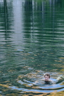
The boys and I hiked up Kaleetan Peak near Snoqualmie Pass today. We'd intended to leave reasonably early, like 8AM, but didn't actually get away until around 11:15 so we didn't start hiking until after noon. We made good time to the lake though, about 2 hours for the 4.5 miles. It was hot; even dunking my head in the cold water at the stream crossing about halfway up only kept the sweat at bay for a few minutes. The lake was almost warm enough for comfortable swimming. We parked for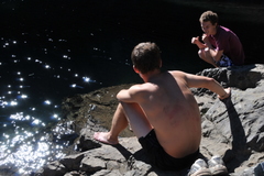 lunch on a ledgy point of rock towards the upper end of the lower lake and lingered there talking
for a couple of hours, until the sun began to slip behind the ridge above us. David and I went
swimming briefly before finishing our lunches. Daniel stood quite a while with his toes in the water
but never dove in.
lunch on a ledgy point of rock towards the upper end of the lower lake and lingered there talking
for a couple of hours, until the sun began to slip behind the ridge above us. David and I went
swimming briefly before finishing our lunches. Daniel stood quite a while with his toes in the water
but never dove in.
We talked about careers some, and money. Daniel said he had no idea what to pursue for a career. I told him I thought he might make a good teacher. He likes an audience and kids, particularly high-school age, might provide that for him. He didn't know if he'd like teaching or not but was concerned that he wouldn't make enough money. Then we talked about managing money and how to learn about finances and investments. I told them that if they were interested in that, they could certainly do it, and if not, then they should find a good money manager to do it for them.
We were feeling pretty lazy after our long break but decided to head up towards the peak. I figured we could hike up another hour before we'd have to turn back if we wanted to get home by dark. After an hour we didn't turn back; instead we took another half hour to reach the summit. We passed the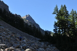
 small upper lake on the left then hiked up the valley on talus to the last gully on the left, which
is more of a broad ledgy slope up to the saddle immediately south of the peak. It was steeper than
I remembered, and though somewhat exposed, it wasn't difficult scrambling. The mosquitos seemed to
small upper lake on the left then hiked up the valley on talus to the last gully on the left, which
is more of a broad ledgy slope up to the saddle immediately south of the peak. It was steeper than
I remembered, and though somewhat exposed, it wasn't difficult scrambling. The mosquitos seemed to
 get worse the higher we climbed. I finally stopped above the saddle to apply bug dope. There
wasn't as much breeze up there as we'd hoped and the sun-heated air was almost as warm as it had
been below the lake. The summit was comfortable though. We stayed on top for about 20 minutes,
took a few pictures, called home to let Susan know we'd be late. We could see the freeway down in
the valley where we'd come from; it looked a long ways away. My estimate of 2 1/2 hours for the
descent proved right on target, even with a 20 minute stop at the lake for a brief and chilly swim.
We descended via the ridge, following a fairly clear trail which became even more obvious once we
reached the high point. I don't think the ridge route was much faster than the valley would have
been, due in part to a 200' climb back up to the high point after skirting the cliffs on the east
side of the ridge.
get worse the higher we climbed. I finally stopped above the saddle to apply bug dope. There
wasn't as much breeze up there as we'd hoped and the sun-heated air was almost as warm as it had
been below the lake. The summit was comfortable though. We stayed on top for about 20 minutes,
took a few pictures, called home to let Susan know we'd be late. We could see the freeway down in
the valley where we'd come from; it looked a long ways away. My estimate of 2 1/2 hours for the
descent proved right on target, even with a 20 minute stop at the lake for a brief and chilly swim.
We descended via the ridge, following a fairly clear trail which became even more obvious once we
reached the high point. I don't think the ridge route was much faster than the valley would have
been, due in part to a 200' climb back up to the high point after skirting the cliffs on the east
side of the ridge.
At the lake I had a bout of diarrhea and was grateful for the conveniently-located outhouse. We started down from the lake with 3 1/2 fingers between the sun and the horizon, about 40 minutes. We hurried, jogging where we could, hiking fast where the trail was too rough. The sunlight left the peaks of Denny Mt to the east of us right on schedule at 8PM, just after we crossed the stream. We overtook another couple descending the talus slope above the waterfalls; I didn't think to ask if they had a flashlight but it looked as though they were going to need it. The light got pretty dim when we entered the woods, but knowing we had a flashlight and extra batteries, I wasn't too concerned. Then just before the lower stream crossing, I felt something hit the back of my legs. It was my lunch bag falling out of my unzipped pack. I checked, and my dayhike bag, with the flashlight in it, had already fallen out, somewhere back up the trail in the dusk. I decided not to go look for it; no telling how far back it was, and we wouldn't be reaching the parking lot until nearly dark as it was. Perhaps the couple behind us would pick it up. We hustled on down the trail. It fortunately becomes wide and well-paved with pea gravel for the last half mile to the parking lot, a good thing for us because by then we could only barely distinguish the few rocks in the tread. The other couple emerged from the woods only 10 minutes behind us, still navigating without flashlights. When I asked about my dayhike bag, he held up a granola bar and asked if it was mine. It was. He hadn't seen the plastic bag with my dayhike essentials though; I'll have to assemble another one.
I've considered running the White River 50 Mile Endurance Run for several summers now but never felt ready for 50 miles; the farthest I've ever run before was 7 1/2 hours and 38 miles. Each time I've run over 7 hours I've begun getting muscle cramps so I figured I just wasn't cut out for really long distances. But White River isn't just a run; it's also a hike with 8,700' elevation gain (and loss) over the 50 miles. Two 4000' climbs account for about 12 miles of the course, so it's really just a long 50K combined with a big hike. That's how I described it to Susan, neglecting to mention the overall distance because she's been opposed to my running a 50 miler. She has a hard enough time seeing me after a marathon, though now that I've done 90-odd of those she's a little more comfortable with it.
Anyhow, last weekend I was talking with Matt Hagen at our Light at the End of the Tunnel marathon and he mentioned that he was doing White River this weekend. Without much consideration I decided to give it a try. Not sure how it would go because while I've been hiking quite a bit recently, I haven't been running much, just a marathon a month with a handful of shorter runs in between. At least my last one, Missoula, was only three weeks ago and I felt fine hiking the next day, so I wouldn't have lost too much distance conditioning and could probably go longer than 26. How much longer, and at what risk of injury - hard to predict.
Susan and I drove up to Crystal the day before for packet pickup, where she discovered I was running a 50 miler. She took it well; I pointed out that my description of the event was not inaccurate, just not quite complete. We didn't really have to go up to Crystal because I could have picked up my shirt at the start on race morning, but having not done the race before, I wanted to get a little more information about where to put drop bags and such. That proved to be a good idea, particularly because I was able to talk with Scott Macoubrey, the race director, for a few minutes about how to run the race. He recommended taking a salt capsule together with a full bottle (20-24 oz) of fluid at each aid station to prevent muscle cramps. The symptoms he described, where the muscle starts fluttering or twitching then seizes up, were exactly what I've experienced. After the Gray Rock 50K, a warm 7 1/2 hour run with lots of elevation gain and loss, half a dozen individual muscles in my legs were doing that all at once. Scott also suggested eating solid food - pb&j sandwiches, bars, potatoes - at the aid stations before the downhill sections, particularly Sun Top, since you could digest them during the aerobically-easy descents. For fluids, he liked carbonated drinks - Coke, 7-up - late in the race for quick energy. I followed his advice during the race, along with a gel every hour in the first half and every 40 minutes or so in the second, and never really got depleted during the entire 12 hour run.
As usual, I didn't get enough sleep the night before the race. Figuring out gear and packing my drop bags took longer than I anticipated. I finally decided to include the extra pair of shoes in the Buck Creek bag at mile 27. I'd start out in Adrenalines and switch to the lighter Racers for the second half, a strategy which worked out well. I put Vaseline, sunburn cream, gels, Gatorade, bars, salt capsules and band aids in each drop bag and needed none of it, except the change of shoes.
In the morning I realized I hadn't planned how I was going to carry adequate fluids. It took me an extra 20 minutes to dig out my old hydration pack and figure which bladder went with it, so I didn't end up checking in until only 5 minutes before the early start at 5:30AM. The 50 or so other early starters left while I was still waiting for a Porta-potty and they were pretty well out of sight by the time I started 5 minutes later. I set out in my Adrenalines, black shorts, white tech T-shirt from the Mid-Mountain Marathon (one of my few other true trail marathons) and lightweight black shell jacket. I figured I'd bring that because of the chance of thunderstorms in the forecast though I only wore it for the first mile or so. I carried my smaller hydration pack with about a quart of water and my fuel belt with phone (in lieu of camera), 8oz bottle, 2 gu's and a small pouch with bandaids, tape, Vaseline, salt capsules, driver's license and car key. In the hydration pack I had 3 more gu's along with more tape and vaseline.
At the early start
At the early start
View back to start
Above Ranger Creek
Corral Pass aid station
Leaving Corral Pass I was 23 minutes behind the 12-hour pace split of 4:02. On the way back down to Ranger Creek I ran about a mile with Rhonda, who's done 23 100-milers in her life but only one marathon in the past 5 years. She went up several times during the awards ceremony after the race, so she must have picked up the pace after she left me. I stopped part way down the 5 mile, 2500' descent from Ranger Creek to tape a developing hot spot on my left big toe. Though I had to replace the tape at Buck Creek, no blister ever developed. My left outer quad started feeling tight on that descent as well so I stopped and massage it briefly. That may have helped because though I had some tenderness there, the tightness pretty well cleared up. At Buck Creek I changed socks and shoes and hung out eating and drinking for almost 15 minutes. That was where I'd planned on quitting if I had
Forest above Fawn Ridge
The trail is flat along the river and down the far side of the air strip for a mile or more before the big hill climb up to Fawn Ridge and Sun Top. I dunked my head in the White River and was feeling cool, well-fueled and strong as I started up the hill. I passed runners steadily all the way up to the aid station at Fawn Ridge, mile 31.7. Unfortunately I didn't record my split there. I passed a couple of other runners just above the aid station then didn't see anyone for an hour. I'd forgotten the long gentle descent through the woods after the false summit. Were it not for the scattered streamers of orange tape, I'd probably have turned back thinking I was on the wrong trail.
Thunderstorm brewing
At Sun Top aid station
The descent on the hard gravel forest road passed fairly quickly. I held back some to avoid trashing my legs, which though not exactly sore were feeling a little stiff. Even so I clocked 8:00/mile by the mile markers for the third mile. I slowed some after that due to pee stops and a longer break to clean pebbles and pine needles out of my shoes and socks. I stopped to pee 3 times
First half ridge climb
Forest along White River
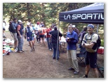
Awards ceremony
08/01/2010
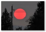
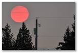
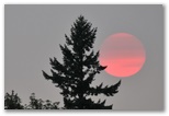 Odd weather today - the sun is shining but the sky is white. The color of the sunlight is pale
orange, as if it were near sunset. Late in the afternoon I took a few photos of the sun as it
dropped towards the horizon behind layers of smoke.
Odd weather today - the sun is shining but the sky is white. The color of the sunlight is pale
orange, as if it were near sunset. Late in the afternoon I took a few photos of the sun as it
dropped towards the horizon behind layers of smoke.
I expected quite a bit of soreness today due to my lack of training for the 50 miler and haven't been disappointed. My legs are fine when I'm sitting down but pretty sore for the first few steps when I get up. Neck and shoulders, uppper arms and back are a little sore too when I move around - they get alot more use in a trail run than on a road marathon.
I expected quite a bit of soreness today due to my lack of training for the 50 miler and haven't been disappointed. My legs are fine when I'm sitting down but pretty sore for the first few steps when I get up. Neck and shoulders, uppper arms and back are a little sore too when I move around - they get alot more use in a trail run than on a road marathon.
08/02/2010
Hiked up the Cedar Butte trail with Janelle today. We get together occasionally for a local hike before work, usually Tiger Mountain but I didn't think my quads could handle that much downhill so we settled for something easier. I've never been up there before but it's a nice little hike, mostly in the woods with a few glimpses of Rattlesnake Lake and the valley down towards North Bend. One branch of the trail borders the rim of the Boxley Blowout, a deep ravine scooped out of the hillside above Rattlesnake Lake by leakage from the Cedar River dam a few years after it was built in 1914. It's an unremarkable steep wooded hillside today but made a big stir in 1918 when the leak caused Rattlesnake Lake to rise and flood the former town of Moncton (which is why the City of Seattle, which built the dam, now owns Rattlesnake Lake, having bought out the inhabitants of the town). We didn't know any of this history during our hike so we talked about work and running, slapped a few mosquitos, wondered at the yodeling of a loon flying so low above the treetops that we could hear its wingbeats. My quads bothered me some on the way down but not as much as I expected, nor as much as they would whenever I pulled myself out of the car doing errands later in the day.
I spent an hour at REI trying on backpacks and settled on an Osprey at half the weight of my old pack, then spent another hour at Fry's debating whether or not to buy a laptop for traveling. Decided against it. Over at the Apple Store I waited a half hour for a technician appointment, which was nonetheless much more convenient shipping the machine back to the factory for diagnosis. The technician fired it up, determined from the thrice-blinking lights that memory was at fault, unscrewed the back of the laptop and removed one of the two memory cards. That was all it took - Daniel's Macbook started up normally for the first time in months. They didn't have replacement memory in stock but it should arrive within a few days. Daniel will be delighted to have a working computer again, and maybe this time around I can persuade him to back it up.
08/05/2010 Lena Lake backpack Photo Gallery
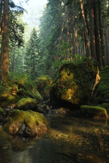 Valley of the Silent Men
Jeff and I are camped this evening along the East Fork of Lena Creek just above where it disappears into its bed of gray cobbles. It's a nice flat spot amidst big hemlocks and cedars with the soft rushing sound of the stream to absorb the silence of the Valley of the Silent Men. The rain stopped an hour or so before sunset and the sky cleared to very pale blue. The late afternoon light made for beautiful photos in the woods but the air remained humid and our gear remained wet. We weren't expecting the rain when we stashed our packs at our lunch spot by the stream a few hundred yards up from the lake. Within an hour after we left them, even before the sky fully clouded over, a fine sprinkle of rain began to filter down through the trees. Soon after that thunder began to rumble overhead. We kept hiking in hopes that the storm would pass us by but the thunder became more frequent and by the time we reached the big camp at the fork in the stream (the Brother's base camp?) the stream was spattered with heavy raindrops and the bushes were dripping. We continued up the trail along the left fork of the stream up to where a strip of burned trees runs down along the west side of a big avalanche path. Though the thunder was diminishing, it also seemed to be getting closer to us and when we saw our first actual flash of lightning (about 3 miles away) we turned back. Just as well that we did because once the sun came out we stopped frequently for photographs on the way down and didn't reach our packs until 7PM. Having seen the camp site back where the stream was running we weren't content to settle for the dry site we'd found at lunchtime so we shouldered our packs and hiked back up for 20 minutes. We had just enough time to set up the tent, pump water, fix supper and rinse off in the stream before dark. My long-sleeved tech shirt got wet in my pack but fortunately my extra short-sleeved shirt was dry. I left my long underwear in the car this morning thinking I wouldn't need it.
 The Valley of the Silent Men might be better named the Valley of the Silent Stream because for the
half mile from our camp down to the lake the bed of the East Fork of Lena Creek is dry. Even where
it drops over steep ledges for the last 100' down to the lake the stream contained water only in
potholes. The lake itself has no above-ground outflow; Lena Creek doesn't emerge above ground until
a half mile or so below the lake. Right below the trail crossing it bubbles up among gray boulders
and cascades on down into the valley. The level of Lena Lake appears to have dropped about five
feet since last winter, leaving a series of small wave-cut terraces in its mostly muddy shores. I
suspect the outflow is more or less constant while the inflow varies seasonally, higher in fall and
winter, lower in summer, so the lake level drops through the summer and rises again with fall rains.
Most of the rock we saw was serpentine and appears to be unstable. The valley, once scoured out by
glaciers, is now being refilled by numerous big rockfalls. Much of the forest understory both below
the lake and above it in the Valley of the Silent Men consists of big moss-covered boulders.
The Valley of the Silent Men might be better named the Valley of the Silent Stream because for the
half mile from our camp down to the lake the bed of the East Fork of Lena Creek is dry. Even where
it drops over steep ledges for the last 100' down to the lake the stream contained water only in
potholes. The lake itself has no above-ground outflow; Lena Creek doesn't emerge above ground until
a half mile or so below the lake. Right below the trail crossing it bubbles up among gray boulders
and cascades on down into the valley. The level of Lena Lake appears to have dropped about five
feet since last winter, leaving a series of small wave-cut terraces in its mostly muddy shores. I
suspect the outflow is more or less constant while the inflow varies seasonally, higher in fall and
winter, lower in summer, so the lake level drops through the summer and rises again with fall rains.
Most of the rock we saw was serpentine and appears to be unstable. The valley, once scoured out by
glaciers, is now being refilled by numerous big rockfalls. Much of the forest understory both below
the lake and above it in the Valley of the Silent Men consists of big moss-covered boulders.
It's nice having Jeff along. We hike at about the same pace and he doesn't seem to mind my photo stops. We talked about being "pretired" and about our travel plans, and about the geology and natural history. I explained how to identify the trees - hemlock, cedar, Douglas fir, true fir.
I had an unusual dream within a dream last night. I dreamt that I was dreaming then woke up and remembered the dream, though I can't recall it now. As I became aware of my surroundings I realized that things weren't right. I can't recall now what it was that tipped me off, but I suddenly realized that I wasn't awake at all but was still dreaming. Then I immediately woke up, for real this time.
Jeff and I are camped this evening along the East Fork of Lena Creek just above where it disappears into its bed of gray cobbles. It's a nice flat spot amidst big hemlocks and cedars with the soft rushing sound of the stream to absorb the silence of the Valley of the Silent Men. The rain stopped an hour or so before sunset and the sky cleared to very pale blue. The late afternoon light made for beautiful photos in the woods but the air remained humid and our gear remained wet. We weren't expecting the rain when we stashed our packs at our lunch spot by the stream a few hundred yards up from the lake. Within an hour after we left them, even before the sky fully clouded over, a fine sprinkle of rain began to filter down through the trees. Soon after that thunder began to rumble overhead. We kept hiking in hopes that the storm would pass us by but the thunder became more frequent and by the time we reached the big camp at the fork in the stream (the Brother's base camp?) the stream was spattered with heavy raindrops and the bushes were dripping. We continued up the trail along the left fork of the stream up to where a strip of burned trees runs down along the west side of a big avalanche path. Though the thunder was diminishing, it also seemed to be getting closer to us and when we saw our first actual flash of lightning (about 3 miles away) we turned back. Just as well that we did because once the sun came out we stopped frequently for photographs on the way down and didn't reach our packs until 7PM. Having seen the camp site back where the stream was running we weren't content to settle for the dry site we'd found at lunchtime so we shouldered our packs and hiked back up for 20 minutes. We had just enough time to set up the tent, pump water, fix supper and rinse off in the stream before dark. My long-sleeved tech shirt got wet in my pack but fortunately my extra short-sleeved shirt was dry. I left my long underwear in the car this morning thinking I wouldn't need it.
It's nice having Jeff along. We hike at about the same pace and he doesn't seem to mind my photo stops. We talked about being "pretired" and about our travel plans, and about the geology and natural history. I explained how to identify the trees - hemlock, cedar, Douglas fir, true fir.
I had an unusual dream within a dream last night. I dreamt that I was dreaming then woke up and remembered the dream, though I can't recall it now. As I became aware of my surroundings I realized that things weren't right. I can't recall now what it was that tipped me off, but I suddenly realized that I wasn't awake at all but was still dreaming. Then I immediately woke up, for real this time.
08/06/2010 Lena Lake backpack
Upper Lena Lake
 I woke up to voices at 5 this morning. Three hikers were headed up the trail towards Brothers
base camp, still using headlamps though the sky was beginning to shed some light. After they passed
I got up to take a leak. When I crawled back into the tent Jeff asked me if we should get up. I
mumbled something and we both went back to sleep for three more hours. Around 10AM we broke camp
and carried our packs up the Upper Lena Lake trail as far as the turnoff that bypasses much of the
trail along the lake. We stashed our packs there under a crumbling log in a grove of large old
cedars. I photographed the cut end one of the big ones which fell across the trail a few years ago
and later counted about 350 rings. We passed big trees - cedars, Douglas firs and hemlocks -
scattered through the forest for the first half of the way up to Upper Lena Lake. Farther up the
trail crosses lush avalanche chutes as it climbs a series of headwalls. The trail was
well-constructed if not well maintained; switchbacks are cut into serpentine bedrock in one place
but forbs and bushes nearly obscured the tread in other areas. In the last half mile before the
lake the trail crosses several steep meadows with colorful flowers - paintbrush, delphinium, phlox
and others.
I woke up to voices at 5 this morning. Three hikers were headed up the trail towards Brothers
base camp, still using headlamps though the sky was beginning to shed some light. After they passed
I got up to take a leak. When I crawled back into the tent Jeff asked me if we should get up. I
mumbled something and we both went back to sleep for three more hours. Around 10AM we broke camp
and carried our packs up the Upper Lena Lake trail as far as the turnoff that bypasses much of the
trail along the lake. We stashed our packs there under a crumbling log in a grove of large old
cedars. I photographed the cut end one of the big ones which fell across the trail a few years ago
and later counted about 350 rings. We passed big trees - cedars, Douglas firs and hemlocks -
scattered through the forest for the first half of the way up to Upper Lena Lake. Farther up the
trail crosses lush avalanche chutes as it climbs a series of headwalls. The trail was
well-constructed if not well maintained; switchbacks are cut into serpentine bedrock in one place
but forbs and bushes nearly obscured the tread in other areas. In the last half mile before the
lake the trail crosses several steep meadows with colorful flowers - paintbrush, delphinium, phlox
and others.
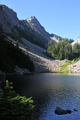
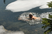 To our surprise the lake was still mostly snow-covered. We parked on a little promontory in the sun
and ate our bars and brownies for lunch. The sun was warm and I was hot from the hike up so I went
for a dip in the lake. It was nice to get rinsed off but the best part was the novelty of swimming
next to slabs of snow-covered ice floating in the water. I only managed two strokes and didn't get
my head wet. Jeff dunked but didn't swim.
To our surprise the lake was still mostly snow-covered. We parked on a little promontory in the sun
and ate our bars and brownies for lunch. The sun was warm and I was hot from the hike up so I went
for a dip in the lake. It was nice to get rinsed off but the best part was the novelty of swimming
next to slabs of snow-covered ice floating in the water. I only managed two strokes and didn't get
my head wet. Jeff dunked but didn't swim.
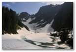 After our swim we hiked up towards Milk Lake, mostly on snow. I continued up the ridge west of the
lake hoping to get around to Mt Bretherton but was blocked by a crag with cliffs on either side at
5300'. The Olympics don't seem very hospitable to wandering, too rugged, though the way up to Mt
Lena on the other side of the lake looked reasonable. Coming down as we were on a Friday afternoon,
we passed lots of backpackers headed up. It would be a tough backpack up to the Upper Lake and we
were glad we'd decided to camp low. Glad to reach the trailhead too, 7 miles and 3 hours after we
left the Upper Lake. Altogether in two days we hiked about 22 miles and 7000' up and down. Next
time I'll try the ascent of South Brother, reported to be just a hike up the trail we followed
yesterday with a final rock scramble at the top..
After our swim we hiked up towards Milk Lake, mostly on snow. I continued up the ridge west of the
lake hoping to get around to Mt Bretherton but was blocked by a crag with cliffs on either side at
5300'. The Olympics don't seem very hospitable to wandering, too rugged, though the way up to Mt
Lena on the other side of the lake looked reasonable. Coming down as we were on a Friday afternoon,
we passed lots of backpackers headed up. It would be a tough backpack up to the Upper Lake and we
were glad we'd decided to camp low. Glad to reach the trailhead too, 7 miles and 3 hours after we
left the Upper Lake. Altogether in two days we hiked about 22 miles and 7000' up and down. Next
time I'll try the ascent of South Brother, reported to be just a hike up the trail we followed
yesterday with a final rock scramble at the top..
Upper Lena Lake
Red Columbine
Milk Lake & Mt Bretherton
08/10/2010 Jackson, NH
Our second full day here. The boys and Kirsten drove down with Jack to Rumney for a day of climbing. Eric and I drove up to Wildcat and ran/hiked the Polecat. I did the three miles and 2000' in 44:35, following the route for the Wildman Biathlon coming up this Saturday. Though the air was comfortable the sun was hot, and we did the run in mid-afternoon after lunch, so I'm hoping to be a little faster on race day. It was a tough workout; I was at maximum effort most of the way up, then jogged back down on rubbery legs. My quads should be able to handle that though with the backpacking and the recent 50 miler, so even though I was pretty wiped out the rest of the evening, I'm hoping for a quick recovery.
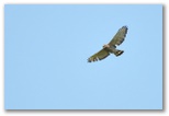 It was a good day for Broad-winged Hawk sightings. As we were walking across the base area at
Wildcat one flew low overhead. On the drive home another flew over us as we were starting up the
hill from the village, and earlier this morning, an adult circled up over the house while a young
one called to it from up near Eric's. Four in one day! Not too much other bird life in evidence.
Around the house I heard a Pileated Woodpecker, a Red-eyed Vireo, a family of Eastern Phoebes, a
possible Eastern Kingbird and a definite Eastern Bluebird, a few hummingbirds around the feeder,
some chickadees and song and chipping sparrows, a few crows and blue jays, and up at Wildcat,
several juncos. I wonder if the warblers have all gone south already.
It was a good day for Broad-winged Hawk sightings. As we were walking across the base area at
Wildcat one flew low overhead. On the drive home another flew over us as we were starting up the
hill from the village, and earlier this morning, an adult circled up over the house while a young
one called to it from up near Eric's. Four in one day! Not too much other bird life in evidence.
Around the house I heard a Pileated Woodpecker, a Red-eyed Vireo, a family of Eastern Phoebes, a
possible Eastern Kingbird and a definite Eastern Bluebird, a few hummingbirds around the feeder,
some chickadees and song and chipping sparrows, a few crows and blue jays, and up at Wildcat,
several juncos. I wonder if the warblers have all gone south already.
Our second full day here. The boys and Kirsten drove down with Jack to Rumney for a day of climbing. Eric and I drove up to Wildcat and ran/hiked the Polecat. I did the three miles and 2000' in 44:35, following the route for the Wildman Biathlon coming up this Saturday. Though the air was comfortable the sun was hot, and we did the run in mid-afternoon after lunch, so I'm hoping to be a little faster on race day. It was a tough workout; I was at maximum effort most of the way up, then jogged back down on rubbery legs. My quads should be able to handle that though with the backpacking and the recent 50 miler, so even though I was pretty wiped out the rest of the evening, I'm hoping for a quick recovery.
Broad-winged Hawk
08/12/2010 Jackson
Spent much of today on the computer creating annotated bird lists and journal entries from our trip in Spain back in May and June. Whether of any value, I don't know, but I enjoy doing it and I particularly enjoy the completed accounts. The boys went climbing with Jack the day before yesterday, then went golf ball hunting down along the Eagle Mt course yesterday and found hundreds of balls. Daniel sold 40 to a golfer for $10. Today I think they went up Doublehead and hit balls off the summit ledges, though I haven't heard how that went. I went for another barefoot run this afternoon, 4.2 miles down to the Valley Cross Rd, up to Gil Bridge and home. Calves are still tight from doing the same route in the other direction three days ago, and probably also from the hill climb two days ago. Feet felt a little more abraded, though not enough to be tender, after todays run, perhaps because the pavement was dry this time. Susan has been taking it easy though today she got a bit carried away and cleaned out all the mouse dropping under the kitchen sink.
Spent much of today on the computer creating annotated bird lists and journal entries from our trip in Spain back in May and June. Whether of any value, I don't know, but I enjoy doing it and I particularly enjoy the completed accounts. The boys went climbing with Jack the day before yesterday, then went golf ball hunting down along the Eagle Mt course yesterday and found hundreds of balls. Daniel sold 40 to a golfer for $10. Today I think they went up Doublehead and hit balls off the summit ledges, though I haven't heard how that went. I went for another barefoot run this afternoon, 4.2 miles down to the Valley Cross Rd, up to Gil Bridge and home. Calves are still tight from doing the same route in the other direction three days ago, and probably also from the hill climb two days ago. Feet felt a little more abraded, though not enough to be tender, after todays run, perhaps because the pavement was dry this time. Susan has been taking it easy though today she got a bit carried away and cleaned out all the mouse dropping under the kitchen sink.
08/13/2010 Jackson
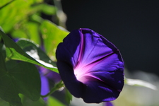
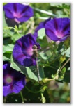 John had 38 blooms on his morning glory this morning, the most yet this summer. After somewhat
unsuccessful results with the sky blue ones last year he tried a new purple variety which blooms
earlier in the summer. It looks just like the morning glories growing wild, or at least
naturalized, along the road across the little coastal plain below Salobreña back in June. Whatever
its orgigins, it's certainly meeting expectations. I went over to get a few pictures and found a
dragonfly perched on one of the flowers.
John had 38 blooms on his morning glory this morning, the most yet this summer. After somewhat
unsuccessful results with the sky blue ones last year he tried a new purple variety which blooms
earlier in the summer. It looks just like the morning glories growing wild, or at least
naturalized, along the road across the little coastal plain below Salobreña back in June. Whatever
its orgigins, it's certainly meeting expectations. I went over to get a few pictures and found a
dragonfly perched on one of the flowers.
Earlier, I hiked up to Halls Ledge with Mom and John and Eric. Half the hike was on a brand new logging road put in to haul wood out from a big new clearcut going in on the back side of Wildcat. I carried the long lens in hopes of finding some warblers in the relatively low birches up near the lookout. We flushed a family of juncos and a few frogs from the trail and found a group of chickadees near the overlook but no warblers, then as the others were just starting down the trail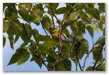 I spotted a Magnolia warbler and managed to get one half-decent shot. I didn't see or hear any
other warblers with it.
I spotted a Magnolia warbler and managed to get one half-decent shot. I didn't see or hear any
other warblers with it.
My new Toshiba M645 laptop arrived this afternoon so I spent the evening getting it set up. Seems like a decent machine, a little faster than my old Dell with a nicer, though smaller, screen. It's going to be alot of work getting it all configured to replace the old machine. The decision to get a new computer was precipitated by the failure, once again, of the graphics card and motherboard on the Dell. It's still usable but the screen superimposes bands of blue and yellow squiggles over whatever it displays and the maximum resolution is 1024x768 since I had to disable the graphics card in order to get it to boot up.
Earlier, I hiked up to Halls Ledge with Mom and John and Eric. Half the hike was on a brand new logging road put in to haul wood out from a big new clearcut going in on the back side of Wildcat. I carried the long lens in hopes of finding some warblers in the relatively low birches up near the lookout. We flushed a family of juncos and a few frogs from the trail and found a group of chickadees near the overlook but no warblers, then as the others were just starting down the trail
Magnolia Warbler
My new Toshiba M645 laptop arrived this afternoon so I spent the evening getting it set up. Seems like a decent machine, a little faster than my old Dell with a nicer, though smaller, screen. It's going to be alot of work getting it all configured to replace the old machine. The decision to get a new computer was precipitated by the failure, once again, of the graphics card and motherboard on the Dell. It's still usable but the screen superimposes bands of blue and yellow squiggles over whatever it displays and the maximum resolution is 1024x768 since I had to disable the graphics card in order to get it to boot up.
08/14/2010 Wildman Biathlon
Eric picked me up around 6:30, nice to be up that early even if I was still a little groggy. I'd intended to get to bed early but only managed 2330. Beautiful morning, sunny and clear until we slipped under a foggy overcast as we drove into Gorham. Joe and Virginia were parked kitty-corner to the garage and had already picked up our bags and shirts when we arrived. We hung out with Joe feeding noseeums while Virginia got ready and warmed up. She wasn't smiling much and Joe told us she was feeling anxious about the race. I was feeling stiff and cold and was glad she was running and not I.
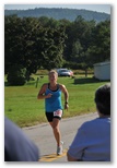
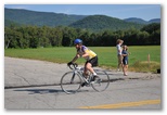 The fog burned off about 15 minutes after the runners took off. The first runner came in about 15
minutes later looking very smooth and comfortable. Virginia finished in 48 minutes; I think she was
pleased with her time. Eric had a good ride too. We waited to watch him come around a second time
before leaving for Gorham, then had to wait 15-20 minutes to turn onto Route 16. Eric passed me
while I waited, then I passed him again six miles before Wildcat. I was ready when he pulled in 30
minutes later. I didn't have as much time as I'd have liked to warm up but that didn't turn out to
be a problem. I had a great run. We were about 85th overall after the bike ride and 51st in the
final results, so I passed 34 runners. No-one passed me. I went all-out all the way up then
sprinted from just below the top of the last hill; the runners I'd passed when I started my sprint
weren't even in sight when I finished. I can't recall when I've been as winded as I was when I
crossed the finish line. My run time was 42:18, 30 seconds slower than my 2007 time but 2:20
faster than three days ago, and I was 16th fastest in the hill climb out of about 140 runners.
The fog burned off about 15 minutes after the runners took off. The first runner came in about 15
minutes later looking very smooth and comfortable. Virginia finished in 48 minutes; I think she was
pleased with her time. Eric had a good ride too. We waited to watch him come around a second time
before leaving for Gorham, then had to wait 15-20 minutes to turn onto Route 16. Eric passed me
while I waited, then I passed him again six miles before Wildcat. I was ready when he pulled in 30
minutes later. I didn't have as much time as I'd have liked to warm up but that didn't turn out to
be a problem. I had a great run. We were about 85th overall after the bike ride and 51st in the
final results, so I passed 34 runners. No-one passed me. I went all-out all the way up then
sprinted from just below the top of the last hill; the runners I'd passed when I started my sprint
weren't even in sight when I finished. I can't recall when I've been as winded as I was when I
crossed the finish line. My run time was 42:18, 30 seconds slower than my 2007 time but 2:20
faster than three days ago, and I was 16th fastest in the hill climb out of about 140 runners.
We stayed for lunch then Joe and Virginia left. Eric and I stayed to collect our third blue mugs at the awards ceremony. We came in 1st in the 50 and over mixed team division. While it is true that we had no competition, our time was nonetheless respectable even in comparison with the 40-49 age group teams. I was somewhat sleepy and had a bit of chest congestion the rest of the day but otherwise felt pretty good.
Eric picked me up around 6:30, nice to be up that early even if I was still a little groggy. I'd intended to get to bed early but only managed 2330. Beautiful morning, sunny and clear until we slipped under a foggy overcast as we drove into Gorham. Joe and Virginia were parked kitty-corner to the garage and had already picked up our bags and shirts when we arrived. We hung out with Joe feeding noseeums while Virginia got ready and warmed up. She wasn't smiling much and Joe told us she was feeling anxious about the race. I was feeling stiff and cold and was glad she was running and not I.
Virginia finishing
Eric
We stayed for lunch then Joe and Virginia left. Eric and I stayed to collect our third blue mugs at the awards ceremony. We came in 1st in the 50 and over mixed team division. While it is true that we had no competition, our time was nonetheless respectable even in comparison with the 40-49 age group teams. I was somewhat sleepy and had a bit of chest congestion the rest of the day but otherwise felt pretty good.
08/16/2010 Jackson
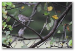
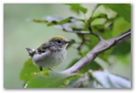
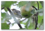
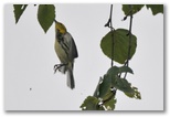
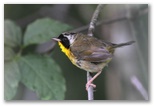 Low overcast most of the day today after light rain overnight. Sitting out on the porch with Mom,
John and Susan after breakfast, I spotted several small birds around the apple trees across the
field and decided to go after them with the camera despite the low light. The birds by the apple
trees were juvenile chipping sparrows but I ended up behind the Tracy's barn where I found a some
more activity - a juvenile Chestnut-sided Warbler, a family of Common Yellowthroats, some
White-throated Sparrows and a Gray Catbird, along with Purple Finches and Goldfinches flying over.
The odd Blue jay, Crow, Red-eyed Vireo, Yellow-rumped Warbler and of course, Black-capped Chickadees
around as well. After an hour or two in the old orchard at the edge of the marsh, I spotted a black
bear nosing around in the tall ferns and sedges on the Sugar Hill Lane side of the marsh so decided
to head home. Up by the barn I found some warblers in the apple trees and followed them over by the
gazebo - juvenile Yellow-rumps, Black-throated Greens and Chestnut-sided warblers along with more
Common Yellowthroats and even an Ovenbird, briefly. Around mid-afternoon the clouds broke up and
the sun came out so I went out again but didn't find much activity despite wandering through the
marsh in my flip-flops. Lots of fresh bear scat in the trail along the Sugar Hill Lane side of the
marsh though.
Low overcast most of the day today after light rain overnight. Sitting out on the porch with Mom,
John and Susan after breakfast, I spotted several small birds around the apple trees across the
field and decided to go after them with the camera despite the low light. The birds by the apple
trees were juvenile chipping sparrows but I ended up behind the Tracy's barn where I found a some
more activity - a juvenile Chestnut-sided Warbler, a family of Common Yellowthroats, some
White-throated Sparrows and a Gray Catbird, along with Purple Finches and Goldfinches flying over.
The odd Blue jay, Crow, Red-eyed Vireo, Yellow-rumped Warbler and of course, Black-capped Chickadees
around as well. After an hour or two in the old orchard at the edge of the marsh, I spotted a black
bear nosing around in the tall ferns and sedges on the Sugar Hill Lane side of the marsh so decided
to head home. Up by the barn I found some warblers in the apple trees and followed them over by the
gazebo - juvenile Yellow-rumps, Black-throated Greens and Chestnut-sided warblers along with more
Common Yellowthroats and even an Ovenbird, briefly. Around mid-afternoon the clouds broke up and
the sun came out so I went out again but didn't find much activity despite wandering through the
marsh in my flip-flops. Lots of fresh bear scat in the trail along the Sugar Hill Lane side of the
marsh though.
Chipping Sparrows
Chestnut-sided Warbler
Yellow-rumped Warbler
Black-throated Green Warbler
Common Yellowthroat
08/17/2010 Mt Washington 50K
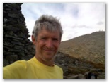 I ran/hiked from the house in Jackson to the top of Mt Washington and back today, 33.3 miles and
8200' in 11:10. Daniel accompanied me as far as Pinkham. We left around 8:30AM and ran up the
Carter Notch road to Camp Gout (4.5mi) then over the Hall's ledge trail to Rte 16 at the bridge just
above the Dana Place (7.2mi). I'd originally planned to run up the Rocky Branch, Isolation and
Davis Path trails to the summit but because Eric decided to to Washington we ran up to Pinkham
(11.7mi) instead to meet him and refuel. We hung out for a half hour there refueling then Susan
gave Daniel a ride home so he could go rafting with Silas and Matt while I pursued Eric up to
Tuckerman's. We met in the bowl then I went ahead of him up to the summit (15.9m). We just missed
each other there; I hung out for a half hour to down a sandwich and carton of chocolate milk, and to
refill my hydration pack again. He arrived as I was sitting on the rocks at the summit trying to
call home, and though he saw me and waved, I missed him in the crowd. I started down at 2:15 and
I ran/hiked from the house in Jackson to the top of Mt Washington and back today, 33.3 miles and
8200' in 11:10. Daniel accompanied me as far as Pinkham. We left around 8:30AM and ran up the
Carter Notch road to Camp Gout (4.5mi) then over the Hall's ledge trail to Rte 16 at the bridge just
above the Dana Place (7.2mi). I'd originally planned to run up the Rocky Branch, Isolation and
Davis Path trails to the summit but because Eric decided to to Washington we ran up to Pinkham
(11.7mi) instead to meet him and refuel. We hung out for a half hour there refueling then Susan
gave Daniel a ride home so he could go rafting with Silas and Matt while I pursued Eric up to
Tuckerman's. We met in the bowl then I went ahead of him up to the summit (15.9m). We just missed
each other there; I hung out for a half hour to down a sandwich and carton of chocolate milk, and to
refill my hydration pack again. He arrived as I was sitting on the rocks at the summit trying to
call home, and though he saw me and waved, I missed him in the crowd. I started down at 2:15 and
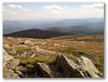 decided to make a loop of it by following the Davis Path over Boott Spur, then the Isolation trail
down to Rocky Branch, down to Rte 16. I ran when I could but the 10.2 mile descent was probably 80%
rock-hopping and took me 3 1/2 hours. The Isolation trail branches left off the Davis Path not far
before the summit of Isolation, and shortly passes through the Rocky Branch #2 camp site in open
mossy fir woods where myriad trails to tent sites obscure the main trail down into the valley. On
my first try I couldn't find the main trail so returned to the Davis Path and continued down it a
little further to make sure that there was no other turnoff down the Rocky Branch. On my second
try, knowing I had no alternative, I managed to find the right trail, which drops into mixed woods
and crosses the Rocky Branch several times during the two miles down to the Rocky Branch trail.
That trail over the height of land is mostly mud and (small) boulders; it runs through a large
birch-bog then enters nice hardwood forest, very green, where it finally becomes reasonably
runnable. I dunked in the Ellis and ate my last Powerbar before starting up the Hall's Ledge trail
and felt great on the hill climb but began to fade again once I reached the top. John called as I
happened to be passing the Jackson overlook so I ate my last gel there. I'd tried to reach home from
decided to make a loop of it by following the Davis Path over Boott Spur, then the Isolation trail
down to Rocky Branch, down to Rte 16. I ran when I could but the 10.2 mile descent was probably 80%
rock-hopping and took me 3 1/2 hours. The Isolation trail branches left off the Davis Path not far
before the summit of Isolation, and shortly passes through the Rocky Branch #2 camp site in open
mossy fir woods where myriad trails to tent sites obscure the main trail down into the valley. On
my first try I couldn't find the main trail so returned to the Davis Path and continued down it a
little further to make sure that there was no other turnoff down the Rocky Branch. On my second
try, knowing I had no alternative, I managed to find the right trail, which drops into mixed woods
and crosses the Rocky Branch several times during the two miles down to the Rocky Branch trail.
That trail over the height of land is mostly mud and (small) boulders; it runs through a large
birch-bog then enters nice hardwood forest, very green, where it finally becomes reasonably
runnable. I dunked in the Ellis and ate my last Powerbar before starting up the Hall's Ledge trail
and felt great on the hill climb but began to fade again once I reached the top. John called as I
happened to be passing the Jackson overlook so I ate my last gel there. I'd tried to reach home from
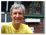 Rte 16 but couldn't quite get through, so I was glad to be able to let them know that I'd be late.
I'd run out of water by then so I ate a few roadside apples, sour after the gel but full of juice,
on the way down to the old dump road. I finished the last few miles barefoot and felt as though I
could keep going as I ran down the hill to home.
Rte 16 but couldn't quite get through, so I was glad to be able to let them know that I'd be late.
I'd run out of water by then so I ate a few roadside apples, sour after the gel but full of juice,
on the way down to the old dump road. I finished the last few miles barefoot and felt as though I
could keep going as I ran down the hill to home.
Susan fixed a delicious dinner - the eggplant with tomato sauce and Feta cheese, Greek salad, goat cheese baked in grape leaves, fresh corn, blueberry pie. Joe and Virginia came over, and all the kids plus a couple friends of theirs. I enjoyed talking with Pat about climbing and photography, and Matt about training for Nordic 50K's. After sitting around for a couple of hours though, I could barely walk.
For future reference, I think 50 calories per mile or 180 calories per hour is a minimum amount to consume during long, low-intensity workouts. I don't know my heart rate but I suspect it was somewhat lower than on the 50 mile run, so maybe 70% of max overall. Fluid is harder to predict but the gallon or so I drank over 11 hours was not enough; 6oz per mile or 20oz per hour would be better. That's too much to carry; maybe there's a sufficiently light water purification system that could be used, or just take chances on drinking from streams. Aside from the great workout and the sense of accomplishment, one of the satisfactions of long mountain runs is the sense of the landscape that you get. Despite having to focus on the ground ahead-of-foot virtually the whole way, I found that by convering such a long distance all in one day, I get a sense of the country, the landscape and the vegetation, that I don't get on shorter outings.
Mile 17
Descent route
Mile 27
Susan fixed a delicious dinner - the eggplant with tomato sauce and Feta cheese, Greek salad, goat cheese baked in grape leaves, fresh corn, blueberry pie. Joe and Virginia came over, and all the kids plus a couple friends of theirs. I enjoyed talking with Pat about climbing and photography, and Matt about training for Nordic 50K's. After sitting around for a couple of hours though, I could barely walk.
For future reference, I think 50 calories per mile or 180 calories per hour is a minimum amount to consume during long, low-intensity workouts. I don't know my heart rate but I suspect it was somewhat lower than on the 50 mile run, so maybe 70% of max overall. Fluid is harder to predict but the gallon or so I drank over 11 hours was not enough; 6oz per mile or 20oz per hour would be better. That's too much to carry; maybe there's a sufficiently light water purification system that could be used, or just take chances on drinking from streams. Aside from the great workout and the sense of accomplishment, one of the satisfactions of long mountain runs is the sense of the landscape that you get. Despite having to focus on the ground ahead-of-foot virtually the whole way, I found that by convering such a long distance all in one day, I get a sense of the country, the landscape and the vegetation, that I don't get on shorter outings.
08/20/2010 South Paris, ME
We drove over to South Paris yesterday to visit Wayne and Donna.Ali came up from Wellesley but Di was too busy to make it. They have a beautifully-maintained old (1760-1840?) house in rural Maine outside of Paris near Streaked Mountain, a bald knob of pegmatite with sloping ledges and views west to the Presidential Range. We hiked up Streaked both days of our visit. I would have loved it when I was a kid - tourmaline everywhere. I collected a small handful of crystal fragments. Wayne and Donna both tell great stories; we hung out in their kitchen, laughed alot, enjoyed their delicious cooking. It was a great visit.
I woke up from a dream this morning.
Reading this a few weeks later, it occurred to me that the car breaking through the cable and concrete blocks might also represent our recent (as in the last year or two) breaking away from the lifestyle constraints of Adventism - drinking beer and wine, no longer attending church . While these things are choices, it sometimes seems that my turning away from Adventism is irresistible, as though I will go in that direction even if I try not to, because in my heart I don't want to sacrifice for my religion any more. So I continue downward in a somewhat controlled skid into what - some private form of Christianity, some unorthodox reconciliation with Christ, or perhaps simply unbelief?
We drove over to South Paris yesterday to visit Wayne and Donna.Ali came up from Wellesley but Di was too busy to make it. They have a beautifully-maintained old (1760-1840?) house in rural Maine outside of Paris near Streaked Mountain, a bald knob of pegmatite with sloping ledges and views west to the Presidential Range. We hiked up Streaked both days of our visit. I would have loved it when I was a kid - tourmaline everywhere. I collected a small handful of crystal fragments. Wayne and Donna both tell great stories; we hung out in their kitchen, laughed alot, enjoyed their delicious cooking. It was a great visit.
I woke up from a dream this morning.
I was driving a green VW bug, with Susan and maybe the boys too, I think, though I didn't have a
clear impression of their presence. We were traversing and descending a steep wooded slope, mature
shady hardwood forest, very green, on a dirt/clay double-track road. The two tracks were fairly
deep but wide, with no rocks so the driving wasn't particularly difficult though the car wasn't
handling very well; the brakes in particular didn't seem to be working. We came to a cable
stretched across the track between several big concrete blocks at a point where the road turned to
the right to run more steeply down the hill. I wanted to stop so I could get out and unhook the
cable so I pulled up parallel to the cable then backed up to park on the side of the track. As I
started to back up, a bird ran along the side of the track by the front of the car. It was about
the size and shape of a cuckoo but colored more or less like a robin. The long tail was banded with
four or five alternating brown and cream-colored bands. The base of the bird's dark bill flared out
to either side in an odd corrugated sort of light and dark pattern.
As I backed across the double-track road I realized the brakes weren't working and that I was in danger of backing right off the road and down the steep wooded hillside so I cut the wheel sharply to turn the car so I'd be backing directly up the hill. The car stopped momentarilly then began to roll forward again. Without using the brakes I maneuvered so that I could park across the track above the cable with the car perpendicular to the slope so it wouldn't roll, but somehow the car turned almost of its own acord so that it was pointing directly down the hill, towards the cable. Before I could stop it, the car rolled forward. Breaking right through the cable, it began to accelerate down the steep double-track. I turned the wheel so that the car would slide sideways down the track, and though it was difficult, I could control our descent that way. Ahead the track seemed to emerge into a more open, brighter area, but it also seemed to be getting even steeper. I couldn't really see where it went, so before I reached the steeper section ahead I woke up.
I considered the dream for a few minutes to fix it in my mind and perhaps to understand its meaning.
The track through the woods reminded me of Arkansas, where we spent our honeymoon. Perhaps it,
along with the VW bug, represents the course of my life. I owned the VW while I was in college and
until shortly before I met Susan, so I associate it with myself before I met Susan and before I
became an Adventist. As I considered it this morning the bird seemed to indicate the time in my
life when I became really involved in birdwatching, during and after college while I was still
single. The cable and concrete blocks reminds me, as I write about it this evening, of the blockade
at the top of the bumpy road at the Adventist Academy where we lived early in our marriage so it may
represent either the beginning of our marriage or my conversion to Adventism, or both. Struggling
to drive the car without brakes may indicate a sense that I haven't had much of a hand in directing
my life in the past, and though I seem to have some say in how it goes at present, my future path
may also be largely out of my control. The downward trend of the road ahead and my inability to get
the car to stop don't portray much optimism about the future, but on the other hand I wasn't
particularly apprehensive when I woke up and the road, though plunging downwards, did appear to
finally be coming out of the woods into the light.As I backed across the double-track road I realized the brakes weren't working and that I was in danger of backing right off the road and down the steep wooded hillside so I cut the wheel sharply to turn the car so I'd be backing directly up the hill. The car stopped momentarilly then began to roll forward again. Without using the brakes I maneuvered so that I could park across the track above the cable with the car perpendicular to the slope so it wouldn't roll, but somehow the car turned almost of its own acord so that it was pointing directly down the hill, towards the cable. Before I could stop it, the car rolled forward. Breaking right through the cable, it began to accelerate down the steep double-track. I turned the wheel so that the car would slide sideways down the track, and though it was difficult, I could control our descent that way. Ahead the track seemed to emerge into a more open, brighter area, but it also seemed to be getting even steeper. I couldn't really see where it went, so before I reached the steeper section ahead I woke up.
Reading this a few weeks later, it occurred to me that the car breaking through the cable and concrete blocks might also represent our recent (as in the last year or two) breaking away from the lifestyle constraints of Adventism - drinking beer and wine, no longer attending church . While these things are choices, it sometimes seems that my turning away from Adventism is irresistible, as though I will go in that direction even if I try not to, because in my heart I don't want to sacrifice for my religion any more. So I continue downward in a somewhat controlled skid into what - some private form of Christianity, some unorthodox reconciliation with Christ, or perhaps simply unbelief?
The boys and I hiked up Kaleetan Peak near Snoqualmie Pass today. We'd intended to leave reasonably early, like 8AM, but didn't actually get away until around 11:15 so we didn't start hiking until after noon. We made good time to the lake though, about 2 hours for the 4.5 miles. It was hot; even dunking my head in the cold water at the stream crossing about halfway up only kept the sweat at bay for a few minutes. The lake was almost warm enough for comfortable swimming. We parked for
We talked about careers some, and money. Daniel said he had no idea what to pursue for a career. I told him I thought he might make a good teacher. He likes an audience and kids, particularly high-school age, might provide that for him. He didn't know if he'd like teaching or not but was concerned that he wouldn't make enough money. Then we talked about managing money and how to learn about finances and investments. I told them that if they were interested in that, they could certainly do it, and if not, then they should find a good money manager to do it for them.
We were feeling pretty lazy after our long break but decided to head up towards the peak. I figured we could hike up another hour before we'd have to turn back if we wanted to get home by dark. After an hour we didn't turn back; instead we took another half hour to reach the summit. We passed the
Daniel on talus
David on ledges
On the summit
David in the lake
At the lake I had a bout of diarrhea and was grateful for the conveniently-located outhouse. We started down from the lake with 3 1/2 fingers between the sun and the horizon, about 40 minutes. We hurried, jogging where we could, hiking fast where the trail was too rough. The sunlight left the peaks of Denny Mt to the east of us right on schedule at 8PM, just after we crossed the stream. We overtook another couple descending the talus slope above the waterfalls; I didn't think to ask if they had a flashlight but it looked as though they were going to need it. The light got pretty dim when we entered the woods, but knowing we had a flashlight and extra batteries, I wasn't too concerned. Then just before the lower stream crossing, I felt something hit the back of my legs. It was my lunch bag falling out of my unzipped pack. I checked, and my dayhike bag, with the flashlight in it, had already fallen out, somewhere back up the trail in the dusk. I decided not to go look for it; no telling how far back it was, and we wouldn't be reaching the parking lot until nearly dark as it was. Perhaps the couple behind us would pick it up. We hustled on down the trail. It fortunately becomes wide and well-paved with pea gravel for the last half mile to the parking lot, a good thing for us because by then we could only barely distinguish the few rocks in the tread. The other couple emerged from the woods only 10 minutes behind us, still navigating without flashlights. When I asked about my dayhike bag, he held up a granola bar and asked if it was mine. It was. He hadn't seen the plastic bag with my dayhike essentials though; I'll have to assemble another one.
09/05/2010 Roots Rock 25K, Port Gamble, WA 15.5 miles, 2:39:25 155
Nice day for this trail ultra-run, cloudy and cool w/ partial clearing and some sunshine by midday. Daniel and I both did the 25K; I'd considered running two laps for 50K but ended up running most of the 1st lap at a pretty hard pace with Tony so decided not to do a second. Daniel ran with us for the first 4 miles or so then had to take a bathroom break. I haven't seen Tony for a while so we had a nice chat about the Maniacs work I'm planning on doing this winter and about potentially getting his help with Light at the End of the Tunnel next year, among other things. As often happens when running with someone, we picked up the pace as we went along, averaging about 11:30 for the first 7 miles and 9:00 for the last 8, with several of those miles at or under 8:00/mile. My heartrate was up around 90% of max for the last half hour. Since I'm running the Skagit Flats marathon next weekend and hoping to come in under 4 hours, it was probably better to run a hard half rather than a full 50K today, so I'm pleased with how things worked out. Daniel finished in 3:05, 15 minutes slower than last year but most of that 15 minutes was probably due to his break. He was satisfied with his time, particularly since his training for the event was limited to running a total of about 35 miles over the past three weeks. As he observed, youth is a wonderful thing.
We've temporarily (we hope) acquired a dog, a dark and fuzzy half-grown puppy with big feet. Daniel's housemate Dana loaned him to Daniel last Sunday afternoon so Daniel brought him out here and Susan kept him here, intending to train him. She's made some progress towards that end; he doesn't nip much any more and he walks along with us quite well without a leash. We allowed him to chew on some of my old running shoes but he decided he prefers Daniel's orchids which were spending the summer outside. He took down about a third of them before we could rescue them, which didn't endear the dog to Daniel.
09/08/2010
Showers and rain the past few days have added up to 1.5" of precipitation. That together with the half inch we received in the wet spell last week should be enough, up in the mountains at least, to bring up the mushrooms, especially Boletus edulis. Jeff and I cancelled our planned
backpack trip this week due to the weather, but perhaps I can get up there on Friday for the
day.
bring up the mushrooms, especially Boletus edulis. Jeff and I cancelled our planned
backpack trip this week due to the weather, but perhaps I can get up there on Friday for the
day.
During a break between showers I noticed some activity in the cedar tree and went out to find several Wilson's Warblers and a small flock of Townsend's Warblers moving through. The Wilson's have a flat, somewhat nasal "chik" call and the Townsend's, a short "chit", sharper than a Yellow- rumped Warbler's call. There might have been another call mixed in but I could only identify those two. Nice to catch the Wilsons coming through; I missed them entirely last fall. I tried for some photos but with little success. Perhaps it's because I haven't been out much recently, but there don't seem to be large numbers of warblers hanging around like there were last fall. For several weeks now I've been sitting at the computer writing up my journal and birdwatching notes from our trip to Spain and England. I'm up to Harlech, just the week in Wales and the QM2 trip (which I've already hand-written) to go, good thing because I'm getting weary of the whole process.
Showers and rain the past few days have added up to 1.5" of precipitation. That together with the half inch we received in the wet spell last week should be enough, up in the mountains at least, to
Townsend's Warblers
During a break between showers I noticed some activity in the cedar tree and went out to find several Wilson's Warblers and a small flock of Townsend's Warblers moving through. The Wilson's have a flat, somewhat nasal "chik" call and the Townsend's, a short "chit", sharper than a Yellow- rumped Warbler's call. There might have been another call mixed in but I could only identify those two. Nice to catch the Wilsons coming through; I missed them entirely last fall. I tried for some photos but with little success. Perhaps it's because I haven't been out much recently, but there don't seem to be large numbers of warblers hanging around like there were last fall. For several weeks now I've been sitting at the computer writing up my journal and birdwatching notes from our trip to Spain and England. I'm up to Harlech, just the week in Wales and the QM2 trip (which I've already hand-written) to go, good thing because I'm getting weary of the whole process.
09/10/2010 Mt Margaret hike
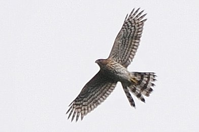
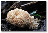
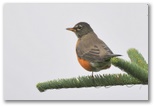 As I promised myself, I made it up to Mt Margaret to look for mushrooms but though I hiked as far
as Twin Lakes, I found only one Boletus edulis and a few coral mushrooms. Maybe they're
late this year.
As I promised myself, I made it up to Mt Margaret to look for mushrooms but though I hiked as far
as Twin Lakes, I found only one Boletus edulis and a few coral mushrooms. Maybe they're
late this year.
I didn't get an early start. There were no other cars at the trailhead. The afternoon was damp and dark though not actually raining. I found a few birds to photograph on the way up in the clearcut -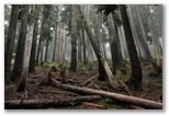 a sharpie over the ridge, a few robins and sparrows in the huckleberry bushes. There weren't many
berries; I've heard this is a bad year and that appears to be the case. The one Bolete I found was
near Twin Lakes. The low huckleberry understorey where I found it was dripping wet and my feet got
cold and sodden as I wandered off the path in search of more. I ate a bar before starting back up the ridge
and it began to drizzle before I reached the car.
a sharpie over the ridge, a few robins and sparrows in the huckleberry bushes. There weren't many
berries; I've heard this is a bad year and that appears to be the case. The one Bolete I found was
near Twin Lakes. The low huckleberry understorey where I found it was dripping wet and my feet got
cold and sodden as I wandered off the path in search of more. I ate a bar before starting back up the ridge
and it began to drizzle before I reached the car.
Sharp-shinned Hawk
I didn't get an early start. There were no other cars at the trailhead. The afternoon was damp and dark though not actually raining. I found a few birds to photograph on the way up in the clearcut -
09/15/2010
I've finally started trying to learn ASP.NET and Visual Studio, something I've been intending to do for five years now. After working through parts of a tutorial I found on the web I'm now beginning to build web pages for recording bird sightings, another long-deferred project. I've had the database on the web for several years and have been writing ASP reports of my bird-watching outings, entering the data into an offline SQL Server database and uploading it. I'm really looking forward to finally being able to enter and report the data directly on a web site, and perhaps also integrating it somehow with eBird.
I've finally started trying to learn ASP.NET and Visual Studio, something I've been intending to do for five years now. After working through parts of a tutorial I found on the web I'm now beginning to build web pages for recording bird sightings, another long-deferred project. I've had the database on the web for several years and have been writing ASP reports of my bird-watching outings, entering the data into an offline SQL Server database and uploading it. I'm really looking forward to finally being able to enter and report the data directly on a web site, and perhaps also integrating it somehow with eBird.
Top
Brianpen Home | Journal Home | Previous | Next (3)